
Marciac na rowerze
Odkrywaj mapę z 16 trasami rowerowymi i szlakami w pobliżu Marciac, stworzonymi przez naszą społeczność.
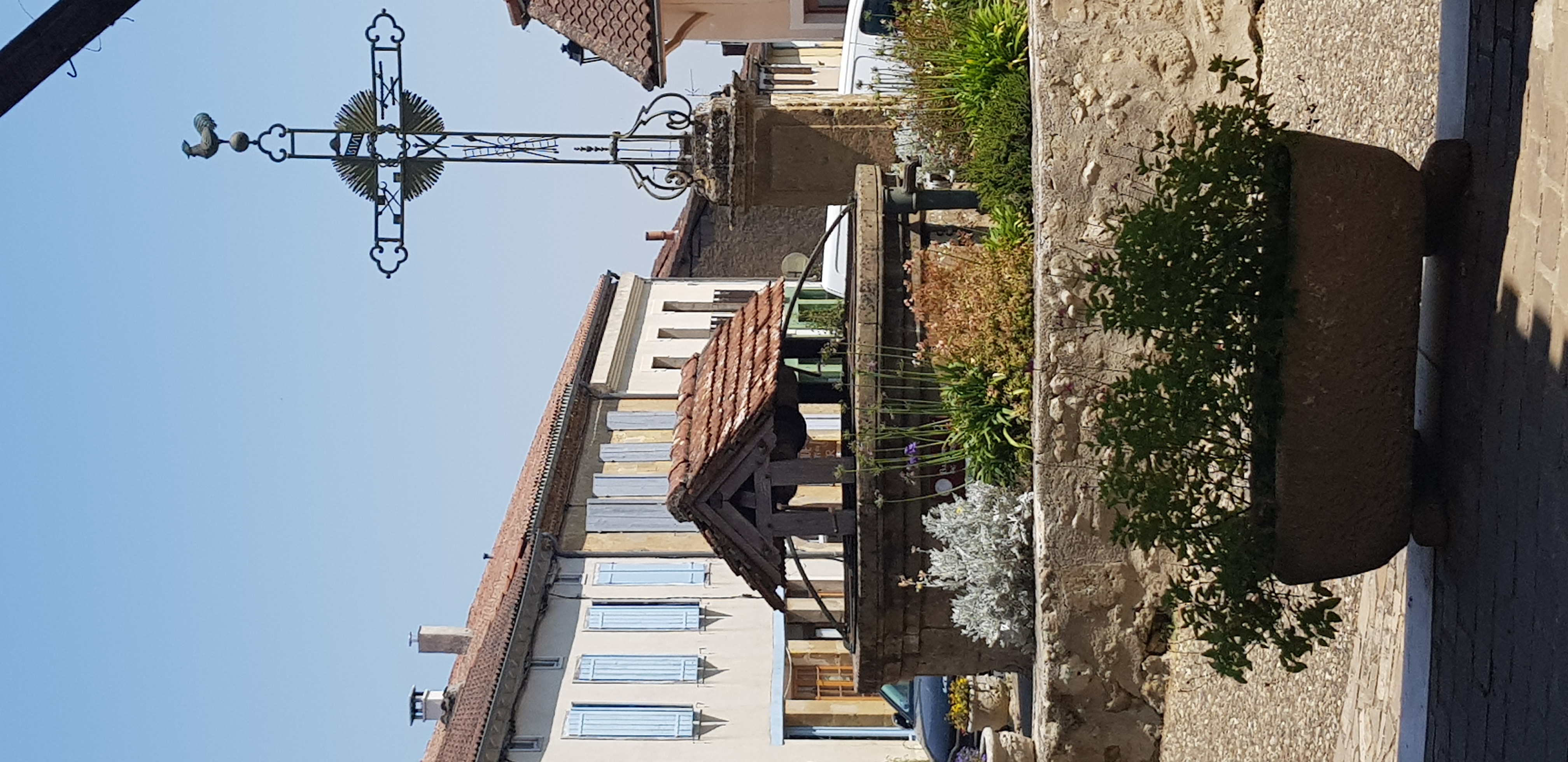
Portret regionu
Poznaj Marciac
Znajdź odpowiednią trasę rowerową dla siebie w Marciac – mamy tam 16 tras do odkrycia.
1107 km
Zarejestrowany dystans
16
Trasy rowerowe
1258
Populacja
Wspólnota
Najaktywniejsi użytkownicy w Marciac


Od naszej społeczności
Najlepsze trasy rowerowe w Marciac i okolicach

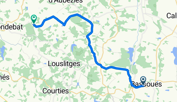
MARCIAC JUILAC JU-BELLOC HÈRES LABATUT R JUILLAC MARCIAC
Trasa rowerowa w Marciac, Occitanie, Francja
- 42,6 km
- Dystans
- 197 m
- Przewyższenia
- 197 m
- Spadek

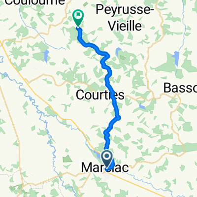
Ride Day 6—13 Sept 2005—32320 Bassoues to 64000 Pau
Trasa rowerowa w Marciac, Occitanie, Francja
<span style="font-size: 12pt; font-family: Arial;">Until Rabastens-de-Bigorre,
we were pretty much on perfect country roads.<span> </span>After that we were on a major road that at times had some
traffic and at other times very little.<span> </span>Most of it wasn’t bad until we got closer to Pau when the traffic
increased exponentially. There was, though, some small shoulder or bicycle lane
for much of this heavy traffic section into Pau.</span>
Background:<br /><br /><br />My wife and I have been doing self-supported tours in Western Europe (a majority in France) since 1993. This series of rides covers our 2005 2 month route through parts of France. Our beginning and ending point is near Chaduri (south of Angoulême) where our friends have a farm with Gites and Chambres d'Hotes.<br /><br /><br />We rode our Dawes touring bicycles purchased in 1993 heavily loaded with 700Cx32 tires. All of our riding was on paved roads, mostly with very little traffic.<br /><br /><br />If any questions, feel free to email me at jeffkadet@netdiving.com<br /><br /><br />Jeff
- 101,7 km
- Dystans
- 657 m
- Przewyższenia
- 666 m
- Spadek

R Marciac Lourdes
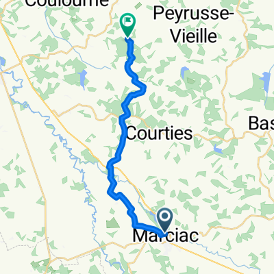
Trasa rowerowa w Marciac, Occitanie, Francja
cette trace suit en grand partie le GR653 (repère et fléchage blanc et rouge), avec quelques variantes.
Le denivelé n'est pas important mais la boue peut être bien présente.
Après la ville de Maubourguet, vous roulerez sur les cretes de l'Echez jusque Ibos.
Ensuite, un peu de route jusque Lourdes avant d'attacher les Puyrénées.
la trace se termine devant "Bike and Py" , shop et café vélo
- 79,6 km
- Dystans
- 880 m
- Przewyższenia
- 661 m
- Spadek
bassouse via peruse vieille to Impasse de Mèque
Trasa rowerowa w Marciac, Occitanie, Francja
- 14,8 km
- Dystans
- 223 m
- Przewyższenia
- 246 m
- Spadek
Odkryj więcej tras
 domaine bilé bassous - marciac - dom bilé
- Dystans
- 31,5 km
- Przewyższenia
- 612 m
- Spadek
- 624 m
- Lokalizacja
- Marciac, Occitanie, Francja
 DOMAINE BILÉ BASSOUSS---MARCIAC en terug
- Dystans
- 34,4 km
- Przewyższenia
- 619 m
- Spadek
- 618 m
- Lokalizacja
- Marciac, Occitanie, Francja
 Rue Saint-Justin 23, Marciac to Chemin du Sende, Ibos
- Dystans
- 43,7 km
- Przewyższenia
- 266 m
- Spadek
- 106 m
- Lokalizacja
- Marciac, Occitanie, Francja
 R Bis
R Bis- Dystans
- 80,2 km
- Przewyższenia
- 880 m
- Spadek
- 641 m
- Lokalizacja
- Marciac, Occitanie, Francja
 marciac to Impasse de Mèque
- Dystans
- 15,6 km
- Przewyższenia
- 223 m
- Spadek
- 203 m
- Lokalizacja
- Marciac, Occitanie, Francja
 Place de l'Hôtel de ville to Impasse de Mèque
- Dystans
- 16,1 km
- Przewyższenia
- 161 m
- Spadek
- 112 m
- Lokalizacja
- Marciac, Occitanie, Francja
 8. Tag Marciac-Pau
- Dystans
- 70,9 km
- Przewyższenia
- 544 m
- Spadek
- 493 m
- Lokalizacja
- Marciac, Occitanie, Francja
 Tour du Gers
- Dystans
- 363 km
- Przewyższenia
- 3196 m
- Spadek
- 3201 m
- Lokalizacja
- Marciac, Occitanie, Francja