Les Riceys na rowerze
Odkrywaj mapę z 28 trasami rowerowymi i szlakami w pobliżu Les Riceys, stworzonymi przez naszą społeczność.
Portret regionu
Poznaj Les Riceys
Znajdź odpowiednią trasę rowerową dla siebie w Les Riceys – mamy tam 28 tras do odkrycia.
982 km
Zarejestrowany dystans
28
Trasy rowerowe
1401
Populacja
Wspólnota
Najaktywniejsi użytkownicy w Les Riceys
Od naszej społeczności
Najlepsze trasy rowerowe w Les Riceys i okolicach
Camino 2015 07 Les Riceys nach Tonnerre
Trasa rowerowa w Les Riceys, Grand Est, Francja
- 42,9 km
- Dystans
- 516 m
- Przewyższenia
- 555 m
- Spadek
Griselles - Gye-sur-Seine-Arthonnay-Griselles
Trasa rowerowa w Les Riceys, Grand Est, Francja
- 70,5 km
- Dystans
- 547 m
- Przewyższenia
- 547 m
- Spadek
Camino 2015 7b Les Riceys nach Tonnere
Trasa rowerowa w Les Riceys, Grand Est, Francja
- 42,6 km
- Dystans
- 311 m
- Przewyższenia
- 356 m
- Spadek
Griselles-Tonnerre-Griselles
Trasa rowerowa w Les Riceys, Grand Est, Francja
- 91,6 km
- Dystans
- 685 m
- Przewyższenia
- 685 m
- Spadek
Odkryj więcej tras
 2 Rue de Bise, Les Riceys à 10 Rue de Bise, Les Riceys
- Dystans
- 12,4 km
- Przewyższenia
- 326 m
- Spadek
- 325 m
- Lokalizacja
- Les Riceys, Grand Est, Francja
 Griselles-Aisey-Chatillon-Griselles
- Dystans
- 95,7 km
- Przewyższenia
- 424 m
- Spadek
- 424 m
- Lokalizacja
- Les Riceys, Grand Est, Francja
 tourmalet 3 etape
- Dystans
- 183,9 km
- Przewyższenia
- 1069 m
- Spadek
- 1075 m
- Lokalizacja
- Les Riceys, Grand Est, Francja
 TdF 2011 Et. 5 Les Riceys - Escolives-Sainte-Camille
- Dystans
- 82 km
- Przewyższenia
- 589 m
- Spadek
- 657 m
- Lokalizacja
- Les Riceys, Grand Est, Francja
 Recovered Route
- Dystans
- 8,1 km
- Przewyższenia
- 120 m
- Spadek
- 119 m
- Lokalizacja
- Les Riceys, Grand Est, Francja
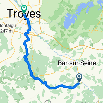
 Les Riceys - Troyes
- Dystans
- 61,8 km
- Przewyższenia
- 527 m
- Spadek
- 623 m
- Lokalizacja
- Les Riceys, Grand Est, Francja
 3 Rue des Perrières, Les Riceys à 1 Rue de la Maison Dieu de Ricey Bas, Les Riceys
- Dystans
- 7,4 km
- Przewyższenia
- 194 m
- Spadek
- 218 m
- Lokalizacja
- Les Riceys, Grand Est, Francja
 230 Chemin Rural de la Grande Lande, Les Riceys à 1 Rue de la Maison Dieu de Ricey Bas, Les Riceys
- Dystans
- 6,1 km
- Przewyższenia
- 58 m
- Spadek
- 57 m
- Lokalizacja
- Les Riceys, Grand Est, Francja


