
Roquefort Bergtraining 80
- 83,9 km
- 1320 m
- 1320 m
- Le Rouret, Prowansja-Alpy-Lazurowe Wybrzeże, Francja

Znajdź odpowiednią trasę rowerową dla siebie w Le Rouret – mamy tam 129 tras do odkrycia. Większość osób wybiera się tutaj na rower w miesiącach Lipiec i Sierpień.
Zarejestrowany dystans
Trasy rowerowe
Populacja
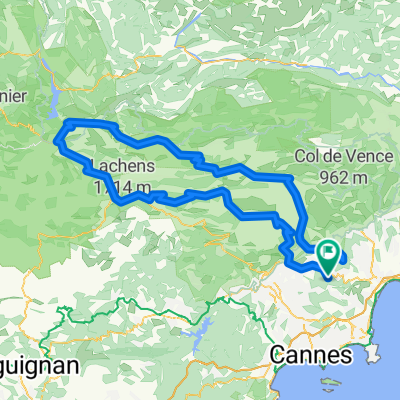
Trasa rowerowa w Le Rouret, Prowansja-Alpy-Lazurowe Wybrzeże, Francja
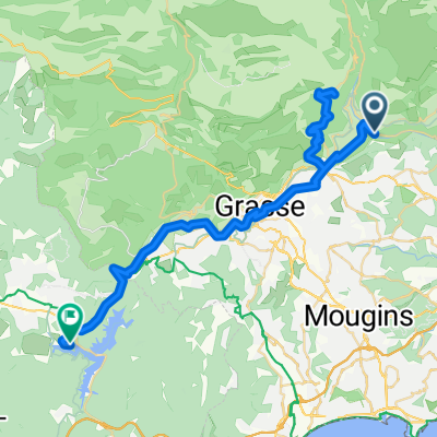
Trasa rowerowa w Le Rouret, Prowansja-Alpy-Lazurowe Wybrzeże, Francja
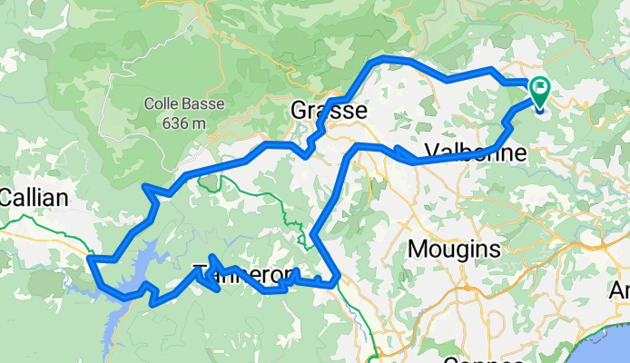
Trasa rowerowa w Le Rouret, Prowansja-Alpy-Lazurowe Wybrzeże, Francja
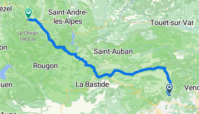
Trasa rowerowa w Le Rouret, Prowansja-Alpy-Lazurowe Wybrzeże, Francja