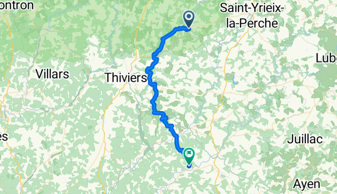
Jumilhac-le-Grand na rowerze
Odkrywaj mapę z 14 trasami rowerowymi i szlakami w pobliżu Jumilhac-le-Grand, stworzonymi przez naszą społeczność.
Portret regionu
Poznaj Jumilhac-le-Grand
Znajdź odpowiednią trasę rowerową dla siebie w Jumilhac-le-Grand – mamy tam 14 tras do odkrycia.
817 km
Zarejestrowany dystans
14
Trasy rowerowe
1344
Populacja
Wspólnota
Najaktywniejsi użytkownicy w Jumilhac-le-Grand
Od naszej społeczności
Najlepsze trasy rowerowe w Jumilhac-le-Grand i okolicach
Dag 3: Jumilhac-Lussac-les Châteaux (vr 12 en za 13/7)
Trasa rowerowa w Jumilhac-le-Grand, Nouvelle-Aquitaine, Francja
- 129,4 km
- Dystans
- 699 m
- Przewyższenia
- 886 m
- Spadek
Dag 3: Jumilhac-Lussac-les Châteaux (za 13/7) - OPTIE 1
Trasa rowerowa w Jumilhac-le-Grand, Nouvelle-Aquitaine, Francja
- 128,9 km
- Dystans
- 529 m
- Przewyższenia
- 717 m
- Spadek
Dag 3: Jumilhac-Confolens (za 13/7) - OPTIE 3
Trasa rowerowa w Jumilhac-le-Grand, Nouvelle-Aquitaine, Francja
- 95,2 km
- Dystans
- 631 m
- Przewyższenia
- 758 m
- Spadek
Route nach Tourtoirac
Trasa rowerowa w Jumilhac-le-Grand, Nouvelle-Aquitaine, Francja
- 40,6 km
- Dystans
- 692 m
- Przewyższenia
- 802 m
- Spadek
Odkryj więcej tras
 12 Rue Rene Demonpion, Jumilhac-le-Grand à 164C–164D Route des Perinches, Jumilhac-le-Grand
- Dystans
- 3,9 km
- Przewyższenia
- 40 m
- Spadek
- 39 m
- Lokalizacja
- Jumilhac-le-Grand, Nouvelle-Aquitaine, Francja
 14 Rue Rene Demonpion, Jumilhac-le-Grand à 164C–164D Route des Perinches, Jumilhac-le-Grand
- Dystans
- 5,6 km
- Przewyższenia
- 60 m
- Spadek
- 60 m
- Lokalizacja
- Jumilhac-le-Grand, Nouvelle-Aquitaine, Francja
 De Place du Château 5, Jumilhac-le-Grand à La Gaulie, Nantheuil
- Dystans
- 19,1 km
- Przewyższenia
- 266 m
- Spadek
- 292 m
- Lokalizacja
- Jumilhac-le-Grand, Nouvelle-Aquitaine, Francja
 Dag 3: Jumilhac-Cieux (vr 12/7)
- Dystans
- 67,9 km
- Przewyższenia
- 612 m
- Spadek
- 564 m
- Lokalizacja
- Jumilhac-le-Grand, Nouvelle-Aquitaine, Francja
 13/16 Jumilhac le Grand - St. Felix de Bourdeilles
- Dystans
- 74,3 km
- Przewyższenia
- 612 m
- Spadek
- 791 m
- Lokalizacja
- Jumilhac-le-Grand, Nouvelle-Aquitaine, Francja
 438 Prat, Jumilhac-le-Grand naar D67, Saint-Pierre-de-Frugie
- Dystans
- 25,7 km
- Przewyższenia
- 467 m
- Spadek
- 496 m
- Lokalizacja
- Jumilhac-le-Grand, Nouvelle-Aquitaine, Francja
 parcours jumilhac
- Dystans
- 32,3 km
- Przewyższenia
- 437 m
- Spadek
- 437 m
- Lokalizacja
- Jumilhac-le-Grand, Nouvelle-Aquitaine, Francja
 jumilhac le grand
- Dystans
- 32,2 km
- Przewyższenia
- 293 m
- Spadek
- 339 m
- Lokalizacja
- Jumilhac-le-Grand, Nouvelle-Aquitaine, Francja


