
Châtellerault na rowerze
Odkrywaj mapę z 100 trasami rowerowymi i szlakami w pobliżu Châtellerault, stworzonymi przez naszą społeczność.
Portret regionu
Poznaj Châtellerault
Znajdź odpowiednią trasę rowerową dla siebie w Châtellerault – mamy tam 100 tras do odkrycia. Większość osób wybiera się tutaj na rower w miesiącach Lipiec i Sierpień.
7736 km
Zarejestrowany dystans
100
Trasy rowerowe
37 210
Populacja
Wspólnota
Najaktywniejsi użytkownicy w Châtellerault


Od naszej społeczności
Najlepsze trasy rowerowe w Châtellerault i okolicach
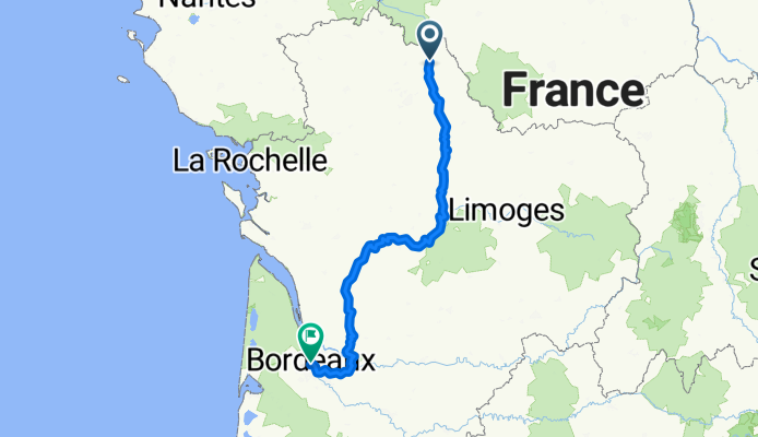
2. Châtellerault bis Bordeaux
Trasa rowerowa w Châtellerault, Nouvelle-Aquitaine, Francja
- 404,7 km
- Dystans
- 3009 m
- Przewyższenia
- 3042 m
- Spadek

DAY ONE Châtellerault - Savigny-sous-Faye
Trasa rowerowa w Châtellerault, Nouvelle-Aquitaine, Francja
- 24,5 km
- Dystans
- 138 m
- Przewyższenia
- 79 m
- Spadek
Chemin du Chilloux d'Ozon 17B to Rue des Glycines
Trasa rowerowa w Châtellerault, Nouvelle-Aquitaine, Francja
- 60,1 km
- Dystans
- 272 m
- Przewyższenia
- 240 m
- Spadek

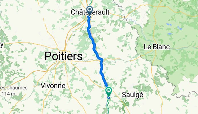
Chatellerault - Lussac Les Châteaux (60 km) - Chabanais (71 km)
Trasa rowerowa w Châtellerault, Nouvelle-Aquitaine, Francja
- 131 km
- Dystans
- 1044 m
- Przewyższenia
- 939 m
- Spadek
Odkryj więcej tras
 SityTrail - 001C Chatellerault St Jacques to St Savin via Angles and En Lo
- Dystans
- 61,2 km
- Przewyższenia
- 490 m
- Spadek
- 462 m
- Lokalizacja
- Châtellerault, Nouvelle-Aquitaine, Francja
 (4) Final Chattelerault - Bordeaux, 282km, 990HM (camping)
- Dystans
- 282,2 km
- Przewyższenia
- 574 m
- Spadek
- 592 m
- Lokalizacja
- Châtellerault, Nouvelle-Aquitaine, Francja
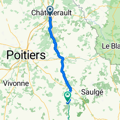 Châtellerault - Lussac-les-Châteaux
- Dystans
- 65 km
- Przewyższenia
- 293 m
- Spadek
- 268 m
- Lokalizacja
- Châtellerault, Nouvelle-Aquitaine, Francja
 11 Tag Châtellerault - Niort
- Dystans
- 112,6 km
- Przewyższenia
- 350 m
- Spadek
- 379 m
- Lokalizacja
- Châtellerault, Nouvelle-Aquitaine, Francja
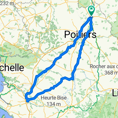
 tour du clain
- Dystans
- 42 km
- Przewyższenia
- 231 m
- Spadek
- 231 m
- Lokalizacja
- Châtellerault, Nouvelle-Aquitaine, Francja
 dag 5 chatelleraut naar nabij Savigne
- Dystans
- 92,5 km
- Przewyższenia
- 601 m
- Spadek
- 537 m
- Lokalizacja
- Châtellerault, Nouvelle-Aquitaine, Francja
 Châtellerault - Lussac-les-châteaux (58km) - Chabanais (130km) - Montbrond (174 km) - Angoulème (220 km)
- Dystans
- 216,9 km
- Przewyższenia
- 1908 m
- Spadek
- 1856 m
- Lokalizacja
- Châtellerault, Nouvelle-Aquitaine, Francja
 Voyage de fouuuuuuuuuuu
- Dystans
- 396,1 km
- Przewyższenia
- 2362 m
- Spadek
- 2362 m
- Lokalizacja
- Châtellerault, Nouvelle-Aquitaine, Francja