
Asson na rowerze
Odkrywaj mapę z 53 trasami rowerowymi i szlakami w pobliżu Asson, stworzonymi przez naszą społeczność.
Portret regionu
Poznaj Asson
Znajdź odpowiednią trasę rowerową dla siebie w Asson – mamy tam 53 tras do odkrycia. Większość osób wybiera się tutaj na rower w miesiącu Lipiec.
4911 km
Zarejestrowany dystans
53
Trasy rowerowe
1810
Populacja
Wspólnota
Najaktywniejsi użytkownicy w Asson
Od naszej społeczności
Najlepsze trasy rowerowe w Asson i okolicach
Day 5 -(Short option) Asson and Col de Soulor
Trasa rowerowa w Asson, Aquitaine-Limousin-Poitou-Charentes, France
The group rides together, and guests who don´t want to do l´Aubisque, will stay at the van, waiting for whatching the race.
- 33 km
- Dystans
- 1255 m
- Przewyższenia
- 105 m
- Spadek
Day 5 - Asson, Col d'Aubisque and Col de Soulor
Trasa rowerowa w Asson, Aquitaine-Limousin-Poitou-Charentes, France
Col de Soulor + Col d'Aubisque - We will watch the finish line back in Col de Soulour (Once the Van reach Col de Soulor, find a place and give food to the group. Then thouse who wants to do Col d´Aubisque, will climb and come back by them selfs (with the guide).
- 48 km
- Dystans
- 1668 m
- Przewyższenia
- 518 m
- Spadek
Europa Tour 2k14 25 Asson - Bois de Masseys
Trasa rowerowa w Asson, Aquitaine-Limousin-Poitou-Charentes, France
225 km mountains:
-Col du Soulor(1)
-Col du Aubisque(HC)
-Frontera del Portalet(HC)
-Forquete de Gabietou(HC)
-Bois de Masseys(HC)
- 223 km
- Dystans
- 5645 m
- Przewyższenia
- 4299 m
- Spadek
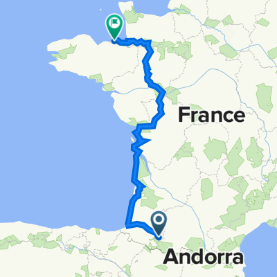
Asson - Marie Blanque - Asson
Trasa rowerowa w Asson, Aquitaine-Limousin-Poitou-Charentes, France
Asson - Lurbe-Saint-Christau - Escot - Coll Marie Blanque - Asson
- 86 km
- Dystans
- 1131 m
- Przewyższenia
- 1132 m
- Spadek
Odkryj więcej tras
- 08/06
- Dystans
- 96,7 km
- Przewyższenia
- 1671 m
- Spadek
- 1675 m
- Lokalizacja
- Asson, Aquitaine-Limousin-Poitou-Charentes, France
- BikeEurope2023-F
- Dystans
- 1173,2 km
- Przewyższenia
- 3067 m
- Spadek
- 3356 m
- Lokalizacja
- Asson, Aquitaine-Limousin-Poitou-Charentes, France
- Asson - Soulour - Aubisque
- Dystans
- 38,4 km
- Przewyższenia
- 1509 m
- Spadek
- 166 m
- Lokalizacja
- Asson, Aquitaine-Limousin-Poitou-Charentes, France
- SOULOR, por Ferrières
- Dystans
- 28,6 km
- Przewyższenia
- 1247 m
- Spadek
- 95 m
- Lokalizacja
- Asson, Aquitaine-Limousin-Poitou-Charentes, France
- Soulor-Aubisque-88km-1980m
- Dystans
- 87,5 km
- Przewyższenia
- 2308 m
- Spadek
- 2308 m
- Lokalizacja
- Asson, Aquitaine-Limousin-Poitou-Charentes, France
- Mifaget-Louvien Jouzon
- Dystans
- 12,4 km
- Przewyższenia
- 305 m
- Spadek
- 240 m
- Lokalizacja
- Asson, Aquitaine-Limousin-Poitou-Charentes, France
- SAINTE COLOME, por Mifaget
- Dystans
- 8,6 km
- Przewyższenia
- 330 m
- Spadek
- 138 m
- Lokalizacja
- Asson, Aquitaine-Limousin-Poitou-Charentes, France
- 2023_Tour_jun_06
- Dystans
- 95,8 km
- Przewyższenia
- 1927 m
- Spadek
- 1926 m
- Lokalizacja
- Asson, Aquitaine-Limousin-Poitou-Charentes, France