


Andora na rowerze
Odkrywaj mapę z 1285 trasami rowerowymi i szlakami w Andora, stworzonymi przez naszą społeczność.
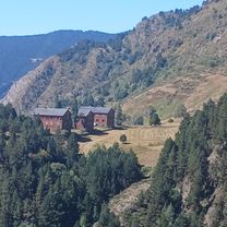
Portret regionu
Poznaj Andora
The miniature state in the Pyrenees is a mountain biker’s paradise where you can discover the most challenging and coolest bike routes with the bike route planner: The mountainous country boasts 65 mountain peaks over 2000 metres and more than a third of the country is located over the tree line. Perfect conditions for bike tours in fresh, not too hot weather that reward with beautiful scenic panoramas of mountain lakes and rugged peaks. But there are also less challenging routes more suitable for less experienced bikers.
138 356 km
Zarejestrowany dystans
1285
Trasy rowerowe
84 000
Populacja
Wspólnota
Najaktywniejsi użytkownicy w Andora
Starannie wybrane trasy
Odkryj Andora dzięki tym kolekcjom
 Wycieczka
 Wycieczka
 Wycieczka
Od naszej społeczności
Najlepsze trasy rowerowe w Andora
Andorra La Vella - Alp
Trasa rowerowa w Escaldes-Engordany, Escaldes-Engordany, Andora
- 64 km
- Dystans
- 556 m
- Przewyższenia
- 464 m
- Spadek
Andorra la Vella - Ax-les-Thermes
Trasa rowerowa w Andorra la Vella, Andorra la Vella, Andora
- 87,7 km
- Dystans
- 4117 m
- Przewyższenia
- 4337 m
- Spadek
Trans Pirineji stage 9
Trasa rowerowa w Ordino, Ordino, Andora
- 105,5 km
- Dystans
- 4475 m
- Przewyższenia
- 4758 m
- Spadek
Odkryj więcej tras
- Wszystkie trasy w Andora
- Trasy okrężne
- Zrelaksowany
- Żwir
- Szosowy
- MTB
- Trekking


 2ª ETAPA VOLTA COLL DE LA COMELLA (Andorra)0
- 15,4 km
- 522 m
- 522 m
- Andorra la Vella, Andorra la Vella, Andora


Najważniejsze momenty
- Discover Andorra’s cultural heritage, like the old iron mines, en route with the bike.
- Take a look at the medieval architecture in the capital Andorra la Vella. The Margineda bridge, the church Santa Coloma from the 9th century and the castle Sant Vicenç d'Enclar are amongst the old buildings.
- Explore the surroundings of Llac d’Engolasters. There are beautiful nature panoramas with the the lake in the foreground and mountains in the back.
Wskazówki
- Andorra has been part of the Tour de France and Tour of Spain stages on numerous occasions. Those ready to tackle mountainous routes can do it like the pros and trace those routes.
- Explore the two bike parks Vallnord Bike Park and Grandvalira Mountain Park with the mountain bike.
- Andorra’s official language is Catalan. But you’ll have no problem when communicating in French or Spanish.
Zobacz, gdzie ludzie jeżdżą na rowerze w Andora
Popularne regiony do jazdy na rowerze w Andora

