


- 42,5 km
- 300 m
- 302 m
- Balatonfüred, Veszprém megye, Węgry

Wenecja na rowerze
Odkrywaj mapę z 467 trasami rowerowymi i szlakami w pobliżu Wenecja, stworzonymi przez naszą społeczność.Portret regionuPoznaj Wenecja
Znajdź odpowiednią trasę rowerową dla siebie w Wenecja – mamy tam 467 tras do odkrycia. Większość osób wybiera się tutaj na rower w miesiącach Czerwiec i Lipiec.
185 394 km
Zarejestrowany dystans
467
Trasy rowerowe
51 298
Populacja
WspólnotaNajaktywniejsi użytkownicy w Wenecja
 Wycieczka
- Wycieczka
- Wycieczka
- Wycieczka
Venice to Cuneo (Northern Italy)
Trasa rowerowa w Wenecja, Wenecja Euganejska, Włochy
- 731,4 km
- Dystans
- 3998 m
- Przewyższenia
- 3501 m
- Spadek
Von Venedig Zentrum bis Rom
Trasa rowerowa w Wenecja, Wenecja Euganejska, Włochy
- 668,3 km
- Dystans
- 7741 m
- Przewyższenia
- 7711 m
- Spadek
Percorso per Cannaregio, Venezia
Trasa rowerowa w Wenecja, Wenecja Euganejska, Włochy
- 7,5 km
- Dystans
- 6 m
- Przewyższenia
- 7 m
- Spadek
Venedig - Guarda Veneta
Trasa rowerowa w Wenecja, Wenecja Euganejska, Włochy
- 97,3 km
- Dystans
- 99 m
- Przewyższenia
- 100 m
- Spadek

Best of Alpine scenery
Isar Cycle PathRiver Isar is only the fourth largest river in Bavaria, but the views along its banks is as stunning as that of the Danube, Inn and Main rivers. Over 295 kilometers (183 miles), the cycle path follows the Isar’s path through a landscape of exceptional variety. Craggy peaks, Alpine pastures and national parks form the backdrop for this cycle tour through Austria and Bavaria.
German part of the Isar Cycle Path

Lakes and castles
Lake Constance - Lake Königssee Cycle PathWhile circling the “Swabian Sea” is always a good idea for a bike trip, there are other amazing cycle routes near Lake Constance waiting to be explored. Highly recommended: the Lake Constance-Lake Königssee-cycle path from Lindau to Berchtesgaden national park. Fairytale castles Hohenschwangau and Neuschwanstein as well as magnificent lake landscapes await.
The Lake Constance-Lake Königssee Cycle Path


Everyone’s favorite
Inn Cycle PathBefore flowing into the Danube near Passau, the River Inn meanders over a distance of 500 kilometers (310 miles) from its source at the Swiss Maloja pass through Austria to Bavaria. Many cyclists follow its course, for the magnificent Inn cycle path is one of the most impressive in Europe. Its German stretch is mostly flat and well suited for families and groups of all abilities.

One river, eight countries
Danube Cycle PathA river originates in the Black Forest. As it winds its way to the Black Sea, it grows into the second longest waterway in Europe: the Danube. The Danube Cycle Path follows the river through eight countries and is one of the most popular long-distance routes for bike tourists. Over 600 kilometers (373 miles) form the German stretch of the Danube Cycle Path and are also part of EuroVelo 6, another stunning route leading from the Atlantic to the Black Sea.
The Danuble Cycle Path in Germany


Paris to Prague
Pan-European Cycle RouteThe “Golden Road”, a historical trade route dating back to the Middle Ages, is now open for cyclists. Under the ambitious name Pan-European cycle route it leads from the French capital through picturesque regions of Germany – Bavaria and Baden-Wuerttemberg – all the way to Prague. The traders used to cover 1570 kilometers (976 miles) on horseback or by cart, today you will find plenty of infrastructure for your cycling needs along the way.
The Pan-European Cycle Route
![Paneuropa-Radweg (Paris - Prag) 2010 [Tag12]](https://media.bikemap.net/routes/656712/staticmaps/in_277a6336-6ba8-4176-b5c7-52f5295b04da_694x400_bikemap-2021-3D-static.png)
- Venedig - Rosolina
- 61,1 km
- 0 m
- 0 m
- Wenecja, Wenecja Euganejska, Włochy
- Venice - Fiume Veneto
- 96,6 km
- 112 m
- 102 m
- Wenecja, Wenecja Euganejska, Włochy
- Von Venedig Zentrum bis Mailand
- 365,2 km
- 1167 m
- 1041 m
- Wenecja, Wenecja Euganejska, Włochy
- Venedig - Este
- 79,3 km
- 108 m
- 104 m
- Wenecja, Wenecja Euganejska, Włochy
- Venice - Caorle
- 47,7 km
- 0 m
- 10 m
- Wenecja, Wenecja Euganejska, Włochy
- Venedig - Sant'Anna
- 66,2 km
- 6 m
- 6 m
- Wenecja, Wenecja Euganejska, Włochy
- Alpi Dolomiti 2015
- 480,9 km
- 5842 m
- 5830 m
- Wenecja, Wenecja Euganejska, Włochy
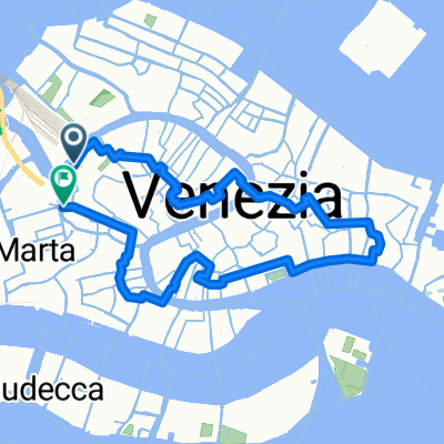
- Citywalk in Venice
- 6,9 km
- 40 m
- 40 m
- Wenecja, Wenecja Euganejska, Włochy


Trasy do Wenecja
- Jednodniowa wycieczka rowerowa odZ Campalto do Wenecja
- Jednodniowa wycieczka rowerowa odZ Padwa do Wenecja