Toskania na rowerze
Odkrywaj mapę z 43 543 trasami rowerowymi i szlakami w Toskania, stworzonymi przez naszą społeczność.
Portret regionu
Poznaj Toskania
Znajdź odpowiednią trasę rowerową dla siebie w Toskania – mamy tam 43 543 tras do odkrycia. Większość osób wybiera się tutaj na rower w miesiącach Maj i Sierpień.
2 855 775 km
Zarejestrowany dystans
43 543
Trasy rowerowe
Wspólnota
Najaktywniejsi użytkownicy w Toskania
Starannie wybrane trasy
Odkryj Toskania dzięki tym kolekcjom
Od naszej społeczności
Najlepsze trasy rowerowe w Toskania
2015 Tuscany Travel
Trasa rowerowa w Piza, Toskania, Włochy
- 481,2 km
- Dystans
- 2248 m
- Przewyższenia
- 2245 m
- Spadek
caprona-montemagno-verruca-buti-san giovanni
Trasa rowerowa w Gabella, Toskania, Włochy
- 19,2 km
- Dystans
- 577 m
- Przewyższenia
- 578 m
- Spadek
Colonnata - Le Cappelle - Sommaia - Il Ciliegio - Le Rocce - La Lea - Colonnata
Trasa rowerowa w Sesto Fiorentino, Toskania, Włochy
- 17,1 km
- Dystans
- 656 m
- Przewyższenia
- 658 m
- Spadek
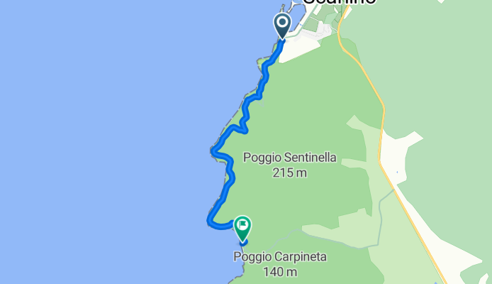
Percorso delle cale
Trasa rowerowa w Follonica, Toskania, Włochy
- 4,1 km
- Dystans
- 255 m
- Przewyższenia
- 244 m
- Spadek
Od naszych redaktorów
Najlepsze trasy rowerowe w Toskania i okolicach

The historic center of Siena transports you to another time. Piazza del Campo, Mangia tower and the grand Siena cathedral are all magnificent sights to behold. Halfway between Siena and Florence lies the town of Greve. Surrounded by vineyards, this medieval market town is hailed by many as the perfect base for cycling holidays in the Chianti region, and with one look at the map, you can see why. San Gimignano is just 40 km (25 miles) away and there is no need to navigate big city traffic on your way out of town. Rolling hills are right on your doorstep here. Bella !
- Strade Bianche Eroica 2011


- Dystans
- 189,3 km
- Przewyższenia
- 1307 m
- Spadek
- 1328 m
- Lokalizacja
- Gaiole in Chianti, Toskania, Włochy
- Strade Bianche 2015


- Dystans
- 202,4 km
- Przewyższenia
- 1391 m
- Spadek
- 1350 m
- Lokalizacja
- San Gimignano, Toskania, Włochy
- Strade Bianche for folk cyclists

- Dystans
- 262,6 km
- Przewyższenia
- 1779 m
- Spadek
- 1755 m
- Lokalizacja
- Tavarnuzze, Toskania, Włochy
- giro 30km strade bianche / asfalto

- Dystans
- 31,4 km
- Przewyższenia
- 24 m
- Spadek
- 21 m
- Lokalizacja
- Campagnola Emilia, Emilia-Romagna, Włochy
- giro 30km strade bianche / asfalto

- Dystans
- 31,4 km
- Przewyższenia
- 24 m
- Spadek
- 21 m
- Lokalizacja
- Campagnola Emilia, Emilia-Romagna, Włochy
- 34/2011 - Pienza e strade bianche CLONED FROM ROUTE 935045

- Dystans
- 46,7 km
- Przewyższenia
- 636 m
- Spadek
- 636 m
- Lokalizacja
- Pienza, Toskania, Włochy

Don't miss out on the dramatic landscape between the charming Tuscan towns of San Gimignano and Volterra. Sparsely dotted with farmhouses and vineyards, Le Balze is a wild area of heavily eroded rock and ravines formed by an ancient lake. The 34 km (21 miles) from San Gimignano to Volterra make for a great round trip which can be done in a day or two. San Gimignano, the medieval "town of fine towers", is a wonderful base for trips to the surrounding region but be sure to save some time to explore the town of Volterra, which was one of the great Etruscan cities. Situated on a hill (532 m / 1745 ft), the view from the ancient city walls overlooking the Cecina valley is spectacular.
- bike tour through Florence


- Dystans
- 11,1 km
- Przewyższenia
- 144 m
- Spadek
- 127 m
- Lokalizacja
- Florencja, Toskania, Włochy
- Florence Countryside Bike-Tour


- Dystans
- 11,6 km
- Przewyższenia
- 166 m
- Spadek
- 168 m
- Lokalizacja
- Florencja, Toskania, Włochy
- Route 7 Florence - Assisi - Florence

- Dystans
- 661,6 km
- Przewyższenia
- 4716 m
- Spadek
- 4719 m
- Lokalizacja
- Florencja, Toskania, Włochy
- 2017 Florence - Rome

- Dystans
- 324,1 km
- Przewyższenia
- 2159 m
- Spadek
- 2210 m
- Lokalizacja
- Florencja, Toskania, Włochy

The Renaissance flourished in Florence, producing great artists such as Leonardo da Vinci and Michelangelo, Botticelli and Donatello. With its wealth of sculptures and wonderful architecture, much of the inner city feels like an open-air museum. it is best to avoid navigating the busy traffic in the outskirts of Florence by starting your bike trip in the countryside. Via Chiantigiana is the road from Florence to Siena and leads through the heart of the wine country. On this winding route through picturesque countryside and the town of Greve, expect to share the road with lots of motorists. An alternative, quieter route is via Cassia which passes through Poggibonsi, Barberino Val d’Elsa and San Casciano on the way back to Florence.
- siena -rospatoio m.oliveto siena

- Dystans
- 86,3 km
- Przewyższenia
- 967 m
- Spadek
- 960 m
- Lokalizacja
- Siena, Toskania, Włochy
- BRUTAL2015-Tag7Z-Siena-Orvieto


- Dystans
- 133,5 km
- Przewyższenia
- 1662 m
- Spadek
- 1686 m
- Lokalizacja
- Siena, Toskania, Włochy

The “white roads” refer to the network of unmade gravel roads stretching across the vineyards and orchards of the Tuscan countryside. The fine limestone dirt and pebbles of the region make the paths appear white and dusty as they wind around and across the hilly fields. Professional biking has also fallen under the spell of this quintessential Tuscan experience. Every year in March, the “Strade Bianche – Eroica Pro” bike race includes over 50 km (30 miles) of these white roads on its gorgeous 200 km (125 miles) long route from San Gimignano to Siena. Although a fairly young racing event, it has become an instant classic.
- Tour Val d'Orcia


- Dystans
- 50,3 km
- Przewyższenia
- 669 m
- Spadek
- 669 m
- Lokalizacja
- Castiglione d'Orcia, Toskania, Włochy
- 07-06-2015


- Dystans
- 41,8 km
- Przewyższenia
- 413 m
- Spadek
- 413 m
- Lokalizacja
- Castiglione d'Orcia, Toskania, Włochy
- Giro della Val d'Orcia


- Dystans
- 216,5 km
- Przewyższenia
- 2518 m
- Spadek
- 2607 m
- Lokalizacja
- San Quirico d'Orcia, Toskania, Włochy
- www.goodbiketuscany.com


- Dystans
- 33,8 km
- Przewyższenia
- 499 m
- Spadek
- 623 m
- Lokalizacja
- Montepulciano, Toskania, Włochy
- Spedaletto - San Quirico - Cosona - Pienza


- Dystans
- 37,8 km
- Przewyższenia
- 544 m
- Spadek
- 544 m
- Lokalizacja
- Pienza, Toskania, Włochy

Here is an unforgettable loop through the Tuscan scenery on both tarmac and gravel roads. Start at San Quirico d’Orcia and follow the gravel road to Cosona. A short climb is rewarded by an incredible view of the UNESCO World Heritage site Val D’Orcia, which resembles the aesthetics of Renaissance landscape art: gentle slopes, panoramic views and slanting light brings out the colors. View the castle ruins of Castello di Cosona and the medieval monastery of Sant’Anna in Camprena, where “The English Patient” was filmed. A paved road leads to Pienza, which was rebuilt as an ideal town in the 15th Century. From here, return to San Quirico via a dirt road off the main road.
- San Gimignano - Volterra

- Dystans
- 67,2 km
- Przewyższenia
- 1415 m
- Spadek
- 1351 m
- Lokalizacja
- San Gimignano, Toskania, Włochy
- 75km San Gimignano kleine Straßen Poggi - Monteriggioni - Colle di Val - San Gimignano

- Dystans
- 75,1 km
- Przewyższenia
- 886 m
- Spadek
- 887 m
- Lokalizacja
- San Gimignano, Toskania, Włochy
- 78km San Gimignano - Montaione . Volterra Rundkurs

- Dystans
- 77,6 km
- Przewyższenia
- 1262 m
- Spadek
- 1262 m
- Lokalizacja
- San Gimignano, Toskania, Włochy
- San Gimignano - Monteriggioni - Certaldo - Rundkurs

- Dystans
- 65,9 km
- Przewyższenia
- 673 m
- Spadek
- 673 m
- Lokalizacja
- San Gimignano, Toskania, Włochy
- Volterra Trail 2016


- Dystans
- 189,9 km
- Przewyższenia
- 2956 m
- Spadek
- 2956 m
- Lokalizacja
- Volterra, Toskania, Włochy
- San Gimignano - Radda - San Gimignano

- Dystans
- 95,8 km
- Przewyższenia
- 1270 m
- Spadek
- 1270 m
- Lokalizacja
- San Gimignano, Toskania, Włochy
Odkryj więcej tras
 Rodellosso 2
- Dystans
- 27,6 km
- Przewyższenia
- 480 m
- Spadek
- 476 m
- Lokalizacja
- Pienza, Toskania, Włochy
 4- Castellina- Siena stat
- Dystans
- 24 km
- Przewyższenia
- 233 m
- Spadek
- 467 m
- Lokalizacja
- Castellina in Chianti, Toskania, Włochy
 Herisau - Sizilien 5. Etappe Arezzo - Viterbo
- Dystans
- 168,6 km
- Przewyższenia
- 1272 m
- Spadek
- 1192 m
- Lokalizacja
- Arezzo, Toskania, Włochy
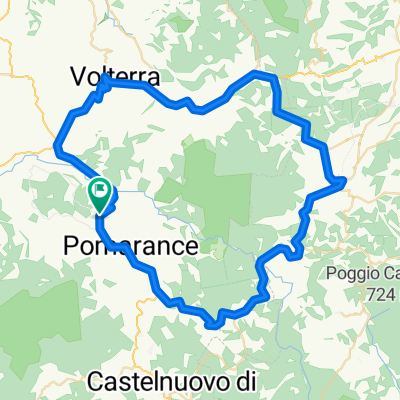 Pomarance-Casole-Volterra
- Dystans
- 75,2 km
- Przewyższenia
- 1608 m
- Spadek
- 1735 m
- Lokalizacja
- Pomarance, Toskania, Włochy
 La Pesta - Gavorrano - Valpiana
- Dystans
- 39,3 km
- Przewyższenia
- 583 m
- Spadek
- 571 m
- Lokalizacja
- Massa Marittima, Toskania, Włochy
 Gran Tour Parco Foreste Casentinesi
- Dystans
- 47,6 km
- Przewyższenia
- 1509 m
- Spadek
- 1510 m
- Lokalizacja
- Pratovecchio, Toskania, Włochy
 Vuelta San Miniato
- Dystans
- 45,1 km
- Przewyższenia
- 129 m
- Spadek
- 130 m
- Lokalizacja
- San Miniato, Toskania, Włochy
 Volterra - Colle - Castellina - Tavernelle - Certaldo - Volterra
- Dystans
- 128,5 km
- Przewyższenia
- 1631 m
- Spadek
- 1631 m
- Lokalizacja
- Volterra, Toskania, Włochy
Regiony rowerowe w Toskania
Montecarlo
70 trasy rowerowe
Fabbriche di Vallico
7 trasy rowerowe
Cesa
49 trasy rowerowe
Serre di Rapolano
27 trasy rowerowe
Massa
274 trasy rowerowe
Zobacz, gdzie ludzie jeżdżą na rowerze w Włochy
Popularne regiony do jazdy na rowerze w Włochy


