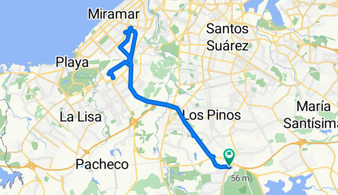
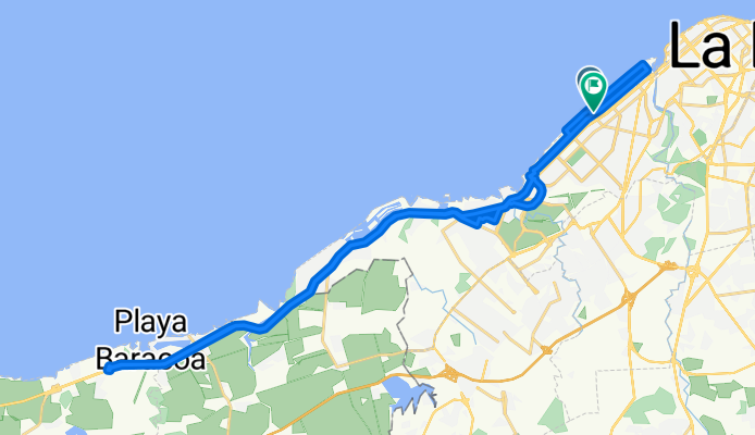
- 118 km
- 1142 m
- 1265 m
- Holguín, Prowincja Holguín, Kuba

Kuba na rowerze
Odkrywaj mapę z 2006 trasami rowerowymi i szlakami w Kuba, stworzonymi przez naszą społeczność.
Portret regionu
Poznaj Kuba
You can find the best bike routes through the diverse Cuba with the bike route planner. There is a lot of scenic variation: Stony coasts, flat wetlands, sandy beaches and wide plains. There are 330 days of sunshine a year on the Caribbean's biggest island and there are less cars on the roads than in the 1940’s in Germany. Perfect for bikers!
292 445 km
Zarejestrowany dystans
2006
Trasy rowerowe
11,4 milionów
Populacja
Wspólnota
Najaktywniejsi użytkownicy w Kuba
Starannie wybrane trasy
Odkryj Kuba dzięki tym kolekcjom
- Wycieczka
- Wycieczka
- Wycieczka
- Wycieczka
Od naszej społeczności
Najlepsze trasy rowerowe w Kuba
de mi casa al instituto Varona ,casa de mi hermano a.mi casas
Trasa rowerowa w Arroyo Naranjo, La Habana, Kuba
- 30,6 km
- Dystans
- 633 m
- Przewyższenia
- 589 m
- Spadek
Frank País a asta mi trabajo Ruta moderata
Trasa rowerowa w Arroyo Naranjo, La Habana, Kuba
- 20,3 km
- Dystans
- 156 m
- Przewyższenia
- 190 m
- Spadek
Ruta larga Baracoa 6/9
Trasa rowerowa w Hawana, La Habana, Kuba
- 46,6 km
- Dystans
- 173 m
- Przewyższenia
- 151 m
- Spadek
Route to Trinidad
Trasa rowerowa w Trinidad, Prowincja Sancti Spíritus, Kuba
- 43,8 km
- Dystans
- 1650 m
- Przewyższenia
- 1650 m
- Spadek
Odkryj więcej tras
- Báguanos
- Cauto Cristo - San Germán
- 95,5 km
- 342 m
- 302 m
- Bayamo, Prowincja Granma, Kuba
- Baracoa
- 85,3 km
- 3495 m
- 3062 m
- Baracoa, Prowincja Guantánamo, Kuba
- Santiago de Cuba - Contramaestre
- 77,3 km
- 1336 m
- 1290 m
- Santiago de Cuba, Prowincja Santiago de Cuba, Kuba
- Contramaestre - Cauto Cristo
- 58 km
- 415 m
- 468 m
- Contramaestre, Prowincja Santiago de Cuba, Kuba
- Baracoa
- 43,7 km
- 557 m
- 939 m
- Palenque, Prowincja Guantánamo, Kuba
- San Germán - Báguanos
- 45,8 km
- 227 m
- 177 m
- San Germán, Prowincja Holguín, Kuba
- Guantánamo
- 91,9 km
- 2243 m
- 2239 m
- Guantánamo, Prowincja Guantánamo, Kuba
Najważniejsze momenty
- A bike tour through the Valle de Viñales (Viñales valley) which received the UNESCO title “humanity’s cultural landscape” thanks to its limestone rocks in 1999. One cycles past beautiful view points, jagged rocks, small huts and green plantations through rural Cuba.
- Visit the Hemingway monument in Cojimar. The famous author had his usual seat in the bar “La Terraza”, which is still open today. The monument looks out on the harbour entrance, as this view inspired Hemingway to write his novel “The old man and the sea”.
- Take a walk through Havana, the capital, and let the country’s history and the old colonial buildings inspire you. You can also go swimming at the beach Playas del Este.
Wskazówki
- During the rainy season from May until October, the humidity after thunderstorms often rises up to 95% and cycling thus becomes accordingly exhausting. There is significantly less rain during the dry season and the average temperature drops to 25°C.
- Mountainbike fans get their money’s worth in East Cuba, the island’s most mountainous part. The Pico Turquino is Cuba’s highest mountain (1.974m). During the guerilla fights, the rebel army’s general command was located at its base.
- At its widest, the main island is only 50 kilometres wide, it’s thus possible to bike from shore to shore within a day.
Zobacz, gdzie ludzie jeżdżą na rowerze w Kuba

