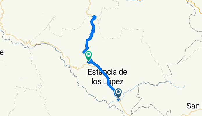
Nayarit na rowerze
Odkrywaj mapę z 341 trasami rowerowymi i szlakami w Nayarit, stworzonymi przez naszą społeczność.
Portret regionu
Poznaj Nayarit
Znajdź odpowiednią trasę rowerową dla siebie w Nayarit – mamy tam 341 tras do odkrycia. Większość osób wybiera się tutaj na rower w miesiącach Kwiecień i Lipiec.
12 345 km
Zarejestrowany dystans
341
Trasy rowerowe
Wspólnota
Najaktywniejsi użytkownicy w Nayarit
Od naszej społeczności
Najlepsze trasy rowerowe w Nayarit
Bici Bucerias Bakery Ride - Climbing La Sierra Madre - Bici Bucerias Bakery Ride - Climbing La Sierra Madre
Trasa rowerowa w San Juan de Abajo, Nayarit, Mexico
Are you a cyclist visiting Puerto Vallarta and looking for a great Puerto Vallarta cycling route? If you like to climb and enjoy the beauty of being in the mountains, this is the ride for you. We start and end at el Colorado. The ride goes up to a town called La Estancia. From there we head back down to this amazing bakery located just 5 km from the turn around point. Once refueled we will start our way back to el Colorado where we will have the most amazing post-ride lunch! Book this tour at www.BiciBucerias.com - If you like to climb and enjoy the beauty of being in the mountains, this is the ride for you. We start and end at el Colorado. The ride goes up to a town called La Estancia. From there we head back down to this amazing bakery located just 5 km from the turn around point. Once refueled we will start our way back to el Colorado where we will have the most amazing post-ride lunch! Book this tour at www.BiciBucerias.com
- 62,7 km
- Dystans
- 1366 m
- Przewyższenia
- 1367 m
- Spadek
el chorrito- el colomo- San Juan
Trasa rowerowa w San Juan de Abajo, Nayarit, Mexico
- 24,2 km
- Dystans
- 11 m
- Przewyższenia
- 39 m
- Spadek
huchichila, valle de banderas-San Juan de abajo Nayarit
Trasa rowerowa w San Juan de Abajo, Nayarit, Mexico
- 19,9 km
- Dystans
- 111 m
- Przewyższenia
- 105 m
- Spadek
Avenida Paseo de los Flamingos, Bucerías to Avenida Paseo de los Flamingos, Bucerías
Trasa rowerowa w Bucerías, Nayarit, Mexico
- 26,9 km
- Dystans
- 47 m
- Przewyższenia
- 54 m
- Spadek
Odkryj więcej tras
- San Juan-el Coatante.
- Dystans
- 28,2 km
- Przewyższenia
- 126 m
- Spadek
- 125 m
- Lokalizacja
- San Juan de Abajo, Nayarit, Mexico
- De Calle Geranios 18, Fraccionamiento Santa Fe a Calle Geranios 18, Fraccionamiento Santa Fe
- Dystans
- 33 km
- Przewyższenia
- 282 m
- Spadek
- 261 m
- Lokalizacja
- San Juan de Abajo, Nayarit, Mexico
- De Melchor Ocampo 43, San José del Valle a Melchor Ocampo 43, San José del Valle
- Dystans
- 4,1 km
- Przewyższenia
- 4 m
- Spadek
- 0 m
- Lokalizacja
- Valle de Banderas, Nayarit, Mexico
- Calle 5 de Mayo 15, Bahía de Banderas to Avenida Lázaro Cárdenas 129, Bahía de Banderas
- Dystans
- 19,1 km
- Przewyższenia
- 99 m
- Spadek
- 99 m
- Lokalizacja
- San Juan de Abajo, Nayarit, Mexico
- Bici Bucerias Gravel Tour www.bicibucerias.com - Bici Bucerias Gravel Tour www.bicibucerias.com
- Dystans
- 40,4 km
- Przewyższenia
- 87 m
- Spadek
- 88 m
- Lokalizacja
- Bucerías, Nayarit, Mexico
- De Paseo Bocanegra, Puerto Vallarta a Calle Río Amazonas 563, Puerto Vallarta
- Dystans
- 14,1 km
- Przewyższenia
- 103 m
- Spadek
- 86 m
- Lokalizacja
- Las Jarretaderas, Nayarit, Mexico
- BAX 3.0
- Dystans
- 40,3 km
- Przewyższenia
- 198 m
- Spadek
- 221 m
- Lokalizacja
- Xalisco, Nayarit, Mexico
- De Unnamed Road, Tepic a Gardenias 149, Tepic
- Dystans
- 11,9 km
- Przewyższenia
- 318 m
- Spadek
- 356 m
- Lokalizacja
- Tepic, Nayarit, Mexico
Regiony rowerowe w Nayarit
Ahuacatlán
3 trasy rowerowe
Corral del Risco (Punta de Mita)
14 trasy rowerowe
Palma Grande
3 trasy rowerowe
Zobacz, gdzie ludzie jeżdżą na rowerze w Mexico
Popularne regiony do jazdy na rowerze w Mexico
MexicoJalisco MexicoTamaulipas MexicoSan Luis Potosí MexicoZacatecas MexicoCampeche