
Taylorsville na rowerze
Odkrywaj mapę rowerową Taylorsville, z wyróżnionymi ścieżkami, szlakami i punktami zainteresowania.
Bądź pionierem
Zainspiruj innych rowerzystów swoją trasą w Taylorsville
Bikemap to globalna społeczność rowerowa z milionami tras tworzonych przez rowerzystów takich jak Ty. W Taylorsville jest na razie tylko kilka tras, więc narysuj swoje ulubione przejazdy na mapie, by pomóc innym odkryć najlepsze trasy.
Od naszej społeczności
Najlepsze trasy rowerowe w Taylorsville i okolicach


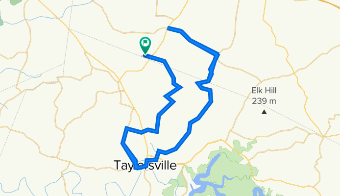
Chesapeake Meadows to Taylorsville DQ
Trasa rowerowa w Taylorsville, Kentucky, USA
This is just a fantastic route that begins in a cul-de-sac of Chesapeake Meadows Ct (very easy to park your vehicle) and goes through various picturesque settings including creeks, vistas, forested areas and more. There are several great side-jaunts along the way that you can take to add additional distance. Extremely low vehicular traffic for the vast majority of the route - and really no dangerous roads at all (except for 100 yds on 55 at the beginning / ending of the ride). We traditionally stop in at DQ for a mid-ride refresher. Just a great little route for a 2 1/2 - 4 hour excursion (depending on your speed and how long you linger at DQ :) )
- 40,1 km
- Dystans
- 326 m
- Przewyższenia
- 326 m
- Spadek
Home-Finchville-Home 50 miles
Trasa rowerowa w Taylorsville, Kentucky, USA
- 82,8 km
- Dystans
- 1099 m
- Przewyższenia
- 1096 m
- Spadek