Wheaton na rowerze
Odkrywaj mapę z 43 trasami rowerowymi i szlakami w pobliżu Wheaton, stworzonymi przez naszą społeczność.
Portret regionu
Poznaj Wheaton
Znajdź odpowiednią trasę rowerową dla siebie w Wheaton – mamy tam 43 tras do odkrycia.
1025 km
Zarejestrowany dystans
43
Trasy rowerowe
48 284
Populacja
Wspólnota
Najaktywniejsi użytkownicy w Wheaton
Od naszej społeczności
Najlepsze trasy rowerowe w Wheaton i okolicach
Wheaton to Bethesda and back
Trasa rowerowa w Wheaton, Maryland, USA
Wheaton - West Kensington - down Stoneybrook road (big hill).
Join Georgetown Branch trail into Bethesda.
Coming back take Branch trail to Conn.
Go 2 blocks North - join Kensington Parkway to Kensington. Home via Plyers Mill.
- 17,3 km
- Dystans
- 186 m
- Przewyższenia
- 185 m
- Spadek
Wheaton to Georgetown and back
Trasa rowerowa w Wheaton, Maryland, USA
Wheaton to Georgetown and back via the Capital Crescent trail through Bethesda and returning via the Rock Creek trail.
Makes use of the 2 best bike trails in DC.
- 44,6 km
- Dystans
- 273 m
- Przewyższenia
- 273 m
- Spadek
Wheaton to Friendship Heights
Trasa rowerowa w Wheaton, Maryland, USA
Through Kensington - down Stonybrook big hill to Rock Creek and Georgetown Branch trail.
<br />Through Bethesda - cross through Somerset town to Wisconsin.
Round trip 16 miles approx.
- 24,8 km
- Dystans
- 249 m
- Przewyższenia
- 249 m
- Spadek
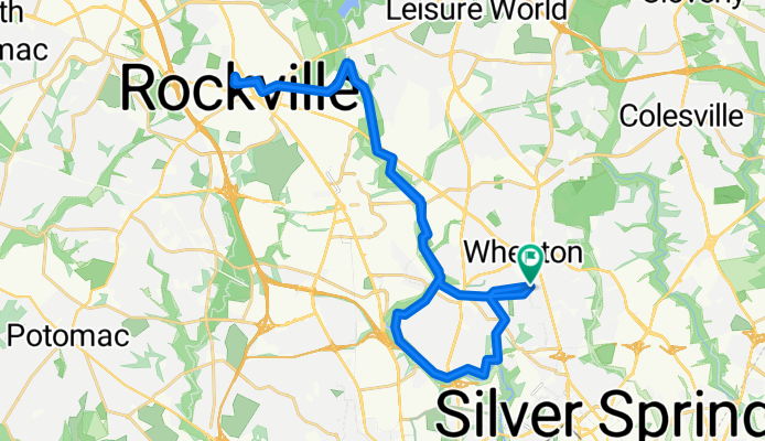
Wheaton to Rockville
Trasa rowerowa w Wheaton, Maryland, USA
Great ride.
Rock Creek Trail North then Baltimore Road towards Rockville which was a challenging but not unbearable climb. Round trip 24 miles.
Cut out Sotuh Kensington on way home.
- 38,4 km
- Dystans
- 258 m
- Przewyższenia
- 259 m
- Spadek
Odkryj więcej tras
 bike tour from Silver Spring to Washington
- Dystans
- 18,1 km
- Przewyższenia
- 103 m
- Spadek
- 160 m
- Lokalizacja
- Wheaton, Maryland, USA
 Sligo Creek to Rock Creek via Takoma
- Dystans
- 25,8 km
- Przewyższenia
- 197 m
- Spadek
- 197 m
- Lokalizacja
- Wheaton, Maryland, USA
 Wheaton to Georgetown and back
- Dystans
- 44,6 km
- Przewyższenia
- 245 m
- Spadek
- 248 m
- Lokalizacja
- Wheaton, Maryland, USA
 Rock Creek to Matthew Henson trail
- Dystans
- 21,4 km
- Przewyższenia
- 207 m
- Spadek
- 204 m
- Lokalizacja
- Wheaton, Maryland, USA
 Leesburg Maryland Virginia Loop
- Dystans
- 107,2 km
- Przewyższenia
- 317 m
- Spadek
- 357 m
- Lokalizacja
- Wheaton, Maryland, USA
 Wheaton to hanes Point
- Dystans
- 35,6 km
- Przewyższenia
- 145 m
- Spadek
- 255 m
- Lokalizacja
- Wheaton, Maryland, USA
 Bethesda Trolley loop
- Dystans
- 23 km
- Przewyższenia
- 205 m
- Spadek
- 204 m
- Lokalizacja
- Wheaton, Maryland, USA
 Wheaton to Olney
- Dystans
- 48,9 km
- Przewyższenia
- 246 m
- Spadek
- 247 m
- Lokalizacja
- Wheaton, Maryland, USA


