
South Connellsville na rowerze
Odkrywaj mapę z 10 trasami rowerowymi i szlakami w pobliżu South Connellsville, stworzonymi przez naszą społeczność.
Portret regionu
Poznaj South Connellsville
Znajdź odpowiednią trasę rowerową dla siebie w South Connellsville – mamy tam 10 tras do odkrycia.
470 km
Zarejestrowany dystans
10
Trasy rowerowe
1970
Populacja
Wspólnota
Najaktywniejsi użytkownicy w South Connellsville


Od naszej społeczności
Najlepsze trasy rowerowe w South Connellsville i okolicach
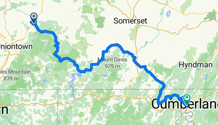
Morrell Ave, Connellsville to Greene St, Cumberland
Trasa rowerowa w South Connellsville, Pensylwania, USA
- 149,9 km
- Dystans
- 3296 m
- Przewyższenia
- 3422 m
- Spadek

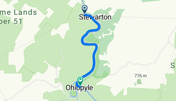
ohio Pyle
Trasa rowerowa w South Connellsville, Pensylwania, USA
- 2,2 km
- Dystans
- 0 m
- Przewyższenia
- 11 m
- Spadek
Brunner Run to WV
Trasa rowerowa w South Connellsville, Pensylwania, USA
- 9,6 km
- Dystans
- 283 m
- Przewyższenia
- 232 m
- Spadek

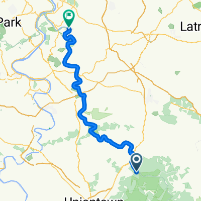
Great Allegheny Passage: South Connellsville to Braddock
Trasa rowerowa w South Connellsville, Pensylwania, USA
- 82,5 km
- Dystans
- 730 m
- Przewyższenia
- 630 m
- Spadek
Odkryj więcej tras
 9-11 Trail: South Connellsville to Greenock
- Dystans
- 65,5 km
- Przewyższenia
- 509 m
- Spadek
- 606 m
- Lokalizacja
- South Connellsville, Pensylwania, USA
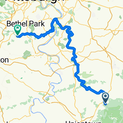 South Connellsville to McMurray
- Dystans
- 104,9 km
- Przewyższenia
- 930 m
- Spadek
- 959 m
- Lokalizacja
- South Connellsville, Pensylwania, USA
 Great Allegheny Passage, Mill Run to Main Street 49, Dunbar
- Dystans
- 21,6 km
- Przewyższenia
- 285 m
- Spadek
- 247 m
- Lokalizacja
- South Connellsville, Pensylwania, USA
 Easy ride in
- Dystans
- 0,1 km
- Przewyższenia
- 0 m
- Spadek
- 0 m
- Lokalizacja
- South Connellsville, Pensylwania, USA
 Route to 237 N First St, Connellsville
- Dystans
- 23,3 km
- Przewyższenia
- 123 m
- Spadek
- 215 m
- Lokalizacja
- South Connellsville, Pensylwania, USA
 Moderate route in Ohiopyle
- Dystans
- 10,6 km
- Przewyższenia
- 166 m
- Spadek
- 157 m
- Lokalizacja
- South Connellsville, Pensylwania, USA