
Parsons na rowerze
Odkrywaj mapę z 26 trasami rowerowymi i szlakami w pobliżu Parsons, stworzonymi przez naszą społeczność.
Portret regionu
Poznaj Parsons
Znajdź odpowiednią trasę rowerową dla siebie w Parsons – mamy tam 26 tras do odkrycia.
1358 km
Zarejestrowany dystans
26
Trasy rowerowe
1485
Populacja
Wspólnota
Najaktywniejsi użytkownicy w Parsons


Od naszej społeczności
Najlepsze trasy rowerowe w Parsons i okolicach
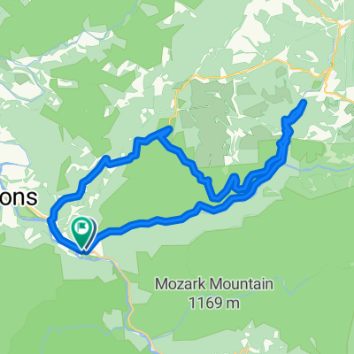
Allegheny Highlands Trail of Wv, Parsons to Main St, Parsons
Trasa rowerowa w Parsons, Wirginia Zachodnia, USA
- 42,2 km
- Dystans
- 531 m
- Przewyższenia
- 527 m
- Spadek

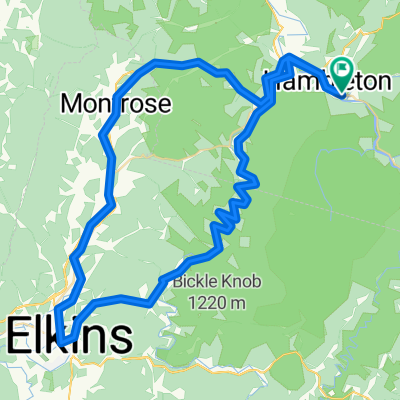
Limestone Mt. Loop
Trasa rowerowa w Parsons, Wirginia Zachodnia, USA
- 33,4 km
- Dystans
- 587 m
- Przewyższenia
- 587 m
- Spadek

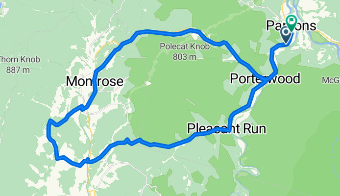
Parsons-Montrose Loop
Trasa rowerowa w Parsons, Wirginia Zachodnia, USA
- 61,5 km
- Dystans
- 604 m
- Przewyższenia
- 602 m
- Spadek

Horseshoe - Limestone Mt. Ride
Trasa rowerowa w Parsons, Wirginia Zachodnia, USA
- 55 km
- Dystans
- 677 m
- Przewyższenia
- 677 m
- Spadek
Odkryj więcej tras
 Texas Mountain
- Dystans
- 34,7 km
- Przewyższenia
- 502 m
- Spadek
- 502 m
- Lokalizacja
- Parsons, Wirginia Zachodnia, USA
 Pifer Mountain Loop
- Dystans
- 31,4 km
- Przewyższenia
- 557 m
- Spadek
- 557 m
- Lokalizacja
- Parsons, Wirginia Zachodnia, USA
 Backbone Mountain Climb
- Dystans
- 8,7 km
- Przewyższenia
- 534 m
- Spadek
- 26 m
- Lokalizacja
- Parsons, Wirginia Zachodnia, USA
 Olson Fire Tower to Parsons
- Dystans
- 35,8 km
- Przewyższenia
- 96 m
- Spadek
- 710 m
- Lokalizacja
- Parsons, Wirginia Zachodnia, USA
 BW falls to Parsons to Deck Creek to apt
- Dystans
- 124,3 km
- Przewyższenia
- 959 m
- Spadek
- 1571 m
- Lokalizacja
- Parsons, Wirginia Zachodnia, USA
 Route in Hendricks
- Dystans
- 83,8 km
- Przewyższenia
- 1531 m
- Spadek
- 1531 m
- Lokalizacja
- Parsons, Wirginia Zachodnia, USA
 Bfalls to Moundsville
- Dystans
- 201,5 km
- Przewyższenia
- 1391 m
- Spadek
- 2151 m
- Lokalizacja
- Parsons, Wirginia Zachodnia, USA
 Second St, Hendricks to Allegheny Highlands Trail of Wv, Hendricks
- Dystans
- 39,5 km
- Przewyższenia
- 798 m
- Spadek
- 794 m
- Lokalizacja
- Parsons, Wirginia Zachodnia, USA