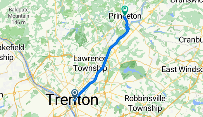
Trenton na rowerze
Odkrywaj mapę z 27 trasami rowerowymi i szlakami w pobliżu Trenton, stworzonymi przez naszą społeczność.
Portret regionu
Poznaj Trenton
Znajdź odpowiednią trasę rowerową dla siebie w Trenton – mamy tam 27 tras do odkrycia.
1221 km
Zarejestrowany dystans
27
Trasy rowerowe
84 913
Populacja
Wspólnota
Najaktywniejsi użytkownicy w Trenton
Od naszej społeczności
Najlepsze trasy rowerowe w Trenton i okolicach
Hwy to Witherspoon and Green St (West)
Trasa rowerowa w Trenton, New Jersey, USA
- 19,4 km
- Dystans
- 92 m
- Przewyższenia
- 52 m
- Spadek
229–299 Federal St, Trenton to 45 Pennwood Dr, Ewing
Trasa rowerowa w Trenton, New Jersey, USA
- 6,5 km
- Dystans
- 42 m
- Przewyższenia
- 20 m
- Spadek
Pennsylvania via River Line
Trasa rowerowa w Trenton, New Jersey, USA
- 63,7 km
- Dystans
- 201 m
- Przewyższenia
- 207 m
- Spadek
Trenton to Lambertville/New Hope and back
Trasa rowerowa w Trenton, New Jersey, USA
- 52,6 km
- Dystans
- 130 m
- Przewyższenia
- 139 m
- Spadek
Odkryj więcej tras
 NJ Coast to Coast
- Dystans
- 82,7 km
- Przewyższenia
- 182 m
- Spadek
- 196 m
- Lokalizacja
- Trenton, New Jersey, USA
 The Almost to Philly Trenton to Camden Ride
- Dystans
- 66,4 km
- Przewyższenia
- 99 m
- Spadek
- 113 m
- Lokalizacja
- Trenton, New Jersey, USA
 Tour of Trenton 2014
- Dystans
- 19,3 km
- Przewyższenia
- 50 m
- Spadek
- 56 m
- Lokalizacja
- Trenton, New Jersey, USA
 200B Whitehead Rd, Hamilton to 3900–3970 Princeton Pike, Princeton
- Dystans
- 9,2 km
- Przewyższenia
- 52 m
- Spadek
- 42 m
- Lokalizacja
- Trenton, New Jersey, USA
 Up to Strawberry Hill
- Dystans
- 59,6 km
- Przewyższenia
- 603 m
- Spadek
- 598 m
- Lokalizacja
- Trenton, New Jersey, USA
 Hill Kill
- Dystans
- 89,6 km
- Przewyższenia
- 573 m
- Spadek
- 571 m
- Lokalizacja
- Trenton, New Jersey, USA
 512 Union St, Trenton to 33 Pennwood Dr, Ewing
- Dystans
- 5,8 km
- Przewyższenia
- 42 m
- Spadek
- 23 m
- Lokalizacja
- Trenton, New Jersey, USA
 512 Union St, Trenton to 54 Pennwood Dr, Ewing
- Dystans
- 6,9 km
- Przewyższenia
- 44 m
- Spadek
- 23 m
- Lokalizacja
- Trenton, New Jersey, USA


