
Skyline View na rowerze
Odkrywaj mapę z 11 trasami rowerowymi i szlakami w pobliżu Skyline View, stworzonymi przez naszą społeczność.
Portret regionu
Poznaj Skyline View
Znajdź odpowiednią trasę rowerową dla siebie w Skyline View – mamy tam 11 tras do odkrycia.
664 km
Zarejestrowany dystans
11
Trasy rowerowe
4003
Populacja
Wspólnota
Najaktywniejsi użytkownicy w Skyline View


Od naszej społeczności
Najlepsze trasy rowerowe w Skyline View i okolicach

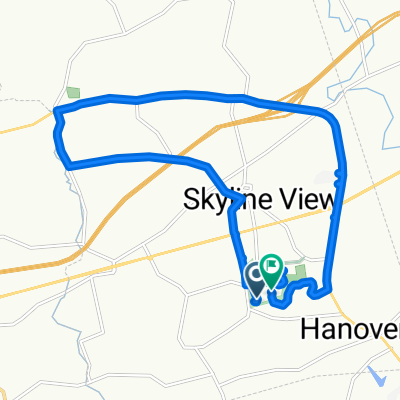
Swatara Gap 40 miler
Trasa rowerowa w Skyline View, Pensylwania, USA
- 65,3 km
- Dystans
- 311 m
- Przewyższenia
- 312 m
- Spadek

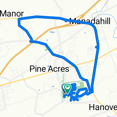
Hummelstown to Marietta
Trasa rowerowa w Skyline View, Pensylwania, USA
- 42,6 km
- Dystans
- 490 m
- Przewyższenia
- 533 m
- Spadek

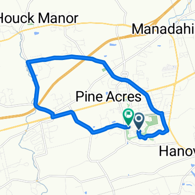
Devonshire Heights Road 8263, Hummelstown to Devonshire Heights Road 8822, Hummelstown
Trasa rowerowa w Skyline View, Pensylwania, USA
- 25,5 km
- Dystans
- 31 m
- Przewyższenia
- 42 m
- Spadek

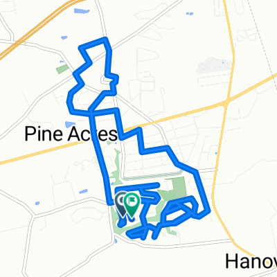
Double Blue Ridge 3Bs
Trasa rowerowa w Skyline View, Pensylwania, USA
- 26,3 km
- Dystans
- 511 m
- Przewyższenia
- 498 m
- Spadek
Odkryj więcej tras
 Piketown Linglestown loop
- Dystans
- 16,7 km
- Przewyższenia
- 141 m
- Spadek
- 102 m
- Lokalizacja
- Skyline View, Pensylwania, USA
 Neighborhood Linglestown Rd loop
- Dystans
- 17,4 km
- Przewyższenia
- 184 m
- Spadek
- 149 m
- Lokalizacja
- Skyline View, Pensylwania, USA
 Route in Harrisburg
- Dystans
- 10,8 km
- Przewyższenia
- 81 m
- Spadek
- 81 m
- Lokalizacja
- Skyline View, Pensylwania, USA
 Chervil Court to Chervil Court
- Dystans
- 14 km
- Przewyższenia
- 126 m
- Spadek
- 94 m
- Lokalizacja
- Skyline View, Pensylwania, USA
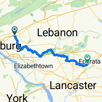 From Harrisburg to Ephrata
- Dystans
- 74,5 km
- Przewyższenia
- 712 m
- Spadek
- 754 m
- Lokalizacja
- Skyline View, Pensylwania, USA
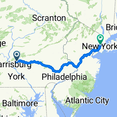 NYC Final
- Dystans
- 357 km
- Przewyższenia
- 2199 m
- Spadek
- 2328 m
- Lokalizacja
- Skyline View, Pensylwania, USA
 Allentown Boulevard to Chocolate World Way
- Dystans
- 13,8 km
- Przewyższenia
- 80 m
- Spadek
- 117 m
- Lokalizacja
- Skyline View, Pensylwania, USA