
Guadalupe na rowerze
Odkrywaj mapę z 452 trasami rowerowymi i szlakami w pobliżu Guadalupe, stworzonymi przez naszą społeczność.
Portret regionu
Poznaj Guadalupe
Znajdź odpowiednią trasę rowerową dla siebie w Guadalupe – mamy tam 452 tras do odkrycia. Większość osób wybiera się tutaj na rower w miesiącach Maj i Wrzesień.
14 995 km
Zarejestrowany dystans
452
Trasy rowerowe
5523
Populacja
Wspólnota
Najaktywniejsi użytkownicy w Guadalupe


Od naszej społeczności
Najlepsze trasy rowerowe w Guadalupe i okolicach
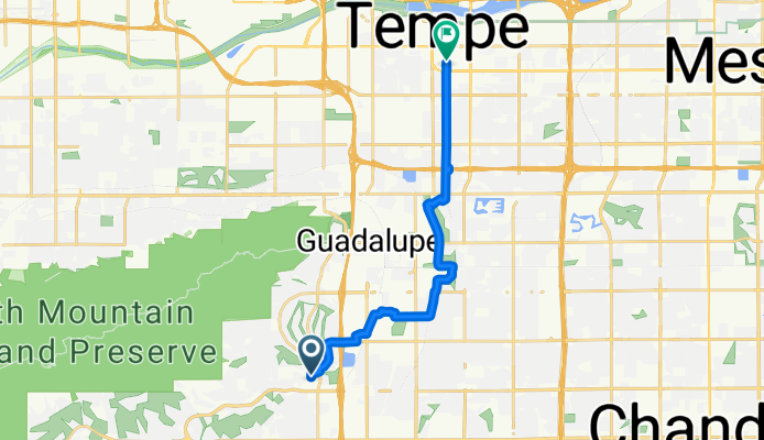
From AHW to campus via Warner
Trasa rowerowa w Guadalupe, Arizona, USA
- 16,5 km
- Dystans
- 56 m
- Przewyższenia
- 75 m
- Spadek
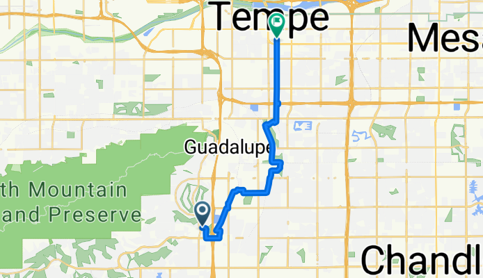

Tempe, AZ - Tonapah, AZ
Trasa rowerowa w Guadalupe, Arizona, USA
- 109,8 km
- Dystans
- 113 m
- Przewyższenia
- 141 m
- Spadek

East Valley Grand Tour
Trasa rowerowa w Guadalupe, Arizona, USA
- 101,3 km
- Dystans
- 1523 m
- Przewyższenia
- 1523 m
- Spadek
Odkryj więcej tras
 Tour De Phoenix Canals
- Dystans
- 146,2 km
- Przewyższenia
- 117 m
- Spadek
- 116 m
- Lokalizacja
- Guadalupe, Arizona, USA
 S 40th St, Phoenix to 17010 S 40th St, Phoenix
- Dystans
- 19,4 km
- Przewyższenia
- 78 m
- Spadek
- 78 m
- Lokalizacja
- Guadalupe, Arizona, USA
 Around the Moutain
- Dystans
- 74,3 km
- Przewyższenia
- 89 m
- Spadek
- 91 m
- Lokalizacja
- Guadalupe, Arizona, USA
 Ahwatukee Pecos Loop
- Dystans
- 43,3 km
- Przewyższenia
- 144 m
- Spadek
- 143 m
- Lokalizacja
- Guadalupe, Arizona, USA
 Chandler to Red Mountain Community College
- Dystans
- 39,3 km
- Przewyższenia
- 116 m
- Spadek
- 5 m
- Lokalizacja
- Guadalupe, Arizona, USA
 Mummy Mountain with Performance Chandler, AZ
- Dystans
- 76,7 km
- Przewyższenia
- 272 m
- Spadek
- 270 m
- Lokalizacja
- Guadalupe, Arizona, USA
 Tour de Dans
- Dystans
- 54,1 km
- Przewyższenia
- 180 m
- Spadek
- 176 m
- Lokalizacja
- Guadalupe, Arizona, USA
 Francisco Park to South Mountain summit and back
- Dystans
- 40,4 km
- Przewyższenia
- 578 m
- Spadek
- 580 m
- Lokalizacja
- Guadalupe, Arizona, USA