
Beloeil na rowerze
Odkrywaj mapę z 255 trasami rowerowymi i szlakami w pobliżu Beloeil, stworzonymi przez naszą społeczność.
Portret regionu
Poznaj Beloeil
Znajdź odpowiednią trasę rowerową dla siebie w Beloeil – mamy tam 255 tras do odkrycia. Większość osób wybiera się tutaj na rower w miesiącach Maj i Sierpień.
9833 km
Zarejestrowany dystans
255
Trasy rowerowe
18 927
Populacja
Wspólnota
Najaktywniejsi użytkownicy w Beloeil
Od naszej społeczności
Najlepsze trasy rowerowe w Beloeil i okolicach
CAE - Trois Monts Moyen
Trasa rowerowa w Beloeil, Quebec, Canada
<div class="routedescription " style="box-sizing: border-box; height: auto; margin-bottom: 15px; overflow: hidden; color: rgb(102, 102, 102); font-family: ProximaNovaSoft-Regular, Helvetica, 'Helvetica Neue', sans-serif; font-size: 13px; line-height: 18.81599998474121px;">
Route d'entrainement pour le cyclo-défis version moyenne.
</div>
- 77,8 km
- Dystans
- 171 m
- Przewyższenia
- 171 m
- Spadek
Métropolitain 75
Trasa rowerowa w Beloeil, Quebec, Canada
Tracé approximatif du parcours de 75km.
- 73,4 km
- Dystans
- 56 m
- Przewyższenia
- 56 m
- Spadek
R.L. Tour Mt-St-Hilaire. 1
Trasa rowerowa w Beloeil, Quebec, Canada
Réserve McGill. Verges . New France Équitation. Gare St-Hilaire.
- 46,3 km
- Dystans
- 233 m
- Przewyższenia
- 235 m
- Spadek
Circuit de la Pomme CLONED FROM ROUTE 249518
Trasa rowerowa w Beloeil, Quebec, Canada
0 kmBd Sir Wilfrid Laurier (116 &
229)
4.3 km droite Chemin Benoit (229)
13.3 km au bout à gauche Rang du
Cordon
14.6 km 1e droite Rang St-Louis
19 km au bout à gauche Rue Principale
(231)
20 km 2e droite Rue st-Joseph /
Chemin de la rivière
22.7 km au bout à droite Rang du Haut
de la rivière (233)
35 km droite Route 112
38 km droite Rang double (si on
rate le chemin, prendre droite 231 puis gauche)
39.8 km continuer Rue principale
41.6 km continuer Chemin de la Montagne
(229)
46.2 km continuer Route de Rougemont
(229)
51 km au bout à droite Rue principale
(227)
52 km 1e gauche Chemin Rouville
54 km 2e droite Chemin de la
Montagne
55.2 km continuer gauche Chemin de la
Montagne
57.7 km au bout à droite Chemin Oziac
Leduc / Rue Fortier
60 km au bout à droite Bd Sir Wilfrid
Laurier (116 & 229)
<br />
- 60,4 km
- Dystans
- 155 m
- Przewyższenia
- 156 m
- Spadek
Odkryj więcej tras
- Chambly Basin
- Dystans
- 44,5 km
- Przewyższenia
- 69 m
- Spadek
- 68 m
- Lokalizacja
- Beloeil, Quebec, Canada
- Basin
- Dystans
- 45,7 km
- Przewyższenia
- 69 m
- Spadek
- 67 m
- Lokalizacja
- Beloeil, Quebec, Canada
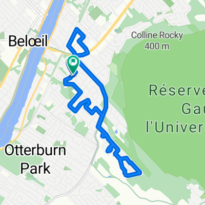
- St Hilaire St Madeleine Grand Allee
- Dystans
- 23,9 km
- Przewyższenia
- 44 m
- Spadek
- 40 m
- Lokalizacja
- Beloeil, Quebec, Canada
- Rougemont
- Dystans
- 50,8 km
- Przewyższenia
- 160 m
- Spadek
- 160 m
- Lokalizacja
- Beloeil, Quebec, Canada
- De 1141 Rue Azarie-Lamer, Beloeil à 1141 Rue Azarie-Lamer, Beloeil
- Dystans
- 14,8 km
- Przewyższenia
- 17 m
- Spadek
- 16 m
- Lokalizacja
- Beloeil, Quebec, Canada
- Circuit de la Pomme
- Dystans
- 61,9 km
- Przewyższenia
- 97 m
- Spadek
- 77 m
- Lokalizacja
- Beloeil, Quebec, Canada
- Défi VQ 2012-1 Métropolitain 150km
- Dystans
- 152,6 km
- Przewyższenia
- 208 m
- Spadek
- 208 m
- Lokalizacja
- Beloeil, Quebec, Canada
- CAE - Trois Monts
- Dystans
- 101 km
- Przewyższenia
- 190 m
- Spadek
- 190 m
- Lokalizacja
- Beloeil, Quebec, Canada