
Oka na rowerze
Odkrywaj mapę z 98 trasami rowerowymi i szlakami w pobliżu Oka, stworzonymi przez naszą społeczność.
Portret regionu
Poznaj Oka
Znajdź odpowiednią trasę rowerową dla siebie w Oka – mamy tam 98 tras do odkrycia. Większość osób wybiera się tutaj na rower w miesiącach Lipiec i Sierpień.
4527 km
Zarejestrowany dystans
98
Trasy rowerowe
1160
Populacja
Wspólnota
Najaktywniejsi użytkownicy w Oka


Od naszej społeczności
Najlepsze trasy rowerowe w Oka i okolicach

Un autre beau tour derrière Oka
Trasa rowerowa w Oka, Quebec, Canada
- 76,6 km
- Dystans
- 293 m
- Przewyższenia
- 293 m
- Spadek

Parcours des Traverses - Montagne
Trasa rowerowa w Oka, Quebec, Canada
ENGLISH DESCRIPTION BELOW *
Que vous choisissiez de longer les rives du lac des Deux-Montagnes (60 km) ou que vous optiez pour la grande boucle sillonnant les terres, les villages et les collines des Basses-Laurentides et de Vaudreuil-Soulanges (140 km), le Parcours des traverses vous transportera d’une rive à l’autre, à la découverte de points de vue, d’ambiance et de paysages à la fois enchanteurs et diversifiés.
Élaboré afin de vous faire vivre une expérience inoubliable pendant une journée ou pour un séjour autour de ce magnifique cours d’eau qu’est le Lac des Deux-Montagnes, ce circuit vous fera profiter de l’hospitalité de nos campings, gîtes, auberges et hôtels situés aux abords de ce circuit.
Whether you choose to cycle along the shore of Lac des Deux-Montagnes (60 km) or opt for the long loop that winds through the farmlands, villages and hills of the Basses-Laurentides and Vaudreuil-Soulanges (140 km), the Parcours des traverses takes you from one bank to the other, offering myriad opportunities to discover spectacular views and a diversity of enchanting landscapes.
Ideal for a either day-trip or a longer stay in the magnificent Lac des Deux-Montagnes region, this trail promises cyclists a memorable experience. Take advantage of the hospitality offered by the campgrounds, B&Bs, inns and hotels located along the way.
Cycle along the Ottawa River and take in panoramic views of the shoreline and Mont Rigaud. Plan a rest stop at Chartier-De Lotbinière Park in the town of Rigaud, then continue along the flank of the mountain towards downtown Vaudreuil-Dorion. This route provides scores of opportunities to admire the area’s architecture and history.
- 144,7 km
- Dystans
- 368 m
- Przewyższenia
- 368 m
- Spadek


ERVLB 40 km
Trasa rowerowa w Oka, Quebec, Canada
9 mai 2015
- 38,7 km
- Dystans
- 156 m
- Przewyższenia
- 154 m
- Spadek
Odkryj więcej tras
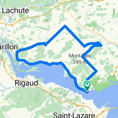
 Itinéraire vers 1449–1487 Ch d'Oka, Oka
- Dystans
- 12,9 km
- Przewyższenia
- 899 m
- Spadek
- 882 m
- Lokalizacja
- Oka, Quebec, Canada
 Boucle Hudson-Oka
- Dystans
- 62,5 km
- Przewyższenia
- 131 m
- Spadek
- 131 m
- Lokalizacja
- Oka, Quebec, Canada
 homa oka
- Dystans
- 58 km
- Przewyższenia
- 147 m
- Spadek
- 151 m
- Lokalizacja
- Oka, Quebec, Canada
 The Willow 110k
- Dystans
- 110,2 km
- Przewyższenia
- 183 m
- Spadek
- 183 m
- Lokalizacja
- Oka, Quebec, Canada
 Rue Main 208, Hudson to Rue Rollande 15, Rigaud
- Dystans
- 20 km
- Przewyższenia
- 65 m
- Spadek
- 59 m
- Lokalizacja
- Oka, Quebec, Canada
 Ok a Pointe fortune
- Dystans
- 30 km
- Przewyższenia
- 141 m
- Spadek
- 121 m
- Lokalizacja
- Oka, Quebec, Canada
 Oka 02
- Dystans
- 73,2 km
- Przewyższenia
- 259 m
- Spadek
- 259 m
- Lokalizacja
- Oka, Quebec, Canada
 Oka to Montreal
- Dystans
- 69,5 km
- Przewyższenia
- 317 m
- Spadek
- 140 m
- Lokalizacja
- Oka, Quebec, Canada