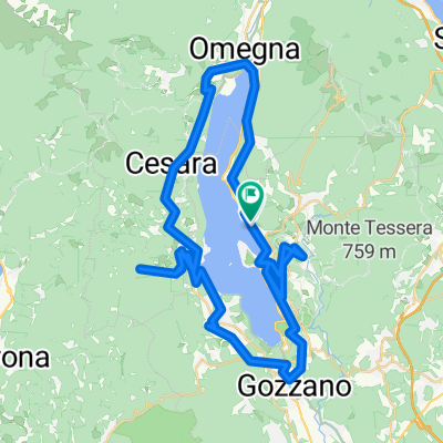


Bergour mit langem Ausfahren
- 77,8 km
- 1259 m
- 1259 m
- Pettenasco, Piemont, Włochy

Odkrywaj mapę z 58 trasami rowerowymi i szlakami w pobliżu Pettenasco, stworzonymi przez naszą społeczność.
Portret regionu
Znajdź odpowiednią trasę rowerową dla siebie w Pettenasco – mamy tam 58 tras do odkrycia. Większość osób wybiera się tutaj na rower w miesiącach Lipiec i Sierpień.
2790 km
Zarejestrowany dystans
58
Trasy rowerowe
1133
Populacja
Wspólnota
Od naszej społeczności
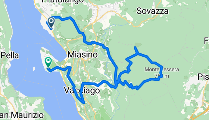
Trasa rowerowa w Pettenasco, Piemont, Włochy
Trasa rowerowa w Pettenasco, Piemont, Włochy
Trasa rowerowa w Pettenasco, Piemont, Włochy
Trasa rowerowa w Pettenasco, Piemont, Włochy