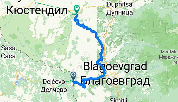
Blagoevgrad na rowerze
Odkrywaj mapę z 214 trasami rowerowymi i szlakami w pobliżu Blagoevgrad, stworzonymi przez naszą społeczność.
Portret regionu
Poznaj Blagoevgrad
Znajdź odpowiednią trasę rowerową dla siebie w Blagoevgrad – mamy tam 214 tras do odkrycia. Większość osób wybiera się tutaj na rower w miesiącach Kwiecień i Maj.
17 857 km
Zarejestrowany dystans
214
Trasy rowerowe
71 306
Populacja
Wspólnota
Najaktywniejsi użytkownicy w Blagoevgrad
Od naszej społeczności
Najlepsze trasy rowerowe w Blagoevgrad i okolicach
Shortcut to/and the extreme downhill path
Trasa rowerowa w Blagoevgrad, Blagoevgrad, Bulgaria
Basically you ride up the neighborhood, around the left side of the zoo, to the rose garden then up the hill past the antennas and up the road.
When you reach the first trees, a place where the riders jump over the road, you can see on your left a stone painted in red paint. Throughout the path you will see such stones to show you the way. However, the first time, I suggest you take the path by foot or very slow.
After the first curve the path goes wildly down. The guys built some wild jumps, side-turns and everything that goes with downhill riding.
Since my skills are not very good, I was braking all the time, and still it was pretty tough for me to stay put on the ground. At the end you should jump a lot on the sides of the path to stay put. There are some pretty scary high jumps too.
Check out the photos on the map to get the idea.
Use good equipment and protection and scream!
- 1,1 km
- Dystans
- 85 m
- Przewyższenia
- 75 m
- Spadek
Nice route to the near villas and back to Blago
Trasa rowerowa w Blagoevgrad, Blagoevgrad, Bulgaria
After the stadium the road is very steep, but if you have good gears and you're in shape it's ride-able since it's cemented. When you reach the top of the hill you will see a weird area-51-like building (the water supply station). Pass it on its left side and then go up. Soon you'll see some shacks and gardens on the right, on the left a nice forest. Go up the road, this section is totally secluded so don't worry to ride wild - there are no cars. At some point you'll reach a dusty intersection near some houses, take left and then ride through the village. Beware the dogs and enjoy the speed. Again the cars are pretty few, but be careful. The road gets pretty curvy about two km. before Blago - there I advise you to slow down and be careful for crazy drivers.
It's a nice one - great progression and change of scenery.
Safe riding!
- 9,4 km
- Dystans
- 243 m
- Przewyższenia
- 213 m
- Spadek
Near the river (right side) to the lake
Trasa rowerowa w Blagoevgrad, Blagoevgrad, Bulgaria
This one I rode about a million times, it's fast, it's beautiful, it gets you to the lake and it's the mountain biking alternative to the alley of Bachinovo.
So, you start from the metal rope bridge cross it, go left and along the river. Shortly you have to go up almost to the road. Then on a sidewalk. Eventually it ends and you go left towards a metal gate. This is the entrance to the baseball field. Get in, ride on the hundred yards then again left along the net of the baseball field. Here comes the cool part. You reach the river, the path is stony and fast, you ride a few meters away from the bank in the forest - nice. After a while you reach a weird asphalt circle, pass it and you are on a small asphalt road that will shortly take you to the lake.
Tie the bike, and hope on a swan :)
- 2 km
- Dystans
- 70 m
- Przewyższenia
- 26 m
- Spadek
Steep route to the almond forest
Trasa rowerowa w Blagoevgrad, Blagoevgrad, Bulgaria
Again I am not 100% sure i got this right. After the stadium ride/push up the road. At some point the road flattens a bit and you should look right for a small path. Go to it and follow it in direction to Blago, the ride is nice and smooth and shortly you'll reach a small hill with almond threes and nice view of the whole town. The place is particularly magical in the spring when the trees are blooming.
Enjoy this one whenever you have a spare hour and want to breathe and feel free.
- 0,7 km
- Dystans
- 50 m
- Przewyższenia
- 29 m
- Spadek
Odkryj więcej tras
- Dead end path with view on Bachinovo
- Dystans
- 1,1 km
- Przewyższenia
- 100 m
- Spadek
- 57 m
- Lokalizacja
- Blagoevgrad, Blagoevgrad, Bulgaria
- Blagoevgrad-Demirevo-Bistrica-Blagoevgrad CLONED FROM ROUTE 819503
- Dystans
- 34 km
- Przewyższenia
- 854 m
- Spadek
- 858 m
- Lokalizacja
- Blagoevgrad, Blagoevgrad, Bulgaria
- Scenic Route to Elenovo and back to Skapto
- Dystans
- 8,8 km
- Przewyższenia
- 283 m
- Spadek
- 303 m
- Lokalizacja
- Blagoevgrad, Blagoevgrad, Bulgaria
- Notre parcours en Macédoine
- Dystans
- 392,5 km
- Przewyższenia
- 3215 m
- Spadek
- 2575 m
- Lokalizacja
- Blagoevgrad, Blagoevgrad, Bulgaria
- Razhodka okolo Blagoevgrad
- Dystans
- 20,7 km
- Przewyższenia
- 424 m
- Spadek
- 515 m
- Lokalizacja
- Blagoevgrad, Blagoevgrad, Bulgaria
- 6 Macedonia
- Dystans
- 122,3 km
- Przewyższenia
- 1142 m
- Spadek
- 2178 m
- Lokalizacja
- Blagoevgrad, Blagoevgrad, Bulgaria
- Blagoevgrad- Sapareva banya
- Dystans
- 50,3 km
- Przewyższenia
- 1160 m
- Spadek
- 798 m
- Lokalizacja
- Blagoevgrad, Blagoevgrad, Bulgaria
- Blagoevgrad - Pehchevo
- Dystans
- 62,3 km
- Przewyższenia
- 1386 m
- Spadek
- 731 m
- Lokalizacja
- Blagoevgrad, Blagoevgrad, Bulgaria