
Glenelg East na rowerze
Odkrywaj mapę z 79 trasami rowerowymi i szlakami w pobliżu Glenelg East, stworzonymi przez naszą społeczność.
Portret regionu
Poznaj Glenelg East
Znajdź odpowiednią trasę rowerową dla siebie w Glenelg East – mamy tam 79 tras do odkrycia. Większość osób wybiera się tutaj na rower w miesiącach Luty i Czerwiec.
3017 km
Zarejestrowany dystans
79
Trasy rowerowe
3701
Populacja
Wspólnota
Najaktywniejsi użytkownicy w Glenelg East


Od naszej społeczności
Najlepsze trasy rowerowe w Glenelg East i okolicach

Camden Park - Marino Rocks - City Loop
Trasa rowerowa w Glenelg East, State of South Australia, Australia
- 48,3 km
- Dystans
- 241 m
- Przewyższenia
- 239 m
- Spadek

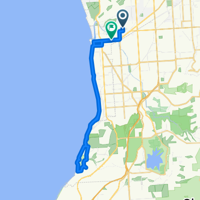
Easty ride west to Adelaide cityRoute to work
Trasa rowerowa w Glenelg East, State of South Australia, Australia
- 9 km
- Dystans
- 50 m
- Przewyższenia
- 8 m
- Spadek

Glenelg East to the Blanche Harbour Shacks
Trasa rowerowa w Glenelg East, State of South Australia, Australia
- 337,4 km
- Dystans
- 392 m
- Przewyższenia
- 397 m
- Spadek

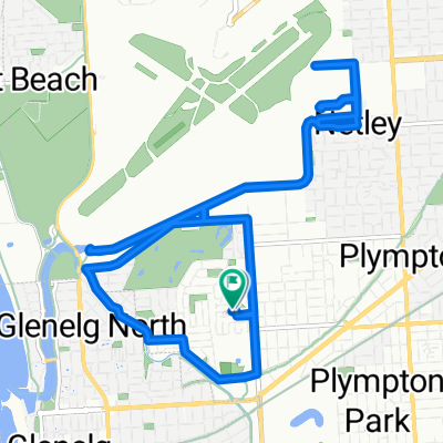
Margie’s Way
Trasa rowerowa w Glenelg East, State of South Australia, Australia
- 9,9 km
- Dystans
- 36 m
- Przewyższenia
- 0 m
- Spadek
Odkryj więcej tras
 42.5km along River Torrens/Mike Turtur
- Dystans
- 42,5 km
- Przewyższenia
- 196 m
- Spadek
- 194 m
- Lokalizacja
- Glenelg East, State of South Australia, Australia
 Training - Home - Norton Summit - Lofty
- Dystans
- 59,2 km
- Przewyższenia
- 695 m
- Spadek
- 693 m
- Lokalizacja
- Glenelg East, State of South Australia, Australia
 Camden Park to Dernancourt along the River Torrens
- Dystans
- 54,1 km
- Przewyższenia
- 204 m
- Spadek
- 204 m
- Lokalizacja
- Glenelg East, State of South Australia, Australia
 Camden Park to Willunga Hill
- Dystans
- 98 km
- Przewyższenia
- 1186 m
- Spadek
- 1185 m
- Lokalizacja
- Glenelg East, State of South Australia, Australia
 Scott Court to Scott Court
- Dystans
- 17,5 km
- Przewyższenia
- 37 m
- Spadek
- 39 m
- Lokalizacja
- Glenelg East, State of South Australia, Australia
 451 ANZAC Highway, Camden Park to 46 Clifton Street, Camden Park
- Dystans
- 28,2 km
- Przewyższenia
- 6 m
- Spadek
- 14 m
- Lokalizacja
- Glenelg East, State of South Australia, Australia
 Pine ave to south tce - Mike Turtur Bikeway
- Dystans
- 18,6 km
- Przewyższenia
- 61 m
- Spadek
- 61 m
- Lokalizacja
- Glenelg East, State of South Australia, Australia
 Slow ride in Camden Park
- Dystans
- 32,5 km
- Przewyższenia
- 13 m
- Spadek
- 22 m
- Lokalizacja
- Glenelg East, State of South Australia, Australia