
Jednodniowa wycieczka rowerowa z Calumpang do Makati City
Dostosuj własną trasę na podstawie naszego szablonu lub zobacz, jak nasza społeczność najchętniej jeździ z Calumpang do Makati City.
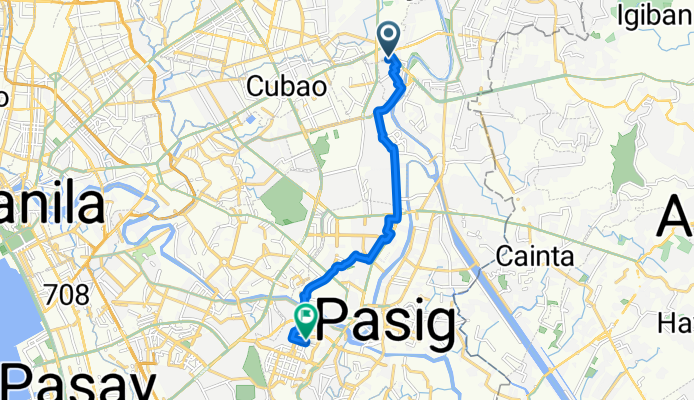
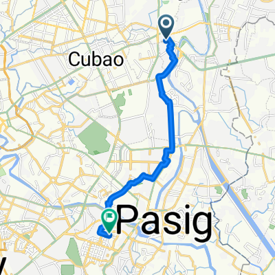
Szablon trasy
Z Calumpang do Makati City

- 1 h 15 min
- Czas
- 21,4 km
- Dystans
- 126 m
- Przewyższenia
- 117 m
- Spadek
- 17,2 km/h
- Śr. Prędkość
- 58 m
- Maks. wysokość
Cycling Route: Calumpang to Makati City
Kick off your ride in Calumpang, a vibrant barangay nestled in Marikina—famous for its shoe-making heritage and riverside bike paths. The route to Makati City covers just over 21 km and is pretty manageable, with some gentle ups and downs (expect about 126 meters of ascent in total). Most of the journey runs on decent surfaces: 87% paved, with a good mix of concrete and asphalt.
You’ll spend a lot of time on quiet city roads, weaving through residential zones and a handful of busier streets, so keep those eyes peeled for traffic! The route is primarily urban, with brief stretches on dedicated cycleways and the occasional path or access road, giving you a nice mix of city vibes and quieter detours.
Arriving in Makati City, you’ll roll into the beating heart of Metro Manila—a major business district jam-packed with cafés, grand skyscrapers, and lush green pockets. Whether you’re commuting, sightseeing, or just chasing a coffee fix, this route is a solid spin across Metro Manila’s diverse neighborhoods.
Wspólnota
Najlepsi użytkownicy w tym regionie


Od naszej społeczności
Najlepsze trasy rowerowe z Calumpang do Makati City

Route from Road 4 3, Marikina
Trasa rowerowa w Calumpang, National Capital Region, Filipiny
- 19,2 km
- Dystans
- 105 m
- Przewyższenia
- 114 m
- Spadek

Bike to Work
Trasa rowerowa w Calumpang, National Capital Region, Filipiny
- 19,9 km
- Dystans
- 48 m
- Przewyższenia
- 94 m
- Spadek

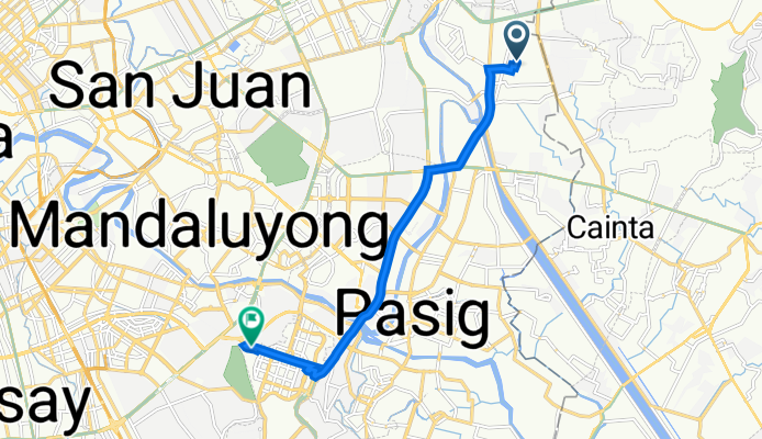
M. A. Roxas Street 349, Marikina to Legazpi Street 130, Makati
Trasa rowerowa w Calumpang, National Capital Region, Filipiny
- 15,8 km
- Dystans
- 160 m
- Przewyższenia
- 162 m
- Spadek

Col. Bonny Serrano Avenue 333, Quezon City to S.Javier 7817, Makati
Trasa rowerowa w Calumpang, National Capital Region, Filipiny
- 12,7 km
- Dystans
- 116 m
- Przewyższenia
- 158 m
- Spadek

Ateneo 06-25-2022
Trasa rowerowa w Calumpang, National Capital Region, Filipiny
- 23,6 km
- Dystans
- 331 m
- Przewyższenia
- 355 m
- Spadek

Col. Bonny Serrano Avenue 333, Quezon City to S.Javier 7817, Makati
Trasa rowerowa w Calumpang, National Capital Region, Filipiny
- 12,4 km
- Dystans
- 95 m
- Przewyższenia
- 139 m
- Spadek

Masinop Street 203, Pasig to McKinley Road 1634, Taguig
Trasa rowerowa w Calumpang, National Capital Region, Filipiny
- 10,4 km
- Dystans
- 55 m
- Przewyższenia
- 19 m
- Spadek

Daang Bakal 320, Marikina to Taguig
Trasa rowerowa w Calumpang, National Capital Region, Filipiny
- 14,2 km
- Dystans
- 38 m
- Przewyższenia
- 23 m
- Spadek

J39C+FW6, Quezon City to Makati
Trasa rowerowa w Calumpang, National Capital Region, Filipiny
- 13,5 km
- Dystans
- 87 m
- Przewyższenia
- 124 m
- Spadek

Pasig to McKinley Road 1634, Taguig
Trasa rowerowa w Calumpang, National Capital Region, Filipiny
- 11,5 km
- Dystans
- 64 m
- Przewyższenia
- 34 m
- Spadek
Molave Street, Marikina to 38th Street, Makati
Trasa rowerowa w Calumpang, National Capital Region, Filipiny
- 12,1 km
- Dystans
- 93 m
- Przewyższenia
- 88 m
- Spadek
to bgc
Trasa rowerowa w Calumpang, National Capital Region, Filipiny
- 11,2 km
- Dystans
- 39 m
- Przewyższenia
- 32 m
- Spadek
Odkryj więcej tras
 Ateneo 06-25-2022
- Dystans
- 23,6 km
- Przewyższenia
- 331 m
- Spadek
- 355 m
- Lokalizacja
- Calumpang, National Capital Region, Filipiny
 Col. Bonny Serrano Avenue 333, Quezon City to S.Javier 7817, Makati
- Dystans
- 12,4 km
- Przewyższenia
- 95 m
- Spadek
- 139 m
- Lokalizacja
- Calumpang, National Capital Region, Filipiny
 Masinop Street 203, Pasig to McKinley Road 1634, Taguig
- Dystans
- 10,4 km
- Przewyższenia
- 55 m
- Spadek
- 19 m
- Lokalizacja
- Calumpang, National Capital Region, Filipiny
 Daang Bakal 320, Marikina to Taguig
- Dystans
- 14,2 km
- Przewyższenia
- 38 m
- Spadek
- 23 m
- Lokalizacja
- Calumpang, National Capital Region, Filipiny
 J39C+FW6, Quezon City to Makati
- Dystans
- 13,5 km
- Przewyższenia
- 87 m
- Spadek
- 124 m
- Lokalizacja
- Calumpang, National Capital Region, Filipiny
 Pasig to McKinley Road 1634, Taguig
- Dystans
- 11,5 km
- Przewyższenia
- 64 m
- Spadek
- 34 m
- Lokalizacja
- Calumpang, National Capital Region, Filipiny
 Molave Street, Marikina to 38th Street, Makati
- Dystans
- 12,1 km
- Przewyższenia
- 93 m
- Spadek
- 88 m
- Lokalizacja
- Calumpang, National Capital Region, Filipiny
 to bgc
- Dystans
- 11,2 km
- Przewyższenia
- 39 m
- Spadek
- 32 m
- Lokalizacja
- Calumpang, National Capital Region, Filipiny
Trasy z Calumpang
Jednodniowa wycieczka rowerowa od
Z Calumpang do Port Area
Szybka przejażdżka rowerowa od
Z Calumpang do Antipolo
Szybka przejażdżka rowerowa od
Z Calumpang do Quezon City
Trasy do Makati City
Jednodniowa wycieczka rowerowa od
Z Las Piñas do Makati City
Jednodniowa wycieczka rowerowa od
Z Imus do Makati City
Szybka przejażdżka rowerowa od
Z Quezon City do Makati City
Szybka przejażdżka rowerowa od
Z Manila do Makati City