
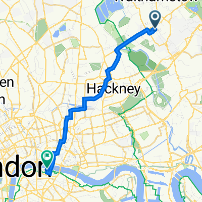
Rowerowa z Walthamstow do City of London
Dostosuj własną trasę na podstawie naszego szablonu lub zobacz, jak nasza społeczność najchętniej jeździ z Walthamstow do City of London.
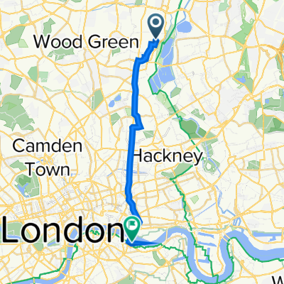
Szablon trasy
Z Walthamstow do City of London

- 57 min
- Czas
- 16,4 km
- Dystans
- 62 m
- Przewyższenia
- 54 m
- Spadek
- 17,3 km/h
- Śr. Prędkość
- 41 m
- Maks. wysokość
Here’s a great urban cycling route from Walthamstow to the City of London, perfect if you want a smooth ride into the heart of the capital. Starting in Walthamstow—a vibrant East London district known for its street markets and creative scene—you'll cruise mostly on quiet roads and cycleways, making the ride relaxed and enjoyable. There's a gentle ascent (nothing too serious!), with the path staying pretty level most of the way.
The 16-kilometer journey gives you a front-row seat to London’s changing scenery, from leafy neighborhoods into the more bustling urban core. Surfaces are mostly paved and smooth (thank you, London infrastructure!) with just a few stretches of paving stones to keep things interesting.
You'll arrive in the City of London, the historic and financial heart of the city, surrounded by skyscrapers, ancient churches, and iconic landmarks like St Paul’s Cathedral and the Gherkin. It’s a fab ride for both commuters and weekend explorers—just make sure you bring a good lock for your bike once you arrive!
Wspólnota
Najlepsi użytkownicy w tym regionie


Od naszej społeczności
Najlepsze trasy rowerowe z Walthamstow do City of London


Waltham Forest, London to Wentworth Street, London
Trasa rowerowa w Walthamstow, Anglia, Zjednoczone Królestwo Wielkiej Brytanii
- 16,2 km
- Dystans
- 58 m
- Przewyższenia
- 39 m
- Spadek

Paul Suggested Cycle Route
Trasa rowerowa w Walthamstow, Anglia, Zjednoczone Królestwo Wielkiej Brytanii
- 12,1 km
- Dystans
- 56 m
- Przewyższenia
- 60 m
- Spadek

Prt2 RideLondon Essex 100
Trasa rowerowa w Walthamstow, Anglia, Zjednoczone Królestwo Wielkiej Brytanii
- 142 km
- Dystans
- 914 m
- Przewyższenia
- 923 m
- Spadek

MA3K - 40 East Ride
Trasa rowerowa w Walthamstow, Anglia, Zjednoczone Królestwo Wielkiej Brytanii
- 37,7 km
- Dystans
- 29 m
- Przewyższenia
- 54 m
- Spadek

13 Callis Road, London to 1 Canter Way, London
Trasa rowerowa w Walthamstow, Anglia, Zjednoczone Królestwo Wielkiej Brytanii
- 9,8 km
- Dystans
- 33 m
- Przewyższenia
- 22 m
- Spadek

99 Manor Road, London to Southwark, London
Trasa rowerowa w Walthamstow, Anglia, Zjednoczone Królestwo Wielkiej Brytanii
- 11,3 km
- Dystans
- 46 m
- Przewyższenia
- 54 m
- Spadek

17 Sunnyside Road, London to 22 Bishopsgate, London
Trasa rowerowa w Walthamstow, Anglia, Zjednoczone Królestwo Wielkiej Brytanii
- 9,9 km
- Dystans
- 72 m
- Przewyższenia
- 68 m
- Spadek

from Adam’s to work
Trasa rowerowa w Walthamstow, Anglia, Zjednoczone Królestwo Wielkiej Brytanii
- 10 km
- Dystans
- 55 m
- Przewyższenia
- 43 m
- Spadek

51.586° N -0.003° W to 51.510° N -0.091° W
Trasa rowerowa w Walthamstow, Anglia, Zjednoczone Królestwo Wielkiej Brytanii
- 12,6 km
- Dystans
- 51 m
- Przewyższenia
- 75 m
- Spadek

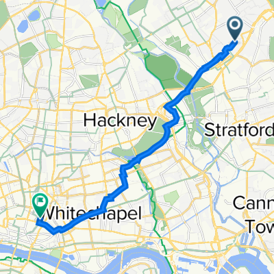
Leytonstone to Aldgate 6 January 08:11
Trasa rowerowa w Walthamstow, Anglia, Zjednoczone Królestwo Wielkiej Brytanii
- 9,8 km
- Dystans
- 28 m
- Przewyższenia
- 41 m
- Spadek

157B Shelbourne Road, London to 31 Pyramid Building, Queen Elizabeth St, London
Trasa rowerowa w Walthamstow, Anglia, Zjednoczone Królestwo Wielkiej Brytanii
- 12,9 km
- Dystans
- 68 m
- Przewyższenia
- 72 m
- Spadek
122 Shelbourne Road, London to 31 Pyramid Building, Queen Elizabeth St, London
Trasa rowerowa w Walthamstow, Anglia, Zjednoczone Królestwo Wielkiej Brytanii
- 12,5 km
- Dystans
- 45 m
- Przewyższenia
- 53 m
- Spadek
Odkryj więcej tras
 13 Callis Road, London to 1 Canter Way, London
- Dystans
- 9,8 km
- Przewyższenia
- 33 m
- Spadek
- 22 m
- Lokalizacja
- Walthamstow, Anglia, Zjednoczone Królestwo Wielkiej Brytanii
 99 Manor Road, London to Southwark, London
- Dystans
- 11,3 km
- Przewyższenia
- 46 m
- Spadek
- 54 m
- Lokalizacja
- Walthamstow, Anglia, Zjednoczone Królestwo Wielkiej Brytanii
 17 Sunnyside Road, London to 22 Bishopsgate, London
- Dystans
- 9,9 km
- Przewyższenia
- 72 m
- Spadek
- 68 m
- Lokalizacja
- Walthamstow, Anglia, Zjednoczone Królestwo Wielkiej Brytanii
 from Adam’s to work
- Dystans
- 10 km
- Przewyższenia
- 55 m
- Spadek
- 43 m
- Lokalizacja
- Walthamstow, Anglia, Zjednoczone Królestwo Wielkiej Brytanii
 51.586° N -0.003° W to 51.510° N -0.091° W
- Dystans
- 12,6 km
- Przewyższenia
- 51 m
- Spadek
- 75 m
- Lokalizacja
- Walthamstow, Anglia, Zjednoczone Królestwo Wielkiej Brytanii
 Leytonstone to Aldgate 6 January 08:11
- Dystans
- 9,8 km
- Przewyższenia
- 28 m
- Spadek
- 41 m
- Lokalizacja
- Walthamstow, Anglia, Zjednoczone Królestwo Wielkiej Brytanii
 157B Shelbourne Road, London to 31 Pyramid Building, Queen Elizabeth St, London
- Dystans
- 12,9 km
- Przewyższenia
- 68 m
- Spadek
- 72 m
- Lokalizacja
- Walthamstow, Anglia, Zjednoczone Królestwo Wielkiej Brytanii
 122 Shelbourne Road, London to 31 Pyramid Building, Queen Elizabeth St, London
- Dystans
- 12,5 km
- Przewyższenia
- 45 m
- Spadek
- 53 m
- Lokalizacja
- Walthamstow, Anglia, Zjednoczone Królestwo Wielkiej Brytanii
Trasy z Walthamstow
Rowerowa od
Z Walthamstow do Hackney
Rowerowa od
Z Walthamstow do Woodford Green
Trasy do City of London
Jednodniowa wycieczka rowerowa od
Z Hinchley Wood do City of London
Rowerowa od
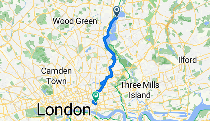
Z Belsize Park do City of London
Rowerowa od
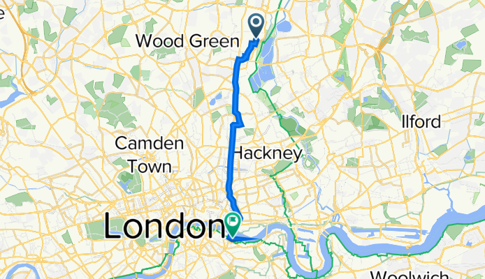
Z Harringay do City of London