
Szybka przejażdżka rowerowa z Coates do Nailsworth
Dostosuj własną trasę na podstawie naszego szablonu lub zobacz, jak nasza społeczność najchętniej jeździ z Coates do Nailsworth.
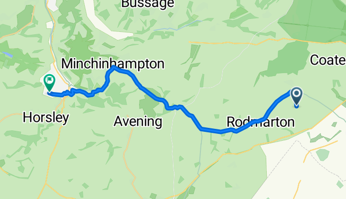
Szablon trasy
Z Coates do Nailsworth

- 1 h 6 min
- Czas
- 17,6 km
- Dystans
- 175 m
- Przewyższenia
- 251 m
- Spadek
- 16,1 km/h
- Śr. Prędkość
- 190 m
- Maks. wysokość
Get ready for a beautiful rural ride from Coates to Nailsworth! Starting in the charming village of Coates, known for its proximity to the historic Thames & Severn Canal and the lush greens of the Cotswold countryside, you’ll set out west on mostly quiet roads—perfect for relaxing pedaling.
The route stretches just under 18 km, gently rolling across classic Gloucestershire terrain. Expect a mix of smooth asphalt sections and some more rustic surfaces—ideal for cyclists who enjoy a bit of adventure off the main drag. There’s a healthy bit of climbing (about 175 m ascent), but you'll be rewarded with a longer descent as you cruise towards Nailsworth.
Nailsworth itself is a lovely little town tucked into the Stroud Valley, celebrated for its vibrant food scene, creative shops, and a thriving arts community. Park your bike and treat yourself to a coffee and a pastry from one of their artisan bakeries! All in all, this route is a sweet sampler of Cotswolds cycling—quiet, scenic, and full of English village charm.
Wspólnota
Najlepsi użytkownicy w tym regionie


Od naszej społeczności
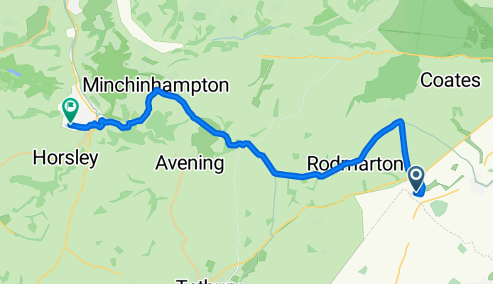
Najlepsze trasy rowerowe z Coates do Nailsworth
Rodmarton, Cirencester to Shortwood Road, Stroud
Trasa rowerowa w Coates, Anglia, Zjednoczone Królestwo Wielkiej Brytanii
- 17,1 km
- Dystans
- 240 m
- Przewyższenia
- 280 m
- Spadek
Kemble, Cirencester to Stone Cottages, Stroud
Trasa rowerowa w Coates, Anglia, Zjednoczone Królestwo Wielkiej Brytanii
- 19,5 km
- Dystans
- 262 m
- Przewyższenia
- 284 m
- Spadek

Crudwell, Cirencester to 1 Stone Cottages, Shortwood Road, Stroud
Trasa rowerowa w Coates, Anglia, Zjednoczone Królestwo Wielkiej Brytanii
- 20,3 km
- Dystans
- 274 m
- Przewyższenia
- 300 m
- Spadek

Daneway Lane, Daneway, Sapperton, Cirencester to 1 Stone Cottages, Shortwood Road, Stroud
Trasa rowerowa w Coates, Anglia, Zjednoczone Królestwo Wielkiej Brytanii
- 16,7 km
- Dystans
- 240 m
- Przewyższenia
- 302 m
- Spadek

Crudwell, Cirencester to Green View, Shortwood Road, Stroud
Trasa rowerowa w Coates, Anglia, Zjednoczone Królestwo Wielkiej Brytanii
- 20,4 km
- Dystans
- 302 m
- Przewyższenia
- 327 m
- Spadek

Crudwell, Cirencester to Green View, Shortwood Road, Stroud
Trasa rowerowa w Coates, Anglia, Zjednoczone Królestwo Wielkiej Brytanii
- 20,4 km
- Dystans
- 283 m
- Przewyższenia
- 318 m
- Spadek

The Barracks, Cirencester to Green View, Shortwood Road, Stroud
Trasa rowerowa w Coates, Anglia, Zjednoczone Królestwo Wielkiej Brytanii
- 16,7 km
- Dystans
- 224 m
- Przewyższenia
- 289 m
- Spadek

The Barracks, Cirencester to Green View, Shortwood Road, Stroud
Trasa rowerowa w Coates, Anglia, Zjednoczone Królestwo Wielkiej Brytanii
- 16,7 km
- Dystans
- 298 m
- Przewyższenia
- 361 m
- Spadek

Crudwell, Cirencester to Green View, Shortwood Road, Stroud
Trasa rowerowa w Coates, Anglia, Zjednoczone Królestwo Wielkiej Brytanii
- 21,5 km
- Dystans
- 640 m
- Przewyższenia
- 667 m
- Spadek

Crudwell, Cirencester to Green View, Shortwood Road, Stroud
Trasa rowerowa w Coates, Anglia, Zjednoczone Królestwo Wielkiej Brytanii
- 20,4 km
- Dystans
- 266 m
- Przewyższenia
- 292 m
- Spadek

Route to Green View, Shortwood Road, Stroud
Trasa rowerowa w Coates, Anglia, Zjednoczone Królestwo Wielkiej Brytanii
- 16,8 km
- Dystans
- 264 m
- Przewyższenia
- 334 m
- Spadek

Route to Green View, Shortwood Road, Stroud
Trasa rowerowa w Coates, Anglia, Zjednoczone Królestwo Wielkiej Brytanii
- 16,9 km
- Dystans
- 344 m
- Przewyższenia
- 410 m
- Spadek
Odkryj więcej tras
 Crudwell, Cirencester to Green View, Shortwood Road, Stroud
- Dystans
- 20,4 km
- Przewyższenia
- 302 m
- Spadek
- 327 m
- Lokalizacja
- Coates, Anglia, Zjednoczone Królestwo Wielkiej Brytanii
 Crudwell, Cirencester to Green View, Shortwood Road, Stroud
- Dystans
- 20,4 km
- Przewyższenia
- 283 m
- Spadek
- 318 m
- Lokalizacja
- Coates, Anglia, Zjednoczone Królestwo Wielkiej Brytanii
 The Barracks, Cirencester to Green View, Shortwood Road, Stroud
- Dystans
- 16,7 km
- Przewyższenia
- 224 m
- Spadek
- 289 m
- Lokalizacja
- Coates, Anglia, Zjednoczone Królestwo Wielkiej Brytanii
 The Barracks, Cirencester to Green View, Shortwood Road, Stroud
- Dystans
- 16,7 km
- Przewyższenia
- 298 m
- Spadek
- 361 m
- Lokalizacja
- Coates, Anglia, Zjednoczone Królestwo Wielkiej Brytanii
 Crudwell, Cirencester to Green View, Shortwood Road, Stroud
- Dystans
- 21,5 km
- Przewyższenia
- 640 m
- Spadek
- 667 m
- Lokalizacja
- Coates, Anglia, Zjednoczone Królestwo Wielkiej Brytanii
 Crudwell, Cirencester to Green View, Shortwood Road, Stroud
- Dystans
- 20,4 km
- Przewyższenia
- 266 m
- Spadek
- 292 m
- Lokalizacja
- Coates, Anglia, Zjednoczone Królestwo Wielkiej Brytanii
 Route to Green View, Shortwood Road, Stroud
- Dystans
- 16,8 km
- Przewyższenia
- 264 m
- Spadek
- 334 m
- Lokalizacja
- Coates, Anglia, Zjednoczone Królestwo Wielkiej Brytanii
 Route to Green View, Shortwood Road, Stroud
- Dystans
- 16,9 km
- Przewyższenia
- 344 m
- Spadek
- 410 m
- Lokalizacja
- Coates, Anglia, Zjednoczone Królestwo Wielkiej Brytanii