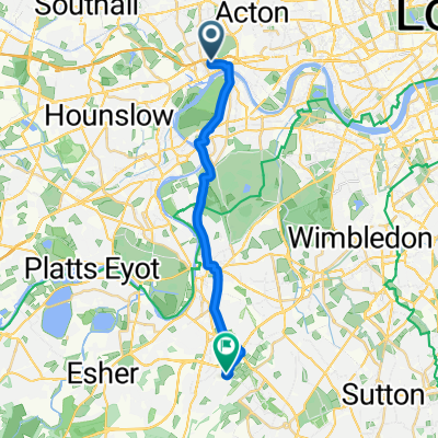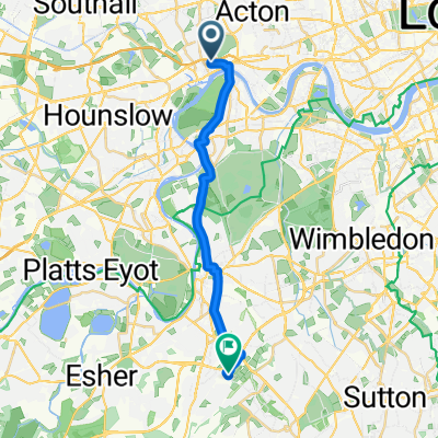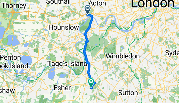

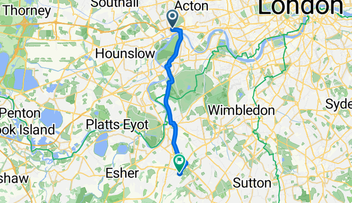
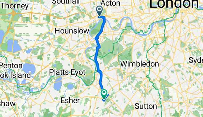


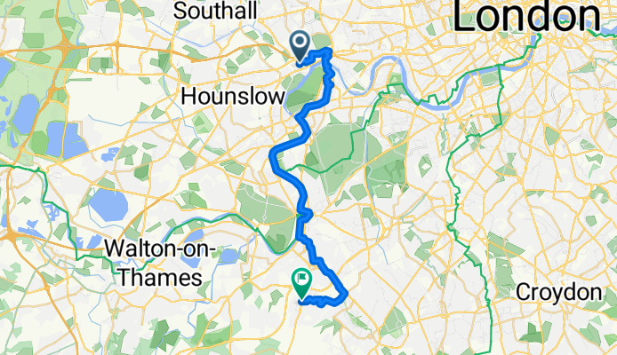
Clayponds Lane, Brentford to Davis Road, Chessington
- 17,3 km
- 89 m
- 72 m
- Brentford, Anglia, Zjednoczone Królestwo Wielkiej Brytanii

Szablon trasy
A relaxed spin from riverside Brentford to suburban Hook. Roll out by the Thames and the canals around Brentford Locks—home to Syon Park, the London Museum of Water & Steam, and Brentford FC’s Gtech Stadium—then follow riverside paths and quiet lanes through Kew and Richmond.
Pick up the smooth tarmac in Richmond Park (keep an eye out for deer) and enjoy gentle rises and wide views before dropping to Kingston Gate. Swing past Kingston’s historic market square for a coffee stop by the river, then continue on backstreets and signed cycleways through Surbiton/Tolworth to Hook.
It’s mostly flat with just a few gentle climbs (around 90 m total). Surfaces are overwhelmingly paved with a couple of short gravel bits, and the route sticks largely to cycleways and quiet roads with only brief busier sections.
Finish in Hook, a leafy corner of the Royal Borough of Kingston upon Thames near the A3, and not far from Chessington World of Adventures—handy if you’re making a day of it.
Wspólnota
Od naszej społeczności
Trasa rowerowa w Brentford, Anglia, Zjednoczone Królestwo Wielkiej Brytanii
Trasa rowerowa w Brentford, Anglia, Zjednoczone Królestwo Wielkiej Brytanii
Trasa rowerowa w Brentford, Anglia, Zjednoczone Królestwo Wielkiej Brytanii
Trasa rowerowa w Brentford, Anglia, Zjednoczone Królestwo Wielkiej Brytanii
Trasa rowerowa w Brentford, Anglia, Zjednoczone Królestwo Wielkiej Brytanii
Trasa rowerowa w Brentford, Anglia, Zjednoczone Królestwo Wielkiej Brytanii
Trasa rowerowa w Brentford, Anglia, Zjednoczone Królestwo Wielkiej Brytanii
Trasa rowerowa w Brentford, Anglia, Zjednoczone Królestwo Wielkiej Brytanii
Trasa rowerowa w Brentford, Anglia, Zjednoczone Królestwo Wielkiej Brytanii
Trasa rowerowa w Brentford, Anglia, Zjednoczone Królestwo Wielkiej Brytanii
Trasa rowerowa w Brentford, Anglia, Zjednoczone Królestwo Wielkiej Brytanii
Trasa rowerowa w Brentford, Anglia, Zjednoczone Królestwo Wielkiej Brytanii
Rowerowa od