
Szablon trasy
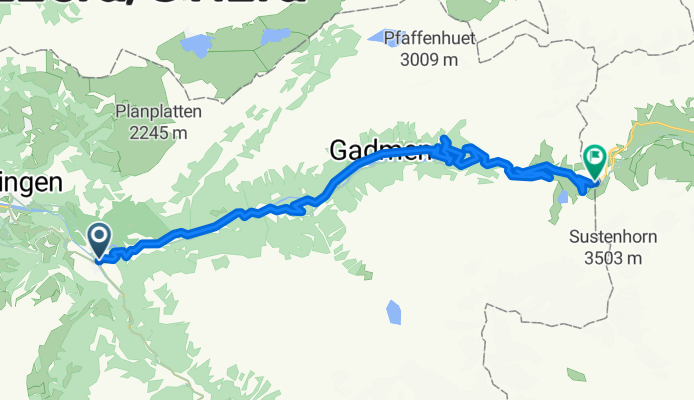
Z Meiringen do Engelberg

- 7 h 7 min
- Czas
- 63,2 km
- Dystans
- 4024 m
- Przewyższenia
- 3621 m
- Spadek
- 8,9 km/h
- Śr. Prędkość
- 2120 m
- Maks. wysokość
Get ready for a real Swiss adventure! This route starts in Meiringen, famous for its Reichenbach Falls (think Sherlock Holmes!) and delicious meringues. From there, you’ll head east into the heart of the Alps, weaving through lush valleys and climbing some serious hills—there’s over 4,000 meters of ascent, so bring your climbing legs!
You’ll ride about 63 kilometers on a mix of quiet backroads, tracks, and scenic paths—some sections are unpaved, so a gravel or mountain bike is your best bet. The route gives you jaw-dropping mountain views, and you’ll hit impressive heights (up to 2,120 meters). Pack a windbreaker!
Your destination, Engelberg, is a charming mountain resort known for its Benedictine monastery and top-notch skiing and hiking. Once you roll into town, reward yourself with a hearty Swiss meal and maybe even a cable car ride for a final view of those peaks. Challenging but absolutely epic!
Wspólnota
Najlepsi użytkownicy w tym regionie


Od naszej społeczności
Najlepsze trasy rowerowe z Meiringen do Engelberg
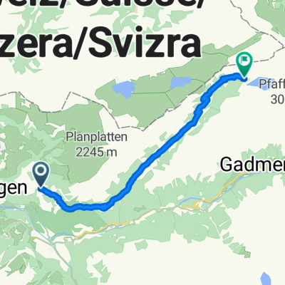
Innertkirchen-Sustenpass
Trasa rowerowa w Meiringen, Berno, Szwajcaria
- 27,6 km
- Dystans
- 1616 m
- Przewyższenia
- 13 m
- Spadek

ENGSTLENALP, por Innertkirchen
Trasa rowerowa w Meiringen, Berno, Szwajcaria
- 17,9 km
- Dystans
- 1245 m
- Przewyższenia
- 6 m
- Spadek

gr sheideck-interlaken-inertkirchen-sustenpass
Trasa rowerowa w Meiringen, Berno, Szwajcaria
- 112,6 km
- Dystans
- 3301 m
- Przewyższenia
- 1696 m
- Spadek

Hasliberg - Engstlenalp
Trasa rowerowa w Meiringen, Berno, Szwajcaria
- 18,4 km
- Dystans
- 1115 m
- Przewyższenia
- 416 m
- Spadek

SUSTENPASS, por Innertkirchen
Trasa rowerowa w Meiringen, Berno, Szwajcaria
- 28 km
- Dystans
- 1667 m
- Przewyższenia
- 0 m
- Spadek

Sustenpass
Trasa rowerowa w Meiringen, Berno, Szwajcaria
- 27,6 km
- Dystans
- 1650 m
- Przewyższenia
- 39 m
- Spadek

0. Engstlenalp
Trasa rowerowa w Meiringen, Berno, Szwajcaria
- 18,1 km
- Dystans
- 994 m
- Przewyższenia
- 236 m
- Spadek

Wasserwendi - Engstlen
Trasa rowerowa w Meiringen, Berno, Szwajcaria
- 18,8 km
- Dystans
- 1023 m
- Przewyższenia
- 361 m
- Spadek

Wasserwendi - Engstlen
Trasa rowerowa w Meiringen, Berno, Szwajcaria
- 18,5 km
- Dystans
- 950 m
- Przewyższenia
- 360 m
- Spadek

Dead End: Engstlenalp
Trasa rowerowa w Meiringen, Berno, Szwajcaria
- 15,6 km
- Dystans
- 1089 m
- Przewyższenia
- 14 m
- Spadek

Winterlicken - Engstlenalp
Trasa rowerowa w Meiringen, Berno, Szwajcaria
- 14,5 km
- Dystans
- 844 m
- Przewyższenia
- 226 m
- Spadek

Badstrasse 5, Schattenhalb až Sustenstrasse, Gadmen
Trasa rowerowa w Meiringen, Berno, Szwajcaria
- 20,5 km
- Dystans
- 864 m
- Przewyższenia
- 131 m
- Spadek
Odkryj więcej tras
 SUSTENPASS, por Innertkirchen
- Dystans
- 28 km
- Przewyższenia
- 1667 m
- Spadek
- 0 m
- Lokalizacja
- Meiringen, Berno, Szwajcaria
 Sustenpass
- Dystans
- 27,6 km
- Przewyższenia
- 1650 m
- Spadek
- 39 m
- Lokalizacja
- Meiringen, Berno, Szwajcaria
 0. Engstlenalp
- Dystans
- 18,1 km
- Przewyższenia
- 994 m
- Spadek
- 236 m
- Lokalizacja
- Meiringen, Berno, Szwajcaria
 Wasserwendi - Engstlen
- Dystans
- 18,8 km
- Przewyższenia
- 1023 m
- Spadek
- 361 m
- Lokalizacja
- Meiringen, Berno, Szwajcaria
 Wasserwendi - Engstlen
- Dystans
- 18,5 km
- Przewyższenia
- 950 m
- Spadek
- 360 m
- Lokalizacja
- Meiringen, Berno, Szwajcaria
 Dead End: Engstlenalp
- Dystans
- 15,6 km
- Przewyższenia
- 1089 m
- Spadek
- 14 m
- Lokalizacja
- Meiringen, Berno, Szwajcaria
 Winterlicken - Engstlenalp
- Dystans
- 14,5 km
- Przewyższenia
- 844 m
- Spadek
- 226 m
- Lokalizacja
- Meiringen, Berno, Szwajcaria
 Badstrasse 5, Schattenhalb až Sustenstrasse, Gadmen
- Dystans
- 20,5 km
- Przewyższenia
- 864 m
- Spadek
- 131 m
- Lokalizacja
- Meiringen, Berno, Szwajcaria
Trasy z Meiringen
Bikepacking od
Z Meiringen do Andermatt
Jednodniowa wycieczka rowerowa od
Z Meiringen do Grindelwald