
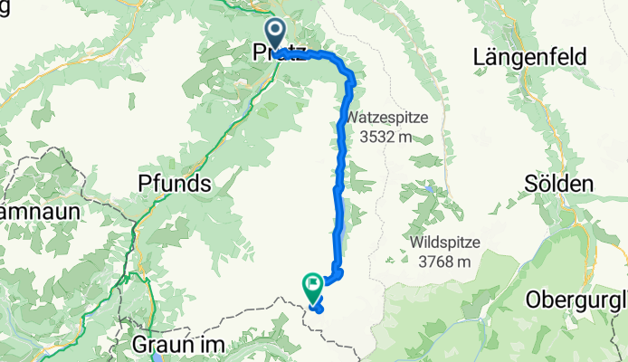
Szablon trasy
Z Prutz do Nauders

- 2 h 55 min
- Czas
- 42,1 km
- Dystans
- 1469 m
- Przewyższenia
- 838 m
- Spadek
- 14,5 km/h
- Śr. Prędkość
- 1493 m
- Maks. wysokość
Get ready for an exhilarating Alpine adventure! This route takes you from Prutz, a charming village on the banks of the Inn River, all the way up to Nauders, a historic mountain town near the tripoint of Austria, Switzerland, and Italy. Covering just over 42 kilometers, the ride is packed with stunning views and plenty of climbing—you’ll ascend nearly 1,500 meters, so it’s a solid challenge for fit riders or ambitious climbers.
Most of your journey is on paved or asphalt roads, though there are a few short unpaved and gravel stretches to keep things interesting. About half the ride follows busier roads (the main passes can get some traffic!), while quieter backroads and mountain tracks let you soak up the alpine scenery at a relaxed pace.
Highlights along the way include brilliant views of the Upper Inn Valley and (as you near Nauders) glimpses of ancient castle ruins. The final stretch climbs up to Nauders, a village known for its nearby ski areas and medieval fortress. Don’t forget to catch your breath and enjoy the Alps—this is a classic Tyrolean mountain route!
Wspólnota
Najlepsi użytkownicy w tym regionie


Od naszej społeczności
Najlepsze trasy rowerowe z Prutz do Nauders

Kaunertalgletscher Panoramastrasse
Trasa rowerowa w Prutz, Tyrol, Austria
- 40,1 km
- Dystans
- 1900 m
- Przewyższenia
- 19 m
- Spadek

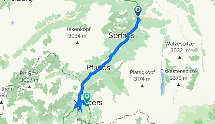
Von Prutz bis Nauders
Trasa rowerowa w Prutz, Tyrol, Austria
- 39,7 km
- Dystans
- 1377 m
- Przewyższenia
- 866 m
- Spadek


Etappe 3 Teil 1 Via Claudia Augusta Alpenüberquerung
Trasa rowerowa w Prutz, Tyrol, Austria
- 36,7 km
- Dystans
- 833 m
- Przewyższenia
- 290 m
- Spadek

Kaunertaler Gletscherkaiser
Trasa rowerowa w Prutz, Tyrol, Austria
- 38,4 km
- Dystans
- 2163 m
- Przewyższenia
- 612 m
- Spadek

Kaunertal Gletscher
Trasa rowerowa w Prutz, Tyrol, Austria
- 38,5 km
- Dystans
- 1891 m
- Przewyższenia
- 12 m
- Spadek
Prutz Kaunertal Gletscher
Trasa rowerowa w Prutz, Tyrol, Austria
- 43,4 km
- Dystans
- 1947 m
- Przewyższenia
- 157 m
- Spadek

Prutz - Kaunataler Gletscher
Trasa rowerowa w Prutz, Tyrol, Austria
- 38 km
- Dystans
- 2171 m
- Przewyższenia
- 623 m
- Spadek

Prutz-Kaunertaler Gletscher (Gletscherkaiserstrecke)
Trasa rowerowa w Prutz, Tyrol, Austria
- 38,8 km
- Dystans
- 2149 m
- Przewyższenia
- 598 m
- Spadek

Nesselgarten Kaunertaler Gletscherstrasse
Trasa rowerowa w Prutz, Tyrol, Austria
- 46,8 km
- Dystans
- 1974 m
- Przewyższenia
- 90 m
- Spadek

Kaunertal Panoramastrasse
Trasa rowerowa w Prutz, Tyrol, Austria
- 39,6 km
- Dystans
- 1882 m
- Przewyższenia
- 25 m
- Spadek

Dorfstraße 4, Prutz nach ReschenStraße 334
Trasa rowerowa w Prutz, Tyrol, Austria
- 37,1 km
- Dystans
- 1326 m
- Przewyższenia
- 852 m
- Spadek
Odkryj więcej tras
 Kaunertal Gletscher
- Dystans
- 38,5 km
- Przewyższenia
- 1891 m
- Spadek
- 12 m
- Lokalizacja
- Prutz, Tyrol, Austria
 Prutz Kaunertal Gletscher
- Dystans
- 43,4 km
- Przewyższenia
- 1947 m
- Spadek
- 157 m
- Lokalizacja
- Prutz, Tyrol, Austria
 Prutz - Kaunataler Gletscher
- Dystans
- 38 km
- Przewyższenia
- 2171 m
- Spadek
- 623 m
- Lokalizacja
- Prutz, Tyrol, Austria
 Prutz-Kaunertaler Gletscher (Gletscherkaiserstrecke)
- Dystans
- 38,8 km
- Przewyższenia
- 2149 m
- Spadek
- 598 m
- Lokalizacja
- Prutz, Tyrol, Austria
 Nesselgarten Kaunertaler Gletscherstrasse
- Dystans
- 46,8 km
- Przewyższenia
- 1974 m
- Spadek
- 90 m
- Lokalizacja
- Prutz, Tyrol, Austria
 Kaunertal Panoramastrasse
- Dystans
- 39,6 km
- Przewyższenia
- 1882 m
- Spadek
- 25 m
- Lokalizacja
- Prutz, Tyrol, Austria
 Kaunertal
- Dystans
- 38,6 km
- Przewyższenia
- 2221 m
- Spadek
- 345 m
- Lokalizacja
- Prutz, Tyrol, Austria
 Dorfstraße 4, Prutz nach ReschenStraße 334
- Dystans
- 37,1 km
- Przewyższenia
- 1326 m
- Spadek
- 852 m
- Lokalizacja
- Prutz, Tyrol, Austria
Trasy do Nauders
Bikepacking od
Z Imst do Nauders
Jednodniowa wycieczka rowerowa od
Z Landeck do Nauders
Jednodniowa wycieczka rowerowa od
Z Pfunds do Nauders