
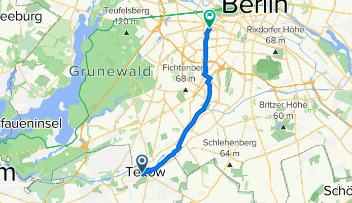
Szybka przejażdżka rowerowa z Teltow do Hansaviertel
Dostosuj własną trasę na podstawie naszego szablonu lub zobacz, jak nasza społeczność najchętniej jeździ z Teltow do Hansaviertel.
Szablon trasy
Z Teltow do Hansaviertel

- 1 h 11 min
- Czas
- 17,8 km
- Dystans
- 49 m
- Przewyższenia
- 51 m
- Spadek
- 15,1 km/h
- Śr. Prędkość
- 55 m
- Maks. wysokość
This ride takes you from the leafy Berlin suburb of Teltow all the way up into the heart of the city at Hansaviertel—a cool 17.8 km city adventure. Starting in Teltow, known for its charming old town and the Teltow Canal, you’ll ease into the trip on a good mix of paved and asphalt surfaces, with the majority of the route being cyclist-friendly.
Rolling mostly along quiet roads and dedicated cycleways, you pass through a blend of suburban scenery and city green spaces. There’s just a tiny bit of gravel and cobblestone, so a regular bike is fine. The elevation gain is almost nothing—less than 50 meters—so it's a chill and accessible ride, even if you're not in Tour de France shape.
You'll wrap up in Hansaviertel, a fascinating Berlin neighborhood built in the 1950s as a showcase for modernist architecture. It's got a unique vibe and is located right near Tiergarten park, perfect for a chill post-ride picnic or exploring Berlin’s city center on foot. Happy pedaling!
Wspólnota
Najlepsi użytkownicy w tym regionie


Od naszej społeczności
Najlepsze trasy rowerowe z Teltow do Hansaviertel

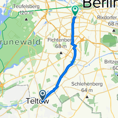
Lichterfelder Allee 31A, Teltow to Nürnberger Straße 22, Berlin
Trasa rowerowa w Teltow, Brandenburgia, Niemcy
- 13,5 km
- Dystans
- 76 m
- Przewyższenia
- 81 m
- Spadek


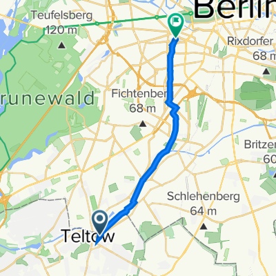
Lichterfelder Allee 31A, Teltow to Nürnberger Straße 49, Berlin
Trasa rowerowa w Teltow, Brandenburgia, Niemcy
- 15,7 km
- Dystans
- 182 m
- Przewyższenia
- 188 m
- Spadek
Potsdamer Straße 61, Teltow to Nürnberger Straße 49, Berlin
Trasa rowerowa w Teltow, Brandenburgia, Niemcy
- 14,6 km
- Dystans
- 554 m
- Przewyższenia
- 562 m
- Spadek

52.402° N 13.275° W to 52.501° N 13.337° W
Trasa rowerowa w Teltow, Brandenburgia, Niemcy
- 13,5 km
- Dystans
- 94 m
- Przewyższenia
- 94 m
- Spadek

Lichterfelder Allee 31A, Teltow to Nürnberger Straße 49, Berlin
Trasa rowerowa w Teltow, Brandenburgia, Niemcy
- 13,5 km
- Dystans
- 77 m
- Przewyższenia
- 87 m
- Spadek

Lichterfelder Allee 31A, Teltow to Nürnberger Straße 49, Berlin
Trasa rowerowa w Teltow, Brandenburgia, Niemcy
- 13,5 km
- Dystans
- 123 m
- Przewyższenia
- 109 m
- Spadek

Potsdamer Straße 61, Teltow to Nürnberger Straße 49, Berlin
Trasa rowerowa w Teltow, Brandenburgia, Niemcy
- 14,5 km
- Dystans
- 59 m
- Przewyższenia
- 68 m
- Spadek

Potsdamer Straße 61, Teltow to Nürnberger Straße 22, Berlin
Trasa rowerowa w Teltow, Brandenburgia, Niemcy
- 15,5 km
- Dystans
- 260 m
- Przewyższenia
- 265 m
- Spadek

52.402° N 13.275° W to Budapester Straße 40, Berlin
Trasa rowerowa w Teltow, Brandenburgia, Niemcy
- 14,2 km
- Dystans
- 68 m
- Przewyższenia
- 73 m
- Spadek

52.402° N 13.275° W to 52.502° N 13.338° W
Trasa rowerowa w Teltow, Brandenburgia, Niemcy
- 13,6 km
- Dystans
- 192 m
- Przewyższenia
- 173 m
- Spadek

Teststrecke
Trasa rowerowa w Teltow, Brandenburgia, Niemcy
- 95,3 km
- Dystans
- 129 m
- Przewyższenia
- 126 m
- Spadek
Odkryj więcej tras
 52.402° N 13.275° W to 52.501° N 13.337° W
- Dystans
- 13,5 km
- Przewyższenia
- 94 m
- Spadek
- 94 m
- Lokalizacja
- Teltow, Brandenburgia, Niemcy
 Lichterfelder Allee 31A, Teltow to Nürnberger Straße 49, Berlin
- Dystans
- 13,5 km
- Przewyższenia
- 77 m
- Spadek
- 87 m
- Lokalizacja
- Teltow, Brandenburgia, Niemcy
 Lichterfelder Allee 31A, Teltow to Nürnberger Straße 49, Berlin
- Dystans
- 13,5 km
- Przewyższenia
- 123 m
- Spadek
- 109 m
- Lokalizacja
- Teltow, Brandenburgia, Niemcy
 Potsdamer Straße 61, Teltow to Nürnberger Straße 49, Berlin
- Dystans
- 14,5 km
- Przewyższenia
- 59 m
- Spadek
- 68 m
- Lokalizacja
- Teltow, Brandenburgia, Niemcy
 Potsdamer Straße 61, Teltow to Nürnberger Straße 22, Berlin
- Dystans
- 15,5 km
- Przewyższenia
- 260 m
- Spadek
- 265 m
- Lokalizacja
- Teltow, Brandenburgia, Niemcy
 52.402° N 13.275° W to Budapester Straße 40, Berlin
- Dystans
- 14,2 km
- Przewyższenia
- 68 m
- Spadek
- 73 m
- Lokalizacja
- Teltow, Brandenburgia, Niemcy
 52.402° N 13.275° W to 52.502° N 13.338° W
- Dystans
- 13,6 km
- Przewyższenia
- 192 m
- Spadek
- 173 m
- Lokalizacja
- Teltow, Brandenburgia, Niemcy
 Teststrecke
- Dystans
- 95,3 km
- Przewyższenia
- 129 m
- Spadek
- 126 m
- Lokalizacja
- Teltow, Brandenburgia, Niemcy
Trasy z Teltow
Jednodniowa wycieczka rowerowa od
Z Teltow do Poczdam
Szybka przejażdżka rowerowa od
Z Teltow do Kleinmachnow
Szybka przejażdżka rowerowa od
Z Teltow do Berlin Schöneberg
Trasy do Hansaviertel
Szybka przejażdżka rowerowa od
Z Tiergarten do Hansaviertel
Szybka przejażdżka rowerowa od
Z Moabit do Hansaviertel