
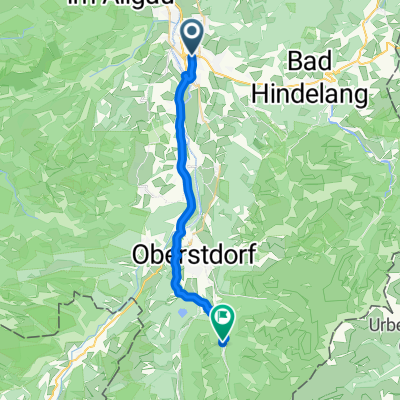
Rowerowa z Sonthofen do Oberstdorf
Dostosuj własną trasę na podstawie naszego szablonu lub zobacz, jak nasza społeczność najchętniej jeździ z Sonthofen do Oberstdorf.
Szablon trasy
Z Sonthofen do Oberstdorf

- 1 h 25 min
- Czas
- 16,7 km
- Dystans
- 112 m
- Przewyższenia
- 38 m
- Spadek
- 11,7 km/h
- Śr. Prędkość
- 829 m
- Maks. wysokość
Get ready for a lovely spin from Sonthofen to Oberstdorf—two gems in the heart of the Allgäu Alps! This 16.7 km route winds mostly along quiet paths and gravel tracks (gravel makes up about two-thirds of the ride), so a sturdy hybrid or gravel bike is your friend here.
You'll start in Sonthofen, the southernmost town in Germany, famous for its alpine views and laid-back vibe. As you roll south, the landscape opens up to lush meadows and distant peaks, with the Allgäu countryside putting on a show. The moderate ascent (about 112 meters up) isn’t too taxing, so you can focus on the scenery—not huffing and puffing.
The finish line is Oberstdorf, a classic mountain town known for its ski jumping hills and as a gateway to hiking and skiing adventures. Grab a coffee or some hearty Bavarian fare when you roll in—this spot is as cozy as they come.
All in all, it’s a relaxed, nature-filled ride, perfect for soaking up the alpine air and getting away from busy roads. Enjoy!
Wspólnota
Najlepsi użytkownicy w tym regionie


Od naszej społeczności
Najlepsze trasy rowerowe z Sonthofen do Oberstdorf
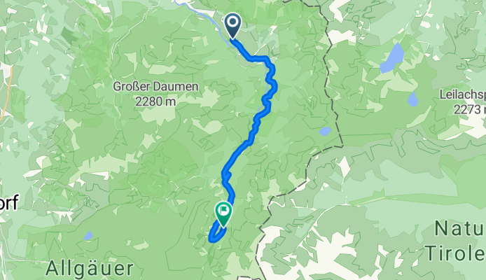
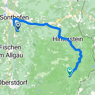
Route zu Giebelhaus
Trasa rowerowa w Sonthofen, Bawaria, Niemcy
- 12,7 km
- Dystans
- 709 m
- Przewyższenia
- 244 m
- Spadek
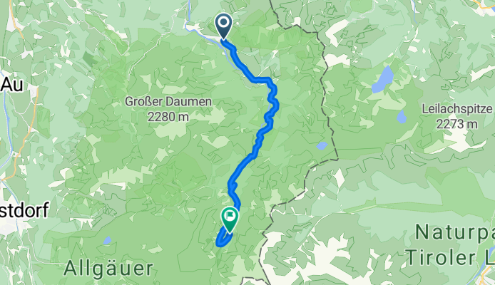
Von Hinterstein bis Bad Hindelang
Trasa rowerowa w Sonthofen, Bawaria, Niemcy
- 13,9 km
- Dystans
- 709 m
- Przewyższenia
- 248 m
- Spadek
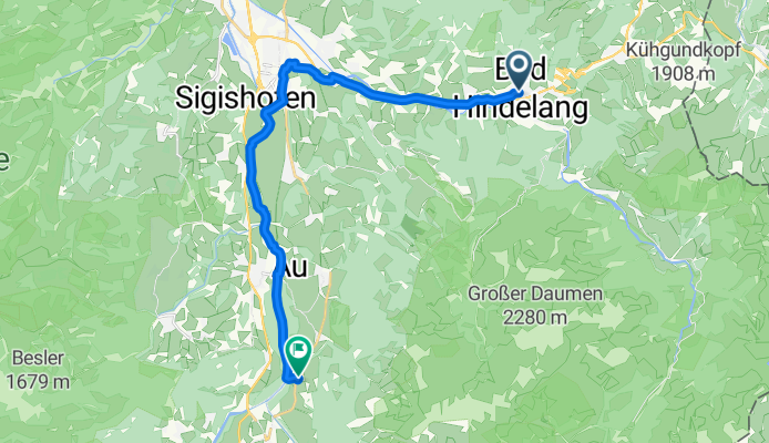
Bad Hindelang über Sonthofen nach Rubi
Trasa rowerowa w Sonthofen, Bawaria, Niemcy
- 18 km
- Dystans
- 106 m
- Przewyższenia
- 142 m
- Spadek
Eichendorffstraße nach Giebelstraße
Trasa rowerowa w Sonthofen, Bawaria, Niemcy
- 22,9 km
- Dystans
- 514 m
- Przewyższenia
- 188 m
- Spadek

Hindelang -Wengenalpe
Trasa rowerowa w Sonthofen, Bawaria, Niemcy
- 17,7 km
- Dystans
- 599 m
- Przewyższenia
- 102 m
- Spadek


sonthofen-gibelhaus
Trasa rowerowa w Sonthofen, Bawaria, Niemcy
- 23,8 km
- Dystans
- 387 m
- Przewyższenia
- 141 m
- Spadek

Rappalptal
Trasa rowerowa w Sonthofen, Bawaria, Niemcy
- 31,6 km
- Dystans
- 666 m
- Przewyższenia
- 109 m
- Spadek

Sonthofen-Obersdorf-Abstecher-zurück
Trasa rowerowa w Sonthofen, Bawaria, Niemcy
- 30 km
- Dystans
- 546 m
- Przewyższenia
- 287 m
- Spadek

Ergee-Giebelhaus 21km
Trasa rowerowa w Sonthofen, Bawaria, Niemcy
- 21 km
- Dystans
- 346 m
- Przewyższenia
- 28 m
- Spadek

Hindelang-Schwarzenberghütte
Trasa rowerowa w Sonthofen, Bawaria, Niemcy
- 18,1 km
- Dystans
- 669 m
- Przewyższenia
- 101 m
- Spadek

Hinterstein Giebelhaus
Trasa rowerowa w Sonthofen, Bawaria, Niemcy
- 20,6 km
- Dystans
- 387 m
- Przewyższenia
- 67 m
- Spadek
Odkryj więcej tras
 Hindelang -Wengenalpe
- Dystans
- 17,7 km
- Przewyższenia
- 599 m
- Spadek
- 102 m
- Lokalizacja
- Sonthofen, Bawaria, Niemcy
 obere Seetour
- Dystans
- 20,7 km
- Przewyższenia
- 246 m
- Spadek
- 104 m
- Lokalizacja
- Sonthofen, Bawaria, Niemcy
 sonthofen-gibelhaus
- Dystans
- 23,8 km
- Przewyższenia
- 387 m
- Spadek
- 141 m
- Lokalizacja
- Sonthofen, Bawaria, Niemcy
 Rappalptal
- Dystans
- 31,6 km
- Przewyższenia
- 666 m
- Spadek
- 109 m
- Lokalizacja
- Sonthofen, Bawaria, Niemcy
 Sonthofen-Obersdorf-Abstecher-zurück
- Dystans
- 30 km
- Przewyższenia
- 546 m
- Spadek
- 287 m
- Lokalizacja
- Sonthofen, Bawaria, Niemcy
 Ergee-Giebelhaus 21km
- Dystans
- 21 km
- Przewyższenia
- 346 m
- Spadek
- 28 m
- Lokalizacja
- Sonthofen, Bawaria, Niemcy
 Hindelang-Schwarzenberghütte
- Dystans
- 18,1 km
- Przewyższenia
- 669 m
- Spadek
- 101 m
- Lokalizacja
- Sonthofen, Bawaria, Niemcy
 Hinterstein Giebelhaus
- Dystans
- 20,6 km
- Przewyższenia
- 387 m
- Spadek
- 67 m
- Lokalizacja
- Sonthofen, Bawaria, Niemcy
Trasy z Sonthofen
Rowerowa od
Z Sonthofen do Burgberg
Trasy do Oberstdorf
Jednodniowa wycieczka rowerowa od
Z Immenstadt im Allgäu do Oberstdorf
Rowerowa od
Z Bolsterlang do Oberstdorf