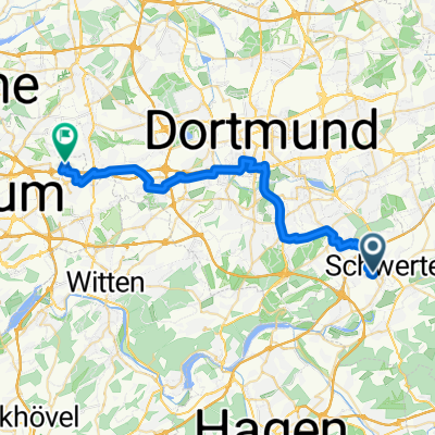


Ludwigstraße 2B, Schwerte nach Gersteinring 50A, Bochum
- 27,4 km
- 259 m
- 270 m
- Schwerte, Nadrenia Północna-Westfalia, Niemcy

Szablon trasy

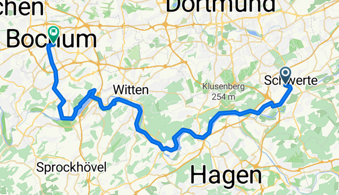
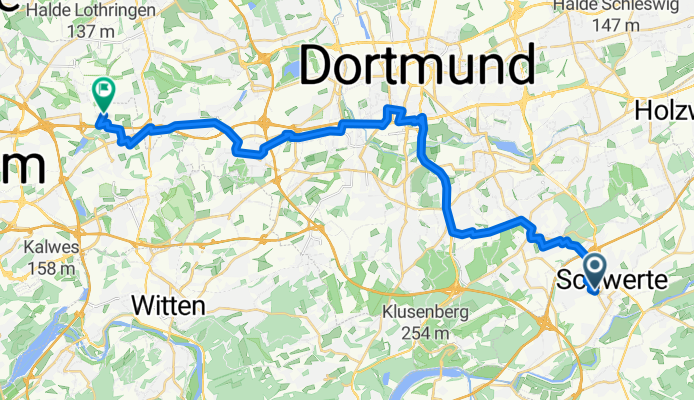
Set off from Schwerte, a charming town on the edge of the Ruhr area known for its historic old town and riverside vibes. The ride to Bochum covers just over 39 km, winding mostly along quiet roads with a comfortable surface—think lots of smooth asphalt and minimal unpaved stretches. You’ll climb a total of about 418 meters, but with some scenic descents to even things out.
The route is peaceful for the most part, steering clear of city rush and letting you soak in the rolling landscapes of North Rhine-Westphalia. It’s a scenic mix of countryside and city outskirts, with just enough variety to keep things interesting—look out for a few sections of gravel. As you cruise into Bochum, you’ll arrive in a lively cultural hotspot famous for its industrial heritage (don’t miss the impressive Deutsches Bergbau-Museum).
Whether you’re riding for the views or the destination, this route offers a relaxed day out on the bike with plenty of local flair at both ends.
Wspólnota
Od naszej społeczności
Trasa rowerowa w Schwerte, Nadrenia Północna-Westfalia, Niemcy
Trasa rowerowa w Schwerte, Nadrenia Północna-Westfalia, Niemcy
Trasa rowerowa w Schwerte, Nadrenia Północna-Westfalia, Niemcy
Trasa rowerowa w Schwerte, Nadrenia Północna-Westfalia, Niemcy
Trasa rowerowa w Schwerte, Nadrenia Północna-Westfalia, Niemcy
Trasa rowerowa w Schwerte, Nadrenia Północna-Westfalia, Niemcy
Trasa rowerowa w Schwerte, Nadrenia Północna-Westfalia, Niemcy
Trasa rowerowa w Schwerte, Nadrenia Północna-Westfalia, Niemcy
Trasa rowerowa w Schwerte, Nadrenia Północna-Westfalia, Niemcy
Trasa rowerowa w Schwerte, Nadrenia Północna-Westfalia, Niemcy
Trasa rowerowa w Schwerte, Nadrenia Północna-Westfalia, Niemcy
Trasa rowerowa w Schwerte, Nadrenia Północna-Westfalia, Niemcy
Rowerowa od
Rowerowa od
Jednodniowa wycieczka rowerowa od
Jednodniowa wycieczka rowerowa od
Rowerowa od
Rowerowa od