
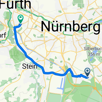
Szybka przejażdżka rowerowa z Norymberga do Fürth
Dostosuj własną trasę na podstawie naszego szablonu lub zobacz, jak nasza społeczność najchętniej jeździ z Norymberga do Fürth.
Szablon trasy
Z Norymberga do Fürth

- 34 min
- Czas
- 10,6 km
- Dystans
- 52 m
- Przewyższenia
- 48 m
- Spadek
- 18,5 km/h
- Śr. Prędkość
- 305 m
- Maks. wysokość
Looking for a relaxed ride between two Franconian cities? This 10.6 km cycling route takes you from the heart of Nuremberg to the center of Fürth, mostly along well-paved paths and quiet roads. Starting in Nuremberg—famous for its medieval old town and impressive castle—you’ll enjoy a gentle ride with just a few small ups and downs (total ascent is only about 52 meters, so nothing too challenging!).
The route is around 96% paved (mostly asphalt), with just a short stretch on gravel and cobbles to add a little variety. You'll mostly be on designated paths and quiet side streets, making the journey safe and easygoing—perfect for a casual bike outing. Ending in Fürth, you’ll find a charming old town and the lovely city park (Stadtpark) inviting you to linger.
Whether you’re commuting, sightseeing, or just cruising for fun, this route offers a great urban cycling experience between two neighboring Bavarian gems!
Wspólnota
Najlepsi użytkownicy w tym regionie


Od naszej społeczności
Najlepsze trasy rowerowe z Norymberga do Fürth

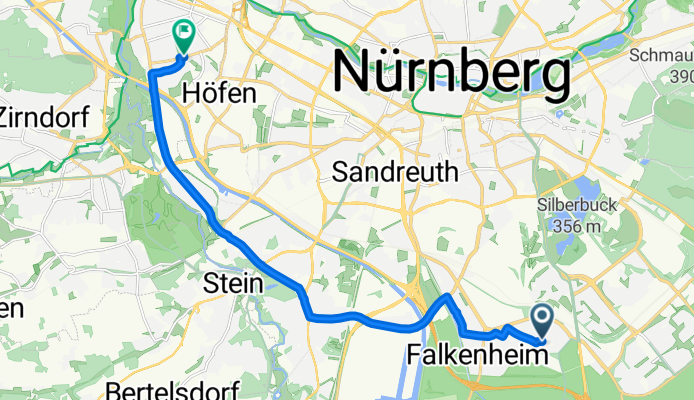
Nürnberg-Fürth über Pegnitz- und Regnitz
Trasa rowerowa w Norymberga, Bawaria, Niemcy
- 19,7 km
- Dystans
- 55 m
- Przewyższenia
- 90 m
- Spadek

Nürnberg-Fürth über Pegnitz- und Regnitz
Trasa rowerowa w Norymberga, Bawaria, Niemcy
- 19,7 km
- Dystans
- 51 m
- Przewyższenia
- 85 m
- Spadek

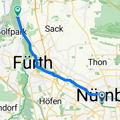
Rückfahrt von NBG nach FUE
Trasa rowerowa w Norymberga, Bawaria, Niemcy
- 12,9 km
- Dystans
- 77 m
- Przewyższenia
- 74 m
- Spadek

Trainingsroute Nürnberg - Fürth / Feierabend Racedrive
Trasa rowerowa w Norymberga, Bawaria, Niemcy
- 11,3 km
- Dystans
- 101 m
- Przewyższenia
- 67 m
- Spadek

Kettensteg NBG. :: Klinikum FTH auf dem Pegnitzradweg
Trasa rowerowa w Norymberga, Bawaria, Niemcy
- 9,7 km
- Dystans
- 48 m
- Przewyższenia
- 33 m
- Spadek

SSP-Tour 2015
Trasa rowerowa w Norymberga, Bawaria, Niemcy
- 47,1 km
- Dystans
- 195 m
- Przewyższenia
- 203 m
- Spadek

Way from Work to Home
Trasa rowerowa w Norymberga, Bawaria, Niemcy
- 13,9 km
- Dystans
- 44 m
- Przewyższenia
- 56 m
- Spadek


N-Wöhrder See - F-Uferstadt
Trasa rowerowa w Norymberga, Bawaria, Niemcy
- 7,2 km
- Dystans
- 31 m
- Przewyższenia
- 37 m
- Spadek

Nürnberg - Großgründlach (cracked tandembike frame)
Trasa rowerowa w Norymberga, Bawaria, Niemcy
- 15,1 km
- Dystans
- 48 m
- Przewyższenia
- 55 m
- Spadek
Leerstetter Straße, Nürnberg nach Fronmüllerstraße, Fürth
Trasa rowerowa w Norymberga, Bawaria, Niemcy
- 13,9 km
- Dystans
- 26 m
- Przewyższenia
- 59 m
- Spadek

Plärrer-Solarhügel und zurück
Trasa rowerowa w Norymberga, Bawaria, Niemcy
- 11,1 km
- Dystans
- 37 m
- Przewyższenia
- 66 m
- Spadek
Odkryj więcej tras
 Kettensteg NBG. :: Klinikum FTH auf dem Pegnitzradweg
- Dystans
- 9,7 km
- Przewyższenia
- 48 m
- Spadek
- 33 m
- Lokalizacja
- Norymberga, Bawaria, Niemcy
 SSP-Tour 2015
- Dystans
- 47,1 km
- Przewyższenia
- 195 m
- Spadek
- 203 m
- Lokalizacja
- Norymberga, Bawaria, Niemcy
 Way from Work to Home
- Dystans
- 13,9 km
- Przewyższenia
- 44 m
- Spadek
- 56 m
- Lokalizacja
- Norymberga, Bawaria, Niemcy
 Samodwiga
- Dystans
- 7,8 km
- Przewyższenia
- 116 m
- Spadek
- 177 m
- Lokalizacja
- Norymberga, Bawaria, Niemcy
 N-Wöhrder See - F-Uferstadt
- Dystans
- 7,2 km
- Przewyższenia
- 31 m
- Spadek
- 37 m
- Lokalizacja
- Norymberga, Bawaria, Niemcy
 Nürnberg - Großgründlach (cracked tandembike frame)
- Dystans
- 15,1 km
- Przewyższenia
- 48 m
- Spadek
- 55 m
- Lokalizacja
- Norymberga, Bawaria, Niemcy
 Leerstetter Straße, Nürnberg nach Fronmüllerstraße, Fürth
- Dystans
- 13,9 km
- Przewyższenia
- 26 m
- Spadek
- 59 m
- Lokalizacja
- Norymberga, Bawaria, Niemcy
 Plärrer-Solarhügel und zurück
- Dystans
- 11,1 km
- Przewyższenia
- 37 m
- Spadek
- 66 m
- Lokalizacja
- Norymberga, Bawaria, Niemcy
Trasy z Norymberga
Jednodniowa wycieczka rowerowa od
Z Norymberga do Ratyzbona
Jednodniowa wycieczka rowerowa od
Z Norymberga do Neumarkt in der Oberpfalz
Szybka przejażdżka rowerowa od
Z Norymberga do Großreuth bei Schweinau
Szybka przejażdżka rowerowa od
Z Norymberga do Stein
Trasy do Fürth
Szybka przejażdżka rowerowa od
Z Zirndorf do Fürth
Szybka przejażdżka rowerowa od
Z Großreuth bei Schweinau do Fürth