
Jednodniowa wycieczka rowerowa z Mittenwald do Bad Tölz
Dostosuj własną trasę na podstawie naszego szablonu lub zobacz, jak nasza społeczność najchętniej jeździ z Mittenwald do Bad Tölz.
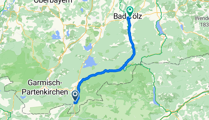
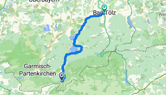
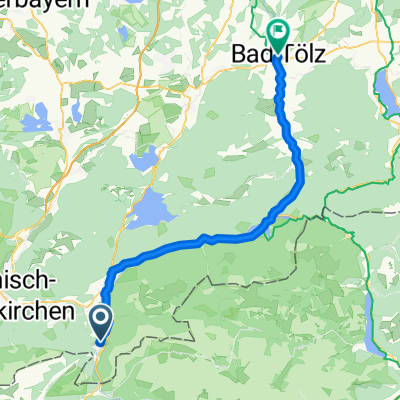
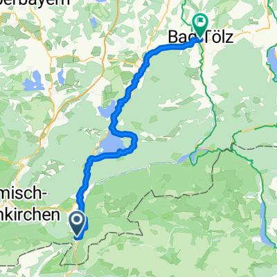
Szablon trasy
Z Mittenwald do Bad Tölz
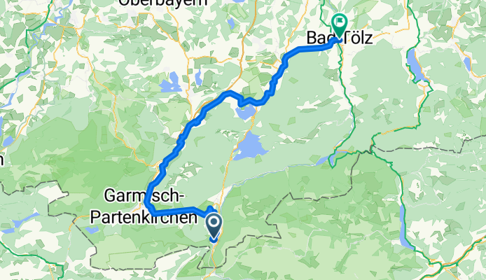
- 5 h 6 min
- Czas
- 84,6 km
- Dystans
- 695 m
- Przewyższenia
- 955 m
- Spadek
- 16,6 km/h
- Śr. Prędkość
- 990 m
- Maks. wysokość
Get ready for a beautiful journey from Mittenwald to Bad Tölz! Starting in the charming alpine town of Mittenwald—famous for its colorful houses and violin-making tradition—you’ll pedal north through dramatic Bavarian landscapes. The ride covers around 85 km with some scenic climbing (nearly 700 meters up!), but you’ll also enjoy long, satisfying descents on the way to Bad Tölz.
Most of the ride is on quiet roads with plenty of paved sections, making for smooth cruising, though you’ll hit a mix of tracks and paths that add a bit of adventure. Take in bubbling streams, lush forests, and those picturesque mountain backdrops along the way.
Bad Tölz is a classic spa town, known for its historic old town and riverside charm—perfect for a well-earned post-ride stroll or a relaxing soak. In all, this route is a rewarding day out, blending epic alpine views with Bavarian hospitality. Don’t forget to snap some photos—you’ll definitely want to relive this one!
Wspólnota
Najlepsi użytkownicy w tym regionie

Od naszej społeczności
Najlepsze trasy rowerowe z Mittenwald do Bad Tölz
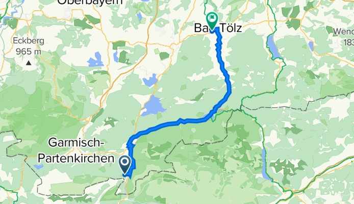
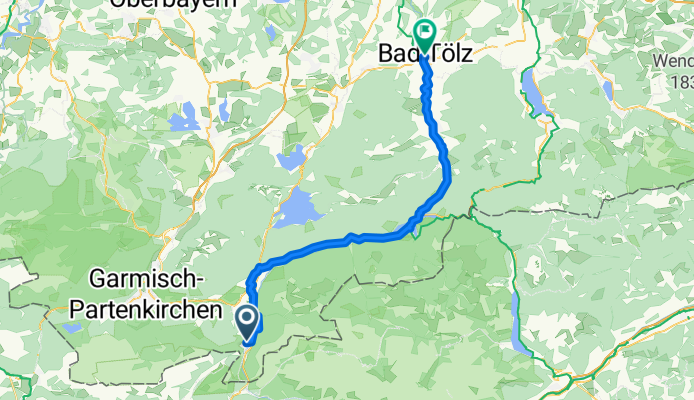
Isar_05 63km Mittenwald - Bad Tölz
Trasa rowerowa w Mittenwald, Bawaria, Niemcy
- 62,8 km
- Dystans
- 171 m
- Przewyższenia
- 424 m
- Spadek
10. Juli 2020 Bad Tölz
Trasa rowerowa w Mittenwald, Bawaria, Niemcy
- 58,2 km
- Dystans
- 153 m
- Przewyższenia
- 405 m
- Spadek
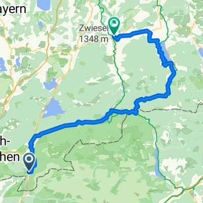
Münchener Seenroute Teil 5
Trasa rowerowa w Mittenwald, Bawaria, Niemcy
- 60,3 km
- Dystans
- 444 m
- Przewyższenia
- 709 m
- Spadek
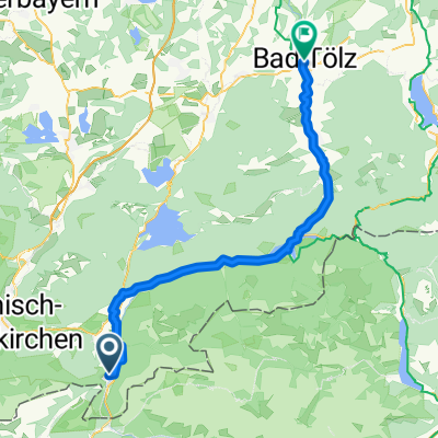
Entlang der Isar von Mittenwald nach Bad Tölz
Trasa rowerowa w Mittenwald, Bawaria, Niemcy
- 56,7 km
- Dystans
- 313 m
- Przewyższenia
- 545 m
- Spadek
Jachenau: Radtour durch die Jachenau von Mittenwald bis Bad Tölz
Trasa rowerowa w Mittenwald, Bawaria, Niemcy
- 58,5 km
- Dystans
- 105 m
- Przewyższenia
- 371 m
- Spadek

Jachenau Radtour von Mittenwald nach Bad Tölz
Trasa rowerowa w Mittenwald, Bawaria, Niemcy
- 57,2 km
- Dystans
- 128 m
- Przewyższenia
- 394 m
- Spadek
Mittenwald-BadTolz
Trasa rowerowa w Mittenwald, Bawaria, Niemcy
- 60 km
- Dystans
- 164 m
- Przewyższenia
- 393 m
- Spadek
Isarradweg Mittenwald-Bad Tölz 60km
Trasa rowerowa w Mittenwald, Bawaria, Niemcy
- 59,8 km
- Dystans
- 246 m
- Przewyższenia
- 519 m
- Spadek

Isarradweg Mittenwald-Bad Tölz
Trasa rowerowa w Mittenwald, Bawaria, Niemcy
- 57,7 km
- Dystans
- 179 m
- Przewyższenia
- 446 m
- Spadek
Münchner Seenrunde 4c (Walchen-Kochelsee)
Trasa rowerowa w Mittenwald, Bawaria, Niemcy
- 63,9 km
- Dystans
- 1058 m
- Przewyższenia
- 1319 m
- Spadek
Münchner Seenrunde 4b (Achenpass-Tegernsee)
Trasa rowerowa w Mittenwald, Bawaria, Niemcy
- 95,4 km
- Dystans
- 1463 m
- Przewyższenia
- 1723 m
- Spadek
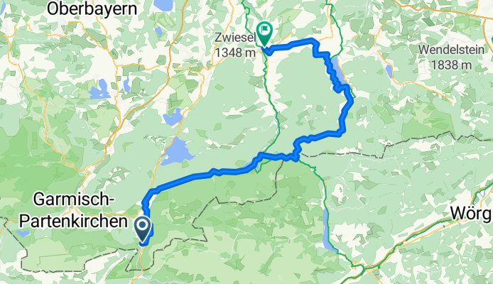
Münchner Seenrunde 4a (Isarradweg)
Trasa rowerowa w Mittenwald, Bawaria, Niemcy
- 60,2 km
- Dystans
- 586 m
- Przewyższenia
- 844 m
- Spadek
Odkryj więcej tras
 Jachenau: Radtour durch die Jachenau von Mittenwald bis Bad Tölz
- Dystans
- 58,5 km
- Przewyższenia
- 105 m
- Spadek
- 371 m
- Lokalizacja
- Mittenwald, Bawaria, Niemcy
 Jachenau Radtour von Mittenwald nach Bad Tölz
- Dystans
- 57,2 km
- Przewyższenia
- 128 m
- Spadek
- 394 m
- Lokalizacja
- Mittenwald, Bawaria, Niemcy
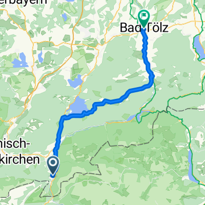
 Mittenwald-BadTolz
- Dystans
- 60 km
- Przewyższenia
- 164 m
- Spadek
- 393 m
- Lokalizacja
- Mittenwald, Bawaria, Niemcy
 Isarradweg Mittenwald-Bad Tölz 60km
- Dystans
- 59,8 km
- Przewyższenia
- 246 m
- Spadek
- 519 m
- Lokalizacja
- Mittenwald, Bawaria, Niemcy
 Isarradweg Mittenwald-Bad Tölz
- Dystans
- 57,7 km
- Przewyższenia
- 179 m
- Spadek
- 446 m
- Lokalizacja
- Mittenwald, Bawaria, Niemcy
 Münchner Seenrunde 4c (Walchen-Kochelsee)
- Dystans
- 63,9 km
- Przewyższenia
- 1058 m
- Spadek
- 1319 m
- Lokalizacja
- Mittenwald, Bawaria, Niemcy
 Münchner Seenrunde 4b (Achenpass-Tegernsee)
- Dystans
- 95,4 km
- Przewyższenia
- 1463 m
- Spadek
- 1723 m
- Lokalizacja
- Mittenwald, Bawaria, Niemcy
 Münchner Seenrunde 4a (Isarradweg)
- Dystans
- 60,2 km
- Przewyższenia
- 586 m
- Spadek
- 844 m
- Lokalizacja
- Mittenwald, Bawaria, Niemcy
Trasy z Mittenwald
Jednodniowa wycieczka rowerowa od
Z Mittenwald do Innsbruck
Jednodniowa wycieczka rowerowa od
Z Mittenwald do Thaur
Szybka przejażdżka rowerowa od
Z Mittenwald do Scharnitz
Trasy do Bad Tölz
Jednodniowa wycieczka rowerowa od
Z Monachium do Bad Tölz