
Jednodniowa wycieczka rowerowa z Lindau do Oberstaufen
Dostosuj własną trasę na podstawie naszego szablonu lub zobacz, jak nasza społeczność najchętniej jeździ z Lindau do Oberstaufen.
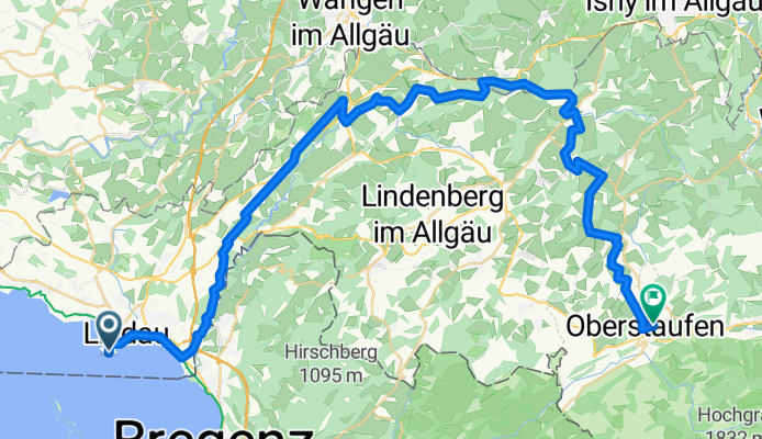
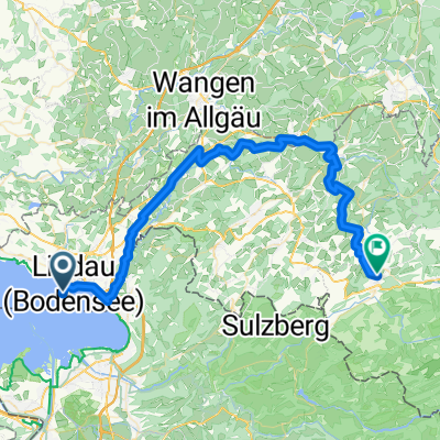
Szablon trasy
Z Lindau do Oberstaufen

- 3 h 5 min
- Czas
- 51,2 km
- Dystans
- 889 m
- Przewyższenia
- 505 m
- Spadek
- 16,6 km/h
- Śr. Prędkość
- 875 m
- Maks. wysokość
Ready for a cycling adventure through southern Germany? This picturesque route starts in the lakeside town of Lindau, famous for its island old town on Lake Constance, complete with a stunning lighthouse and Bavarian Lion statue greeting you at the harbor.
You'll pedal eastwards into the hilly Allgäu region, covering about 51 km, with nearly 900 meters of ascent—so get ready for some calf-busting climbs (and gorgeous views as your reward!). Most of your ride is on quiet roads and paved paths, winding through lush countryside, charming villages, and maybe even the occasional sound of cowbells.
The journey finishes in Oberstaufen, a cozy alpine resort nestled at around 875 meters elevation. Oberstaufen is known for its spa culture, traditional Bavarian flair, and access to beautiful mountain hiking—and after your ride, you’ve definitely earned one of their famous cheese platters or a slice of apple strudel.
Perfect for anyone who enjoys a mix of lake views, rolling farmland, and lush alpine scenery. Don’t forget your camera—or your appetite!
Wspólnota
Najlepsi użytkownicy w tym regionie


Od naszej społeczności
Najlepsze trasy rowerowe z Lindau do Oberstaufen

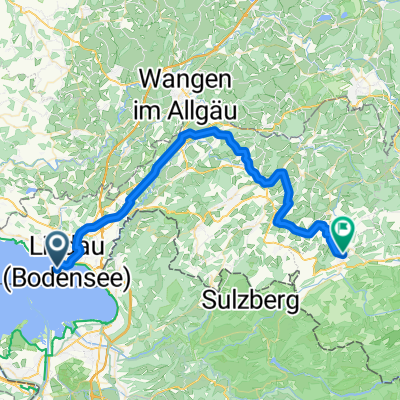
BKR - Etappe 1
Trasa rowerowa w Lindau, Bawaria, Niemcy
- 52,8 km
- Dystans
- 765 m
- Przewyższenia
- 372 m
- Spadek

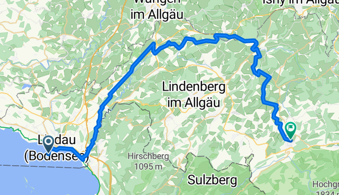
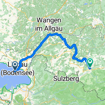
Bodensee-Königssee-Radweg II (Lindau - Oberstaufen)
Trasa rowerowa w Lindau, Bawaria, Niemcy
- 54,9 km
- Dystans
- 569 m
- Przewyższenia
- 172 m
- Spadek

Lindau-Oberstaufen
Trasa rowerowa w Lindau, Bawaria, Niemcy
- 53,8 km
- Dystans
- 570 m
- Przewyższenia
- 173 m
- Spadek

Lindau - Oberstaufen (Bodensee-Königssee)
Trasa rowerowa w Lindau, Bawaria, Niemcy
- 50,4 km
- Dystans
- 736 m
- Przewyższenia
- 330 m
- Spadek

Bregenzer Straße, Lindau (Bodensee) nach Gottfried-Resl-Weg 2, Oberstaufen
Trasa rowerowa w Lindau, Bawaria, Niemcy
- 51,7 km
- Dystans
- 589 m
- Przewyższenia
- 196 m
- Spadek
Lindau-Oberstaufen
Trasa rowerowa w Lindau, Bawaria, Niemcy
- 53,2 km
- Dystans
- 567 m
- Przewyższenia
- 171 m
- Spadek
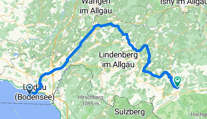
Lindau - Oberstaufen
Trasa rowerowa w Lindau, Bawaria, Niemcy
- 53,4 km
- Dystans
- 920 m
- Przewyższenia
- 513 m
- Spadek

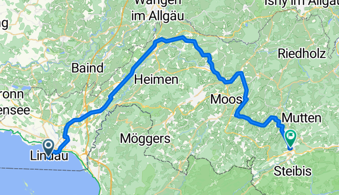
Tag 1: Lindau - Moosmühle
Trasa rowerowa w Lindau, Bawaria, Niemcy
- 51 km
- Dystans
- 808 m
- Przewyższenia
- 426 m
- Spadek
Bahnhofplatz nach Auf der Höh
Trasa rowerowa w Lindau, Bawaria, Niemcy
- 47,5 km
- Dystans
- 819 m
- Przewyższenia
- 424 m
- Spadek
Bahnhofplatz nach Kirchplatz
Trasa rowerowa w Lindau, Bawaria, Niemcy
- 47,9 km
- Dystans
- 808 m
- Przewyższenia
- 412 m
- Spadek

Am Bahnhof, Lindau (Bodensee) to Sinswang 1, Oberstaufen
Trasa rowerowa w Lindau, Bawaria, Niemcy
- 51 km
- Dystans
- 564 m
- Przewyższenia
- 183 m
- Spadek

Odkryj więcej tras
 Bregenzer Straße, Lindau (Bodensee) nach Gottfried-Resl-Weg 2, Oberstaufen
- Dystans
- 51,7 km
- Przewyższenia
- 589 m
- Spadek
- 196 m
- Lokalizacja
- Lindau, Bawaria, Niemcy
 Lindau-Oberstaufen
- Dystans
- 53,2 km
- Przewyższenia
- 567 m
- Spadek
- 171 m
- Lokalizacja
- Lindau, Bawaria, Niemcy
 Lindau - Oberstaufen
- Dystans
- 53,4 km
- Przewyższenia
- 920 m
- Spadek
- 513 m
- Lokalizacja
- Lindau, Bawaria, Niemcy
 Tag 1: Lindau - Moosmühle
- Dystans
- 51 km
- Przewyższenia
- 808 m
- Spadek
- 426 m
- Lokalizacja
- Lindau, Bawaria, Niemcy
 Bahnhofplatz nach Auf der Höh
- Dystans
- 47,5 km
- Przewyższenia
- 819 m
- Spadek
- 424 m
- Lokalizacja
- Lindau, Bawaria, Niemcy
 Bahnhofplatz nach Kirchplatz
- Dystans
- 47,9 km
- Przewyższenia
- 808 m
- Spadek
- 412 m
- Lokalizacja
- Lindau, Bawaria, Niemcy
 Am Bahnhof, Lindau (Bodensee) to Sinswang 1, Oberstaufen
- Dystans
- 51 km
- Przewyższenia
- 564 m
- Spadek
- 183 m
- Lokalizacja
- Lindau, Bawaria, Niemcy
 Tag-1_15-01-2011
- Dystans
- 57,4 km
- Przewyższenia
- 630 m
- Spadek
- 290 m
- Lokalizacja
- Lindau, Bawaria, Niemcy
Trasy z Lindau
Jednodniowa wycieczka rowerowa od
Z Lindau do Friedrichshafen
Jednodniowa wycieczka rowerowa od
Z Lindau do Füssen
Szybka przejażdżka rowerowa od
Z Lindau do Bregencja
Szybka przejażdżka rowerowa od
Z Lindau do Bodolz