
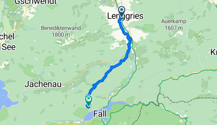
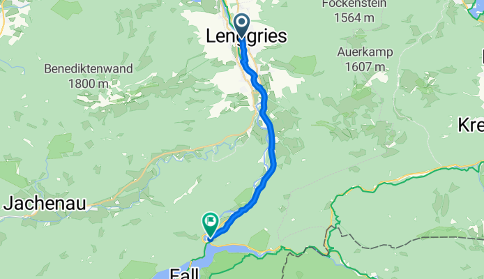
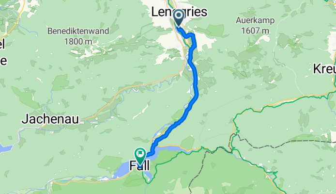
Szablon trasy
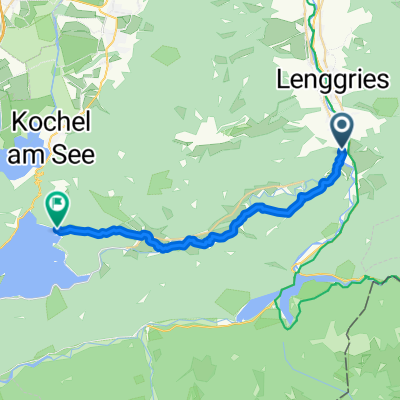
Z Lenggries do Jachenau

- 1 h 20 min
- Czas
- 20,7 km
- Dystans
- 236 m
- Przewyższenia
- 143 m
- Spadek
- 15,6 km/h
- Śr. Prędkość
- 777 m
- Maks. wysokość
A mellow Alpine-valley spin from Lenggries to Jachenau. Roll out of Lenggries by the Isar—this Brauneck base town has plenty of cafés if you need a pre-ride espresso—then follow quiet lanes and signed cycleways toward the Jachenau valley. The route is about 21 km with roughly 236 m of climbing: think gentle rises through meadows and short forested sections rather than big mountain grinds. It’s mostly paved/asphalt, with a few brief gravel/pebblestone stretches, so wider road tires are nice but not essential. You’ll have mostly calm roads, with a couple of busier bits—stay alert near village approaches.
Scenery is classic Upper Bavaria: river glimpses, wooden farmhouses, and mountain backdrops. Jachenau itself is a long, spread-out village known for its traditional timber houses and easy access to Walchensee and the Herzogstand–Heimgarten massif—perfect for a post-ride stroll or pastry stop. Expect a relaxed couple of hours with photo breaks; add time if you detour to the water.
Wspólnota
Najlepsi użytkownicy w tym regionie


Od naszej społeczności
Najlepsze trasy rowerowe z Lenggries do Jachenau

Lenggries - Walchensee (Straße)
Trasa rowerowa w Lenggries, Bawaria, Niemcy
- 20,6 km
- Dystans
- 264 m
- Przewyższenia
- 157 m
- Spadek

Lenggries - Walchensee
Trasa rowerowa w Lenggries, Bawaria, Niemcy
- 22,4 km
- Dystans
- 255 m
- Przewyższenia
- 148 m
- Spadek

Sylvensteinspeicher
Trasa rowerowa w Lenggries, Bawaria, Niemcy
- 75,9 km
- Dystans
- 443 m
- Przewyższenia
- 435 m
- Spadek

Isarradweg_3 Lengries-Sylvenstein
Trasa rowerowa w Lenggries, Bawaria, Niemcy
- 14,7 km
- Dystans
- 136 m
- Przewyższenia
- 37 m
- Spadek

WSV teststrecke
Trasa rowerowa w Lenggries, Bawaria, Niemcy
- 13,8 km
- Dystans
- 134 m
- Przewyższenia
- 56 m
- Spadek
Schützenstraße nach B307
Trasa rowerowa w Lenggries, Bawaria, Niemcy
- 13,5 km
- Dystans
- 115 m
- Przewyższenia
- 68 m
- Spadek
Letten, Lenggries nach Berg, Jachenau
Trasa rowerowa w Lenggries, Bawaria, Niemcy
- 8,5 km
- Dystans
- 65 m
- Przewyższenia
- 7 m
- Spadek
Jachental - MTB
Trasa rowerowa w Lenggries, Bawaria, Niemcy
- 21,7 km
- Dystans
- 384 m
- Przewyższenia
- 284 m
- Spadek

Scharfreiterstraße, Lenggries nach B307, Lenggries
Trasa rowerowa w Lenggries, Bawaria, Niemcy
- 13,4 km
- Dystans
- 117 m
- Przewyższenia
- 24 m
- Spadek
Anton-Dräxl-Straße, Lenggries nach Schöttlstraße, Lenggries
Trasa rowerowa w Lenggries, Bawaria, Niemcy
- 15,8 km
- Dystans
- 332 m
- Przewyższenia
- 241 m
- Spadek
Lenggries-Sylvenstein per Rad
Trasa rowerowa w Lenggries, Bawaria, Niemcy
- 15,8 km
- Dystans
- 219 m
- Przewyższenia
- 128 m
- Spadek
Odkryj więcej tras
 WSV teststrecke
- Dystans
- 13,8 km
- Przewyższenia
- 134 m
- Spadek
- 56 m
- Lokalizacja
- Lenggries, Bawaria, Niemcy
 sylve
sylve- Dystans
- 17,5 km
- Przewyższenia
- 501 m
- Spadek
- 172 m
- Lokalizacja
- Lenggries, Bawaria, Niemcy
 Schützenstraße nach B307
- Dystans
- 13,5 km
- Przewyższenia
- 115 m
- Spadek
- 68 m
- Lokalizacja
- Lenggries, Bawaria, Niemcy
 Letten, Lenggries nach Berg, Jachenau
- Dystans
- 8,5 km
- Przewyższenia
- 65 m
- Spadek
- 7 m
- Lokalizacja
- Lenggries, Bawaria, Niemcy
 Jachental - MTB
- Dystans
- 21,7 km
- Przewyższenia
- 384 m
- Spadek
- 284 m
- Lokalizacja
- Lenggries, Bawaria, Niemcy
 Scharfreiterstraße, Lenggries nach B307, Lenggries
- Dystans
- 13,4 km
- Przewyższenia
- 117 m
- Spadek
- 24 m
- Lokalizacja
- Lenggries, Bawaria, Niemcy
 Anton-Dräxl-Straße, Lenggries nach Schöttlstraße, Lenggries
- Dystans
- 15,8 km
- Przewyższenia
- 332 m
- Spadek
- 241 m
- Lokalizacja
- Lenggries, Bawaria, Niemcy
 Lenggries-Sylvenstein per Rad
- Dystans
- 15,8 km
- Przewyższenia
- 219 m
- Spadek
- 128 m
- Lokalizacja
- Lenggries, Bawaria, Niemcy
Trasy do Jachenau
Jednodniowa wycieczka rowerowa od
Z Bad Tölz do Jachenau