
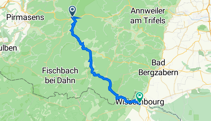
Jednodniowa wycieczka rowerowa z Hinterweidenthal do Schweigen-Rechtenbach
Dostosuj własną trasę na podstawie naszego szablonu lub zobacz, jak nasza społeczność najchętniej jeździ z Hinterweidenthal do Schweigen-Rechtenbach.
Szablon trasy
Z Hinterweidenthal do Schweigen-Rechtenbach

- 2 h 18 min
- Czas
- 34,5 km
- Dystans
- 966 m
- Przewyższenia
- 969 m
- Spadek
- 15 km/h
- Śr. Prędkość
- 274 m
- Maks. wysokość
This ride takes you from the charming village of Hinterweidenthal, nestled in the heart of the Palatinate Forest, all the way down to Schweigen-Rechtenbach, the famous gateway to the German Wine Route. You'll cover about 34.5 km, with plenty of ups and downs—nearly 970 meters of climbing and descending along the way. Most of the route rolls over smooth asphalt and quiet tracks, giving you a pleasant mix of forested paths and peaceful rural roads.
Hinterweidenthal is known for its dramatic red sandstone rock formations—if you’ve got a moment before you start, Tolksmühle and Teufelstisch are worth a peek. The ride itself leads you through lush forests and rolling hills, so expect some good leg workouts on those ascents.
Your adventure ends in Schweigen-Rechtenbach, right at the impressive Deutsches Weintor, where the German Wine Route officially begins. Treat yourself to a glass of local Riesling or a well-earned slice of Pfälzer sausage when you arrive—after all, you’ve earned it!
Wspólnota
Najlepsi użytkownicy w tym regionie


Od naszej społeczności
Najlepsze trasy rowerowe z Hinterweidenthal do Schweigen-Rechtenbach

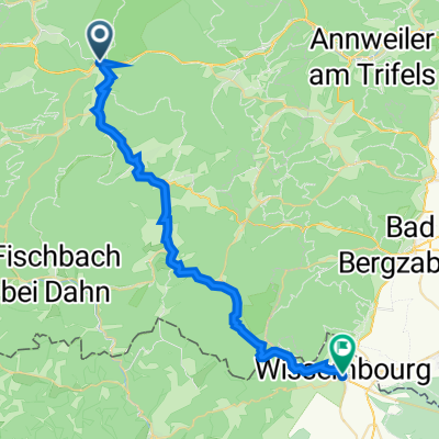
Radweg Hinterweidenthal - Wissembourg
Trasa rowerowa w Hinterweidenthal, Nadrenia-Palatynat, Niemcy
- 32,1 km
- Dystans
- 913 m
- Przewyższenia
- 973 m
- Spadek

Hinterweidenthal Bf. - Wissembourg Frank. - Hinterweidenthal Bf. - Wissembourg Frank.
Trasa rowerowa w Hinterweidenthal, Nadrenia-Palatynat, Niemcy
- 31,2 km
- Dystans
- 922 m
- Przewyższenia
- 983 m
- Spadek

Wieslautertal-Radweg - Wieslautertal-Radweg
Trasa rowerowa w Hinterweidenthal, Nadrenia-Palatynat, Niemcy
- 32,9 km
- Dystans
- 921 m
- Przewyższenia
- 991 m
- Spadek

Zwischen Deutschland und Frankreich
Trasa rowerowa w Hinterweidenthal, Nadrenia-Palatynat, Niemcy
- 30,9 km
- Dystans
- 779 m
- Przewyższenia
- 804 m
- Spadek

Lange Radrunde vom 23. August, 10:25
Trasa rowerowa w Hinterweidenthal, Nadrenia-Palatynat, Niemcy
- 32 km
- Dystans
- 394 m
- Przewyższenia
- 489 m
- Spadek

Hinterweidenthal_Dahn_Wissembourg
Trasa rowerowa w Hinterweidenthal, Nadrenia-Palatynat, Niemcy
- 31,5 km
- Dystans
- 305 m
- Przewyższenia
- 369 m
- Spadek

1.Hinterweidenthal-Wissembourg
Trasa rowerowa w Hinterweidenthal, Nadrenia-Palatynat, Niemcy
- 38,9 km
- Dystans
- 311 m
- Przewyższenia
- 379 m
- Spadek

Im Tal 4-6, Hinterweidenthal nach Rue du Général Leclerc 29, Wissembourg
Trasa rowerowa w Hinterweidenthal, Nadrenia-Palatynat, Niemcy
- 31,2 km
- Dystans
- 890 m
- Przewyższenia
- 948 m
- Spadek

Tour de Netzwerkökonomie 2022
Trasa rowerowa w Hinterweidenthal, Nadrenia-Palatynat, Niemcy
- 53 km
- Dystans
- 711 m
- Przewyższenia
- 757 m
- Spadek

Hinterweidenthal-Weissenburg
Trasa rowerowa w Hinterweidenthal, Nadrenia-Palatynat, Niemcy
- 29,7 km
- Dystans
- 357 m
- Przewyższenia
- 421 m
- Spadek

Radweg Hinterweidenthal - Wissembourg
Trasa rowerowa w Hinterweidenthal, Nadrenia-Palatynat, Niemcy
- 31,7 km
- Dystans
- 322 m
- Przewyższenia
- 391 m
- Spadek
Hinterweidenthal nach 15 Place du Marché aux Choux, Wissembourg
Trasa rowerowa w Hinterweidenthal, Nadrenia-Palatynat, Niemcy
- 32,7 km
- Dystans
- 886 m
- Przewyższenia
- 957 m
- Spadek
Odkryj więcej tras
 Lange Radrunde vom 23. August, 10:25
- Dystans
- 32 km
- Przewyższenia
- 394 m
- Spadek
- 489 m
- Lokalizacja
- Hinterweidenthal, Nadrenia-Palatynat, Niemcy
 Hinterweidenthal_Dahn_Wissembourg
- Dystans
- 31,5 km
- Przewyższenia
- 305 m
- Spadek
- 369 m
- Lokalizacja
- Hinterweidenthal, Nadrenia-Palatynat, Niemcy
 1.Hinterweidenthal-Wissembourg
- Dystans
- 38,9 km
- Przewyższenia
- 311 m
- Spadek
- 379 m
- Lokalizacja
- Hinterweidenthal, Nadrenia-Palatynat, Niemcy
 Im Tal 4-6, Hinterweidenthal nach Rue du Général Leclerc 29, Wissembourg
- Dystans
- 31,2 km
- Przewyższenia
- 890 m
- Spadek
- 948 m
- Lokalizacja
- Hinterweidenthal, Nadrenia-Palatynat, Niemcy
 Tour de Netzwerkökonomie 2022
- Dystans
- 53 km
- Przewyższenia
- 711 m
- Spadek
- 757 m
- Lokalizacja
- Hinterweidenthal, Nadrenia-Palatynat, Niemcy
 Hinterweidenthal-Weissenburg
- Dystans
- 29,7 km
- Przewyższenia
- 357 m
- Spadek
- 421 m
- Lokalizacja
- Hinterweidenthal, Nadrenia-Palatynat, Niemcy
 Radweg Hinterweidenthal - Wissembourg
- Dystans
- 31,7 km
- Przewyższenia
- 322 m
- Spadek
- 391 m
- Lokalizacja
- Hinterweidenthal, Nadrenia-Palatynat, Niemcy
 Hinterweidenthal nach 15 Place du Marché aux Choux, Wissembourg
- Dystans
- 32,7 km
- Przewyższenia
- 886 m
- Spadek
- 957 m
- Lokalizacja
- Hinterweidenthal, Nadrenia-Palatynat, Niemcy