
Jednodniowa wycieczka rowerowa z Marienthal do Reinbek
Dostosuj własną trasę na podstawie naszego szablonu lub zobacz, jak nasza społeczność najchętniej jeździ z Marienthal do Reinbek.
Szablon trasy
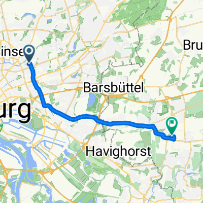
Z Marienthal do Reinbek
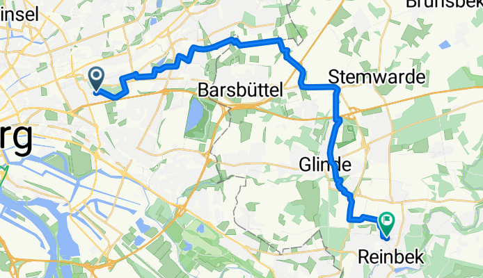
- 1 h 15 min
- Czas
- 20,5 km
- Dystans
- 52 m
- Przewyższenia
- 24 m
- Spadek
- 16,5 km/h
- Śr. Prędkość
- 46 m
- Maks. wysokość
This scenic ride takes you from Marienthal, a lush and leafy district in Hamburg known for its beautiful parks and historic villas, out to the charming town of Reinbek. The route covers about 20.5 km and is mostly flat, with modest climbs—so it’s perfect if you’re looking for a comfortable cruise without too much exertion.
You’ll roll mostly along quiet roads (nearly half the route!), and there’s a good stretch on car-free paths and the occasional gravel track—great for soaking up the countryside atmosphere as you leave the city behind. Almost 90% of your ride is on paved or asphalt surfaces, so you don’t have to worry too much about off-road tires.
Reinbek, your destination, is famous for its lovely Renaissance castle set by the river Bille—a perfect spot to relax and maybe grab a coffee before heading back or hopping on the train home. So, pump up your tires, pack a snack, and enjoy a gentle adventure out of the city!
Wspólnota
Najlepsi użytkownicy w tym regionie


Od naszej społeczności
Najlepsze trasy rowerowe z Marienthal do Reinbek


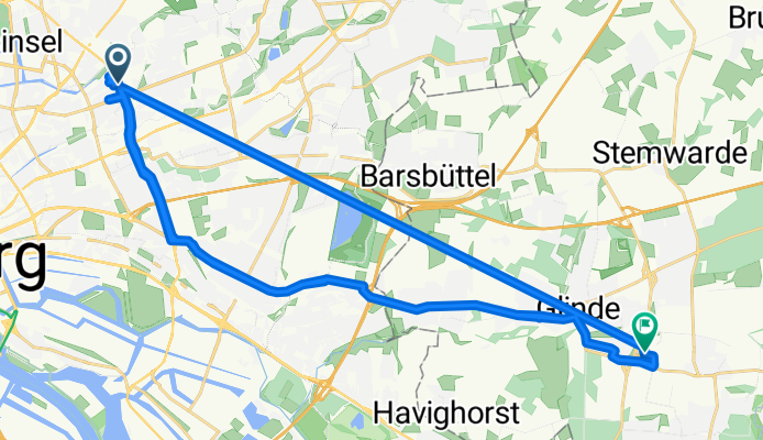
Leichte Fahrt
Trasa rowerowa w Marienthal, Hamburg, Niemcy
- 46,4 km
- Dystans
- 220 m
- Przewyższenia
- 194 m
- Spadek

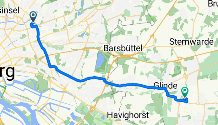
Gemütliche Fahrt
Trasa rowerowa w Marienthal, Hamburg, Niemcy
- 16,8 km
- Dystans
- 75 m
- Przewyższenia
- 55 m
- Spadek

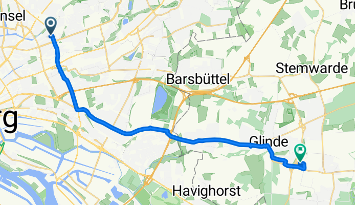
Entspannte Route
Trasa rowerowa w Marienthal, Hamburg, Niemcy
- 16,9 km
- Dystans
- 151 m
- Przewyższenia
- 123 m
- Spadek


Entspannte Route
Trasa rowerowa w Marienthal, Hamburg, Niemcy
- 17,2 km
- Dystans
- 74 m
- Przewyższenia
- 48 m
- Spadek
Odkryj więcej tras
 Entspannte Route
- Dystans
- 16,9 km
- Przewyższenia
- 151 m
- Spadek
- 123 m
- Lokalizacja
- Marienthal, Hamburg, Niemcy
 Stetige Fahrt
- Dystans
- 16,4 km
- Przewyższenia
- 73 m
- Spadek
- 55 m
- Lokalizacja
- Marienthal, Hamburg, Niemcy
 Stetige Fahrt
- Dystans
- 16,8 km
- Przewyższenia
- 72 m
- Spadek
- 48 m
- Lokalizacja
- Marienthal, Hamburg, Niemcy
 Stetige Fahrt
- Dystans
- 16,5 km
- Przewyższenia
- 67 m
- Spadek
- 90 m
- Lokalizacja
- Marienthal, Hamburg, Niemcy
 Leichte Fahrt
- Dystans
- 16,5 km
- Przewyższenia
- 74 m
- Spadek
- 39 m
- Lokalizacja
- Marienthal, Hamburg, Niemcy
 Leichte Fahrt
- Dystans
- 16,5 km
- Przewyższenia
- 69 m
- Spadek
- 55 m
- Lokalizacja
- Marienthal, Hamburg, Niemcy
 Stetige Fahrt
- Dystans
- 16,6 km
- Przewyższenia
- 68 m
- Spadek
- 36 m
- Lokalizacja
- Marienthal, Hamburg, Niemcy
 Entspannte Route
- Dystans
- 17,2 km
- Przewyższenia
- 74 m
- Spadek
- 48 m
- Lokalizacja
- Marienthal, Hamburg, Niemcy
Trasy z Marienthal
Rowerowa od
Z Marienthal do Borgfelde
Rowerowa od
Z Marienthal do Wandsbek