

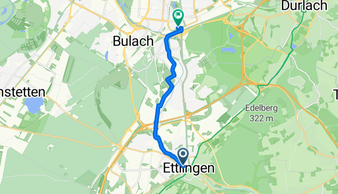
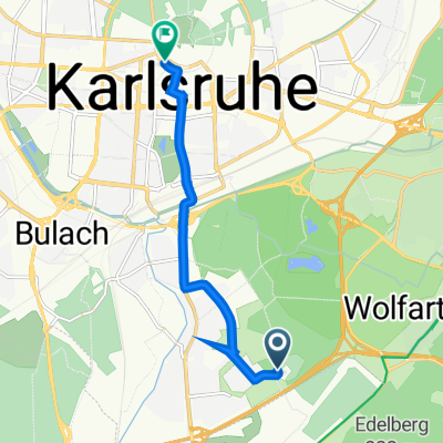
Szablon trasy
Z Ettlingen do Karlsruhe

- 40 min
- Czas
- 11,7 km
- Dystans
- 37 m
- Przewyższenia
- 53 m
- Spadek
- 17,5 km/h
- Śr. Prędkość
- 153 m
- Maks. wysokość
This leisurely 11.7 km ride takes you from the charming town of Ettlingen to the bustling city of Karlsruhe. Starting in Ettlingen, known for its beautiful Baroque old town and the Albtal stream running through it, you’ll mostly follow gentle paths and quiet roads—perfect for a relaxed outing. The route is super friendly for most bikes, as it’s over 90% paved and mostly flat, with just a few mild ups and downs.
Along the way, you’ll glide through suburban greenery and might even catch glimpses of the Black Forest foothills in the distance. As you approach Karlsruhe, the vibe transforms into a lively urban mix. Karlsruhe is famous as Germany’s “fan city” (it’s shaped like a hand fan!), and it’s home to the impressive Karlsruhe Palace and lots of green parks.
With plenty of smooth cycling paths and minimal traffic, this is a great everyday ride whether you’re commuting or just exploring. Finish up with a coffee or ice cream in Karlsruhe’s lively city center—you’ve earned it!
Wspólnota
Najlepsi użytkownicy w tym regionie


Od naszej społeczności
Najlepsze trasy rowerowe z Ettlingen do Karlsruhe

Arbeitsweg Etzenrot - Karlsruhe Mühlburg
Trasa rowerowa w Ettlingen, Badenia-Wirtembergia, Niemcy
- 18 km
- Dystans
- 41 m
- Przewyższenia
- 214 m
- Spadek

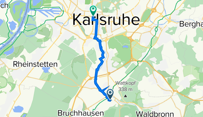
Von Karlsruhe ins Gaistal
Trasa rowerowa w Ettlingen, Badenia-Wirtembergia, Niemcy
- 75,2 km
- Dystans
- 1169 m
- Przewyższenia
- 1172 m
- Spadek

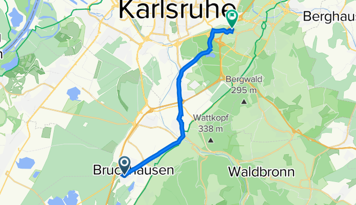
malsch -> völkersbach -> schöllbronn -> ettlingen
Trasa rowerowa w Ettlingen, Badenia-Wirtembergia, Niemcy
- 36,5 km
- Dystans
- 420 m
- Przewyższenia
- 438 m
- Spadek

Zum Tierpark
Trasa rowerowa w Ettlingen, Badenia-Wirtembergia, Niemcy
- 11,6 km
- Dystans
- 49 m
- Przewyższenia
- 261 m
- Spadek

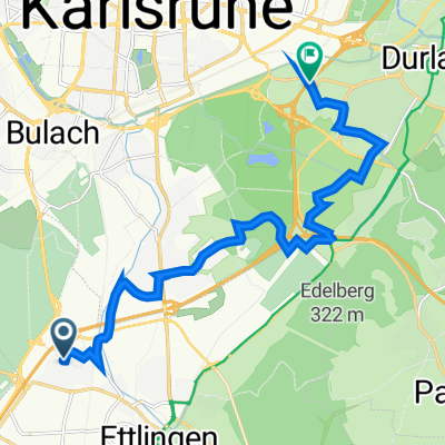
Palmbach - Berghausen - Grötzingen - Durlach - Wolfartsweier
Trasa rowerowa w Ettlingen, Badenia-Wirtembergia, Niemcy
- 17,4 km
- Dystans
- 54 m
- Przewyższenia
- 193 m
- Spadek
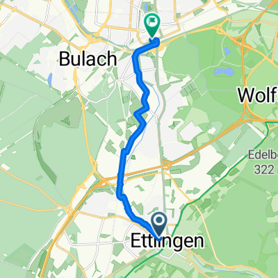
Schillerstraße, Ettlingen nach Bulach, Karlsruhe
Trasa rowerowa w Ettlingen, Badenia-Wirtembergia, Niemcy
- 7,8 km
- Dystans
- 34 m
- Przewyższenia
- 48 m
- Spadek
Rheintalstraße 1, Ettlingen nach Dieselstraße 12, Karlsruhe
Trasa rowerowa w Ettlingen, Badenia-Wirtembergia, Niemcy
- 12,5 km
- Dystans
- 32 m
- Przewyższenia
- 36 m
- Spadek

Battstraße 85, Karlsruhe nach Zirkel 35, Karlsruhe
Trasa rowerowa w Ettlingen, Badenia-Wirtembergia, Niemcy
- 6,4 km
- Dystans
- 16 m
- Przewyższenia
- 20 m
- Spadek
Büro_KA
Trasa rowerowa w Ettlingen, Badenia-Wirtembergia, Niemcy
- 10,3 km
- Dystans
- 28 m
- Przewyższenia
- 51 m
- Spadek

Buchenweg 33A, Ettlingen nach Gut-Magnus-Straße 28, Karlsruhe
Trasa rowerowa w Ettlingen, Badenia-Wirtembergia, Niemcy
- 13 km
- Dystans
- 86 m
- Przewyższenia
- 82 m
- Spadek

Waldbronn- Sonnenbad
Trasa rowerowa w Ettlingen, Badenia-Wirtembergia, Niemcy
- 17,5 km
- Dystans
- 48 m
- Przewyższenia
- 184 m
- Spadek

Gaisbachtal, Teufelsmühel
Trasa rowerowa w Ettlingen, Badenia-Wirtembergia, Niemcy
- 79,3 km
- Dystans
- 1165 m
- Przewyższenia
- 1196 m
- Spadek
Odkryj więcej tras
 Palmbach - Berghausen - Grötzingen - Durlach - Wolfartsweier
- Dystans
- 17,4 km
- Przewyższenia
- 54 m
- Spadek
- 193 m
- Lokalizacja
- Ettlingen, Badenia-Wirtembergia, Niemcy
 Schillerstraße, Ettlingen nach Bulach, Karlsruhe
- Dystans
- 7,8 km
- Przewyższenia
- 34 m
- Spadek
- 48 m
- Lokalizacja
- Ettlingen, Badenia-Wirtembergia, Niemcy
 Rheintalstraße 1, Ettlingen nach Dieselstraße 12, Karlsruhe
- Dystans
- 12,5 km
- Przewyższenia
- 32 m
- Spadek
- 36 m
- Lokalizacja
- Ettlingen, Badenia-Wirtembergia, Niemcy
 Battstraße 85, Karlsruhe nach Zirkel 35, Karlsruhe
- Dystans
- 6,4 km
- Przewyższenia
- 16 m
- Spadek
- 20 m
- Lokalizacja
- Ettlingen, Badenia-Wirtembergia, Niemcy
 Büro_KA
- Dystans
- 10,3 km
- Przewyższenia
- 28 m
- Spadek
- 51 m
- Lokalizacja
- Ettlingen, Badenia-Wirtembergia, Niemcy
 Buchenweg 33A, Ettlingen nach Gut-Magnus-Straße 28, Karlsruhe
- Dystans
- 13 km
- Przewyższenia
- 86 m
- Spadek
- 82 m
- Lokalizacja
- Ettlingen, Badenia-Wirtembergia, Niemcy
 Waldbronn- Sonnenbad
- Dystans
- 17,5 km
- Przewyższenia
- 48 m
- Spadek
- 184 m
- Lokalizacja
- Ettlingen, Badenia-Wirtembergia, Niemcy
 Gaisbachtal, Teufelsmühel
- Dystans
- 79,3 km
- Przewyższenia
- 1165 m
- Spadek
- 1196 m
- Lokalizacja
- Ettlingen, Badenia-Wirtembergia, Niemcy
Trasy z Ettlingen
Jednodniowa wycieczka rowerowa od
Z Ettlingen do Bad Herrenalb
Rowerowa od
Z Ettlingen do Rheinstetten
Trasy do Karlsruhe
Bikepacking od
Z Fryburg Bryzgowijski do Karlsruhe
Jednodniowa wycieczka rowerowa od
Z Königsbach-Stein do Karlsruhe
Jednodniowa wycieczka rowerowa od
Z Bruchsal do Karlsruhe
Rowerowa od
Z Rheinstetten do Karlsruhe
Rowerowa od
Z Eggenstein-Leopoldshafen do Karlsruhe