
Szablon trasy
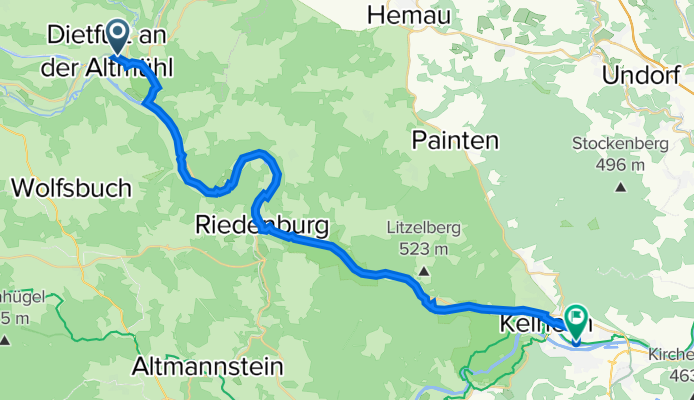
Z Dietfurt do Kelheim

- 2 h 27 min
- Czas
- 34,8 km
- Dystans
- 261 m
- Przewyższenia
- 282 m
- Spadek
- 14,2 km/h
- Śr. Prędkość
- 506 m
- Maks. wysokość
This ride takes you from Dietfurt, known as the “Gateway to Altmühltal” and famous for its quirky “Chinese Carnival,” all the way to Kelheim, where the Danube and Altmühl rivers meet. Covering just under 35 km, the route winds mostly along gravel and unpaved tracks—perfect if you want to lose the traffic and get close to nature.
You'll start with a gentle climb out of Dietfurt before coasting through serene forest paths and open countryside, surrounded by the rolling hills of the Altmühltal Nature Park. The ups and downs are mild, with about 260 meters of ascent—just enough to make a cold drink in Kelheim taste even better.
The approach to Kelheim is a highlight, with dramatic limestone cliffs in view and, if you’ve got the energy, a worthy detour to the famous Befreiungshalle (Hall of Liberation). Most of your ride is on quiet tracks or gravel, so a sturdy bike is a good idea. This is an easygoing day out, ideal for anyone wanting to discover Bavaria beyond the tarmac.
Wspólnota
Najlepsi użytkownicy w tym regionie


Od naszej społeczności
Najlepsze trasy rowerowe z Dietfurt do Kelheim

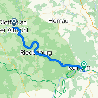
Altmühltalradweg 4
Trasa rowerowa w Dietfurt, Bawaria, Niemcy
- 46,8 km
- Dystans
- 102 m
- Przewyższenia
- 126 m
- Spadek

NAR_7
Trasa rowerowa w Dietfurt, Bawaria, Niemcy
- 45,6 km
- Dystans
- 209 m
- Przewyższenia
- 236 m
- Spadek

Beilngries-Kelheim
Trasa rowerowa w Dietfurt, Bawaria, Niemcy
- 43,2 km
- Dystans
- 61 m
- Przewyższenia
- 87 m
- Spadek

Schneider-Peterle-Gasse 5, Beilngries nach Ludwigstraße 11, Kelheim
Trasa rowerowa w Dietfurt, Bawaria, Niemcy
- 49,6 km
- Dystans
- 297 m
- Przewyższenia
- 322 m
- Spadek

Beilngries - Kelheim
Trasa rowerowa w Dietfurt, Bawaria, Niemcy
- 48,6 km
- Dystans
- 597 m
- Przewyższenia
- 619 m
- Spadek


06 Dietfirt - Kehlheim
Trasa rowerowa w Dietfurt, Bawaria, Niemcy
- 34,1 km
- Dystans
- 39 m
- Przewyższenia
- 60 m
- Spadek

Bahnhofstraße 39, Dietfurt an der Altmühl nach Donaustraße 1–19, Kelheim
Trasa rowerowa w Dietfurt, Bawaria, Niemcy
- 31,3 km
- Dystans
- 373 m
- Przewyższenia
- 393 m
- Spadek
Frauengasse 5, Dietfurt an der Altmühl nach Pumpstation 4, Kelheim
Trasa rowerowa w Dietfurt, Bawaria, Niemcy
- 36,3 km
- Dystans
- 151 m
- Przewyższenia
- 172 m
- Spadek

Dietfurt Kehlheim
Trasa rowerowa w Dietfurt, Bawaria, Niemcy
- 34,5 km
- Dystans
- 60 m
- Przewyższenia
- 89 m
- Spadek

Altmühl-Radweg (4)
Trasa rowerowa w Dietfurt, Bawaria, Niemcy
- 36,7 km
- Dystans
- 88 m
- Przewyższenia
- 105 m
- Spadek

Wertheim - Wien 5.Etappe
Trasa rowerowa w Dietfurt, Bawaria, Niemcy
- 44 km
- Dystans
- 32 m
- Przewyższenia
- 54 m
- Spadek
Odkryj więcej tras
 Beilngries - Kelheim
- Dystans
- 48,6 km
- Przewyższenia
- 597 m
- Spadek
- 619 m
- Lokalizacja
- Dietfurt, Bawaria, Niemcy
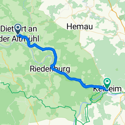
 Kelheim
- Dystans
- 44,2 km
- Przewyższenia
- 100 m
- Spadek
- 122 m
- Lokalizacja
- Dietfurt, Bawaria, Niemcy
 06 Dietfirt - Kehlheim
- Dystans
- 34,1 km
- Przewyższenia
- 39 m
- Spadek
- 60 m
- Lokalizacja
- Dietfurt, Bawaria, Niemcy
 Bahnhofstraße 39, Dietfurt an der Altmühl nach Donaustraße 1–19, Kelheim
- Dystans
- 31,3 km
- Przewyższenia
- 373 m
- Spadek
- 393 m
- Lokalizacja
- Dietfurt, Bawaria, Niemcy
 Frauengasse 5, Dietfurt an der Altmühl nach Pumpstation 4, Kelheim
- Dystans
- 36,3 km
- Przewyższenia
- 151 m
- Spadek
- 172 m
- Lokalizacja
- Dietfurt, Bawaria, Niemcy
 Dietfurt Kehlheim
- Dystans
- 34,5 km
- Przewyższenia
- 60 m
- Spadek
- 89 m
- Lokalizacja
- Dietfurt, Bawaria, Niemcy
 Altmühl-Radweg (4)
- Dystans
- 36,7 km
- Przewyższenia
- 88 m
- Spadek
- 105 m
- Lokalizacja
- Dietfurt, Bawaria, Niemcy
 Wertheim - Wien 5.Etappe
- Dystans
- 44 km
- Przewyższenia
- 32 m
- Spadek
- 54 m
- Lokalizacja
- Dietfurt, Bawaria, Niemcy
Trasy z Dietfurt
Rowerowa od
Z Dietfurt do Riedenburg
Trasy do Kelheim
Bikepacking od
Z Rothenburg nad Tauber do Kelheim
Jednodniowa wycieczka rowerowa od
Z Ratyzbona do Kelheim
Jednodniowa wycieczka rowerowa od
Z Ingolstadt do Kelheim