
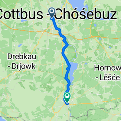
Szablon trasy
Z Chociebuż do Spremberg
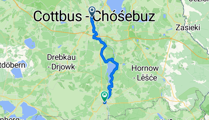
- 1 h 58 min
- Czas
- 33 km
- Dystans
- 197 m
- Przewyższenia
- 174 m
- Spadek
- 16,8 km/h
- Śr. Prędkość
- 132 m
- Maks. wysokość
Set off from the heart of Cottbus—famous for its pretty Altmarkt square and historic buildings—for a gentle spin to Spremberg. This 33 km ride is largely flat with around 200 meters of climbing, so it’s manageable for most cyclists without too many tough sections. The route is made up of mainly paved paths and asphalt (hello, smooth riding!), with a few delightful stretches over paving stones for a bit of extra character.
You’ll cruise through peaceful countryside and quiet villages, swapping city bustle for easygoing rural vibes. With over half the ride on dedicated pathways, you'll have space to relax and take in the scenery.
Your finish line is Spremberg, an inviting small town known for its island-based historic center in the Spree river. Reward yourself with a café break in the quaint old town before heading back or hopping a train home. All in all, it’s a rewarding escape from city life and a great way to explore southern Brandenburg on two wheels!
Wspólnota
Najlepsi użytkownicy w tym regionie


Od naszej społeczności
Najlepsze trasy rowerowe z Chociebuż do Spremberg


Skater Strecke Cottbus Gallinchen Spremberg hin und zurück!
Trasa rowerowa w Chociebuż, Brandenburgia, Niemcy
- 18 km
- Dystans
- 151 m
- Przewyższenia
- 135 m
- Spadek

Arbeitsweg von CB
Trasa rowerowa w Chociebuż, Brandenburgia, Niemcy
- 54,7 km
- Dystans
- 189 m
- Przewyższenia
- 159 m
- Spadek
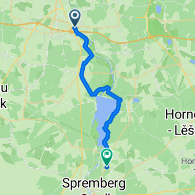
Cottbus - Spreetal
Trasa rowerowa w Chociebuż, Brandenburgia, Niemcy
- 34,2 km
- Dystans
- 203 m
- Przewyższenia
- 159 m
- Spadek

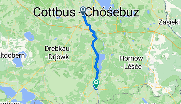
Cottbus - Spremberg
Trasa rowerowa w Chociebuż, Brandenburgia, Niemcy
- 26,8 km
- Dystans
- 101 m
- Przewyższenia
- 77 m
- Spadek

Kutzeburger Weg 11, Cottbus nach An den Mühlen 2, Spremberg
Trasa rowerowa w Chociebuż, Brandenburgia, Niemcy
- 18,8 km
- Dystans
- 120 m
- Przewyższenia
- 105 m
- Spadek
Güterzufuhrstraße nach An den Mühlen
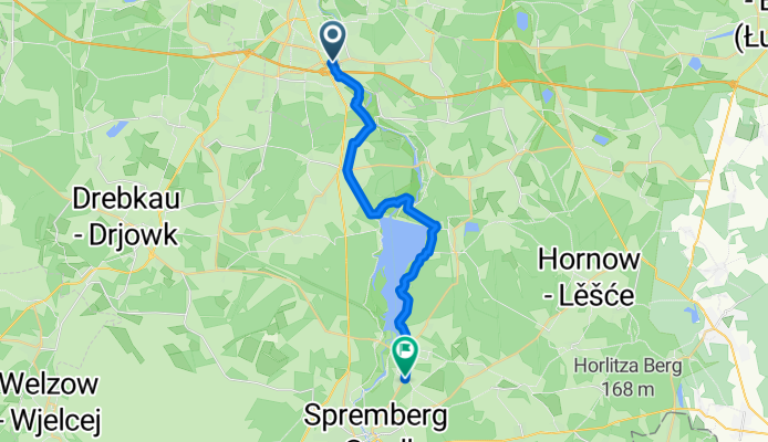
Trasa rowerowa w Chociebuż, Brandenburgia, Niemcy
- 31,5 km
- Dystans
- 436 m
- Przewyższenia
- 445 m
- Spadek


Hainstraße 6, Cottbus nach Straße des Aufbaus 11, Spreetal
Trasa rowerowa w Chociebuż, Brandenburgia, Niemcy
- 39,6 km
- Dystans
- 94 m
- Przewyższenia
- 54 m
- Spadek
Große Mühle, Cottbus nach Liebigstraße, Spremberg
Trasa rowerowa w Chociebuż, Brandenburgia, Niemcy
- 20,9 km
- Dystans
- 145 m
- Przewyższenia
- 97 m
- Spadek

Sachsendorfer Straße 28, Cottbus nach Muskauer Straße 17, Spremberg
Trasa rowerowa w Chociebuż, Brandenburgia, Niemcy
- 28,1 km
- Dystans
- 154 m
- Przewyższenia
- 119 m
- Spadek

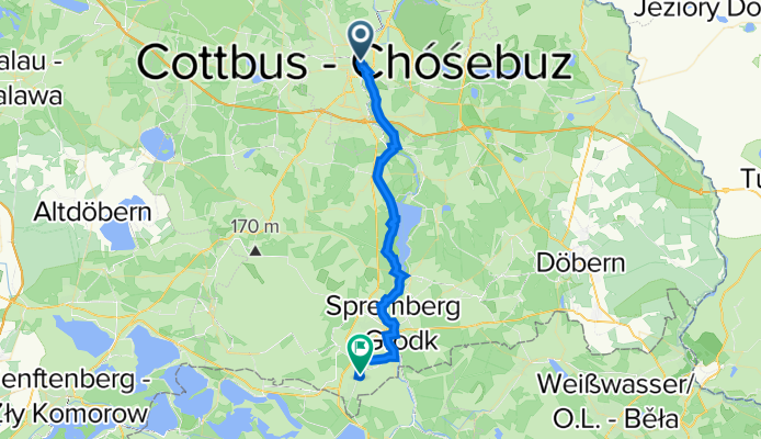
RTK 14 NIBG Verbindung Cottbus Talsperre Spremberg
Trasa rowerowa w Chociebuż, Brandenburgia, Niemcy
- 22,5 km
- Dystans
- 115 m
- Przewyższenia
- 91 m
- Spadek

Tour Brandenburg 13
Trasa rowerowa w Chociebuż, Brandenburgia, Niemcy
- 29,3 km
- Dystans
- 158 m
- Przewyższenia
- 132 m
- Spadek

Welzower Straße 27, Cottbus nach Forster Landstraße 42A, Spremberg
Trasa rowerowa w Chociebuż, Brandenburgia, Niemcy
- 23,7 km
- Dystans
- 248 m
- Przewyższenia
- 203 m
- Spadek
Odkryj więcej tras
 Kutzeburger Weg 11, Cottbus nach An den Mühlen 2, Spremberg
- Dystans
- 18,8 km
- Przewyższenia
- 120 m
- Spadek
- 105 m
- Lokalizacja
- Chociebuż, Brandenburgia, Niemcy
 Güterzufuhrstraße nach An den Mühlen
- Dystans
- 31,5 km
- Przewyższenia
- 436 m
- Spadek
- 445 m
- Lokalizacja
- Chociebuż, Brandenburgia, Niemcy
 Hainstraße 6, Cottbus nach Straße des Aufbaus 11, Spreetal
- Dystans
- 39,6 km
- Przewyższenia
- 94 m
- Spadek
- 54 m
- Lokalizacja
- Chociebuż, Brandenburgia, Niemcy
 Große Mühle, Cottbus nach Liebigstraße, Spremberg
- Dystans
- 20,9 km
- Przewyższenia
- 145 m
- Spadek
- 97 m
- Lokalizacja
- Chociebuż, Brandenburgia, Niemcy
 Sachsendorfer Straße 28, Cottbus nach Muskauer Straße 17, Spremberg
- Dystans
- 28,1 km
- Przewyższenia
- 154 m
- Spadek
- 119 m
- Lokalizacja
- Chociebuż, Brandenburgia, Niemcy
 RTK 14 NIBG Verbindung Cottbus Talsperre Spremberg
- Dystans
- 22,5 km
- Przewyższenia
- 115 m
- Spadek
- 91 m
- Lokalizacja
- Chociebuż, Brandenburgia, Niemcy
 Tour Brandenburg 13
- Dystans
- 29,3 km
- Przewyższenia
- 158 m
- Spadek
- 132 m
- Lokalizacja
- Chociebuż, Brandenburgia, Niemcy
 Welzower Straße 27, Cottbus nach Forster Landstraße 42A, Spremberg
- Dystans
- 23,7 km
- Przewyższenia
- 248 m
- Spadek
- 203 m
- Lokalizacja
- Chociebuż, Brandenburgia, Niemcy
Trasy z Chociebuż
Jednodniowa wycieczka rowerowa od
Z Chociebuż do Lübbenau/Spreewald
Szybka przejażdżka rowerowa od
Z Chociebuż do Burg
Trasy do Spremberg
Jednodniowa wycieczka rowerowa od
Z Drebkau do Spremberg
Jednodniowa wycieczka rowerowa od
Z Budziszyn do Spremberg