

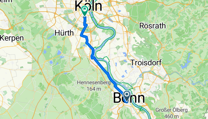
Jednodniowa wycieczka rowerowa z Bonn do Neustadt/Süd
Dostosuj własną trasę na podstawie naszego szablonu lub zobacz, jak nasza społeczność najchętniej jeździ z Bonn do Neustadt/Süd.
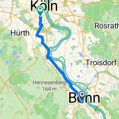
Szablon trasy
Z Bonn do Neustadt/Süd

- 1 h 51 min
- Czas
- 31,7 km
- Dystans
- 75 m
- Przewyższenia
- 86 m
- Spadek
- 17,1 km/h
- Śr. Prędkość
- 69 m
- Maks. wysokość
Hop on your bike in sunny Bonn, the charming former capital of West Germany and birthplace of Beethoven. Your ride to Neustadt/Süd in Cologne is about 32 kilometers—just enough to stretch your legs without breaking a sweat. The route is almost entirely paved, with wide paths for most of the journey, making for a smooth and stress-free ride.
You'll cruise north, loosely following the Rhine, passing through leafy suburbs and peaceful riverside stretches—perfect for a lunchtime picnic or quick coffee break. With hardly any hills (ascent and descent are minimal), this route is beginner-friendly, and the scenery shifts from Bonn’s historic cityscape to Cologne’s lively Neustadt/Süd, a district known for its hip cafes, diverse eateries, and buzzing nightlife.
Most of your ride is on dedicated paths or quiet roads, so you can relax and enjoy the journey. Watch out for a few short sections of paving stones, but otherwise, it’s smooth rolling all the way. Once you arrive, reward yourself with a stroll through the Belgian Quarter or a well-earned Kölsch beer!
Wspólnota
Najlepsi użytkownicy w tym regionie


Od naszej społeczności
Najlepsze trasy rowerowe z Bonn do Neustadt/Süd

RBF2022E2
Trasa rowerowa w Bonn, Nadrenia Północna-Westfalia, Niemcy
- 52,2 km
- Dystans
- 173 m
- Przewyższenia
- 177 m
- Spadek

B-Pop nach K-Kle Stadt
Trasa rowerowa w Bonn, Nadrenia Północna-Westfalia, Niemcy
- 28,5 km
- Dystans
- 51 m
- Przewyższenia
- 64 m
- Spadek

09-09-05 17.RBF-8.Etappe: Bonn-Brühl-Köln
Trasa rowerowa w Bonn, Nadrenia Północna-Westfalia, Niemcy
- 42,2 km
- Dystans
- 35 m
- Przewyższenia
- 27 m
- Spadek
Bogen heim
Trasa rowerowa w Bonn, Nadrenia Północna-Westfalia, Niemcy
- 77,1 km
- Dystans
- 297 m
- Przewyższenia
- 305 m
- Spadek

RBF2022E2
Trasa rowerowa w Bonn, Nadrenia Północna-Westfalia, Niemcy
- 51,4 km
- Dystans
- 180 m
- Przewyższenia
- 184 m
- Spadek

B-Pop nach K-Kle Rhein
Trasa rowerowa w Bonn, Nadrenia Północna-Westfalia, Niemcy
- 30,6 km
- Dystans
- 58 m
- Przewyższenia
- 71 m
- Spadek

Adenauerplatz 1, Niederkassel nach Kerpener Straße 60, Köln
Trasa rowerowa w Bonn, Nadrenia Północna-Westfalia, Niemcy
- 24,7 km
- Dystans
- 51 m
- Przewyższenia
- 57 m
- Spadek

tourenplan
Trasa rowerowa w Bonn, Nadrenia Północna-Westfalia, Niemcy
- 64,6 km
- Dystans
- 308 m
- Przewyższenia
- 314 m
- Spadek
Meckenheimer Allee, Bonn nach Vorgebirgstraße, Köln
Trasa rowerowa w Bonn, Nadrenia Północna-Westfalia, Niemcy
- 28,6 km
- Dystans
- 54 m
- Przewyższenia
- 69 m
- Spadek

tourenplan_raw
Trasa rowerowa w Bonn, Nadrenia Północna-Westfalia, Niemcy
- 63,6 km
- Dystans
- 255 m
- Przewyższenia
- 264 m
- Spadek

Adenauerplatz 1, Niederkassel nach Kerpener Straße 62, Köln
Trasa rowerowa w Bonn, Nadrenia Północna-Westfalia, Niemcy
- 24,5 km
- Dystans
- 51 m
- Przewyższenia
- 55 m
- Spadek

course_BonnKottenforstKoeln_8August2020_56km_xxxhm
Trasa rowerowa w Bonn, Nadrenia Północna-Westfalia, Niemcy
- 56,3 km
- Dystans
- 210 m
- Przewyższenia
- 217 m
- Spadek
Odkryj więcej tras
 RBF2022E2
- Dystans
- 51,4 km
- Przewyższenia
- 180 m
- Spadek
- 184 m
- Lokalizacja
- Bonn, Nadrenia Północna-Westfalia, Niemcy
 B-Pop nach K-Kle Rhein
- Dystans
- 30,6 km
- Przewyższenia
- 58 m
- Spadek
- 71 m
- Lokalizacja
- Bonn, Nadrenia Północna-Westfalia, Niemcy
 Adenauerplatz 1, Niederkassel nach Kerpener Straße 60, Köln
- Dystans
- 24,7 km
- Przewyższenia
- 51 m
- Spadek
- 57 m
- Lokalizacja
- Bonn, Nadrenia Północna-Westfalia, Niemcy
 tourenplan
- Dystans
- 64,6 km
- Przewyższenia
- 308 m
- Spadek
- 314 m
- Lokalizacja
- Bonn, Nadrenia Północna-Westfalia, Niemcy
 Meckenheimer Allee, Bonn nach Vorgebirgstraße, Köln
- Dystans
- 28,6 km
- Przewyższenia
- 54 m
- Spadek
- 69 m
- Lokalizacja
- Bonn, Nadrenia Północna-Westfalia, Niemcy
 tourenplan_raw
- Dystans
- 63,6 km
- Przewyższenia
- 255 m
- Spadek
- 264 m
- Lokalizacja
- Bonn, Nadrenia Północna-Westfalia, Niemcy
 Adenauerplatz 1, Niederkassel nach Kerpener Straße 62, Köln
- Dystans
- 24,5 km
- Przewyższenia
- 51 m
- Spadek
- 55 m
- Lokalizacja
- Bonn, Nadrenia Północna-Westfalia, Niemcy
 course_BonnKottenforstKoeln_8August2020_56km_xxxhm
- Dystans
- 56,3 km
- Przewyższenia
- 210 m
- Spadek
- 217 m
- Lokalizacja
- Bonn, Nadrenia Północna-Westfalia, Niemcy
Trasy z Bonn
Jednodniowa wycieczka rowerowa od
Z Bonn do Altstadt Nord
Jednodniowa wycieczka rowerowa od
Z Bonn do Rheinbach
Szybka przejażdżka rowerowa od
Z Bonn do Troisdorf
Szybka przejażdżka rowerowa od
Z Bonn do Sankt Augustin
Trasy do Neustadt/Süd
Jednodniowa wycieczka rowerowa od
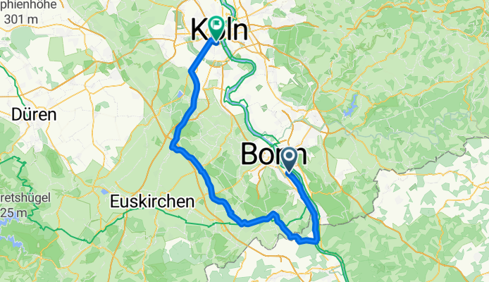
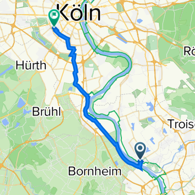
Z Bornheim do Neustadt/Süd
Jednodniowa wycieczka rowerowa od
Z Euskirchen do Neustadt/Süd
Szybka przejażdżka rowerowa od
Z Frechen do Neustadt/Süd
Szybka przejażdżka rowerowa od
Z Poll do Neustadt/Süd