
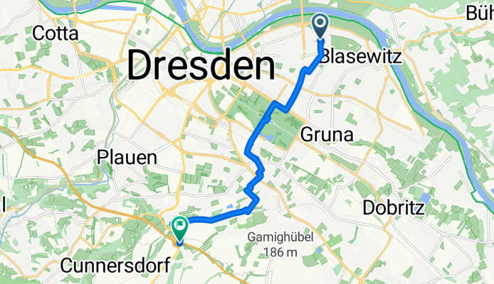
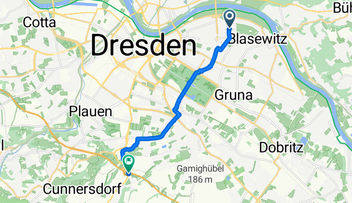
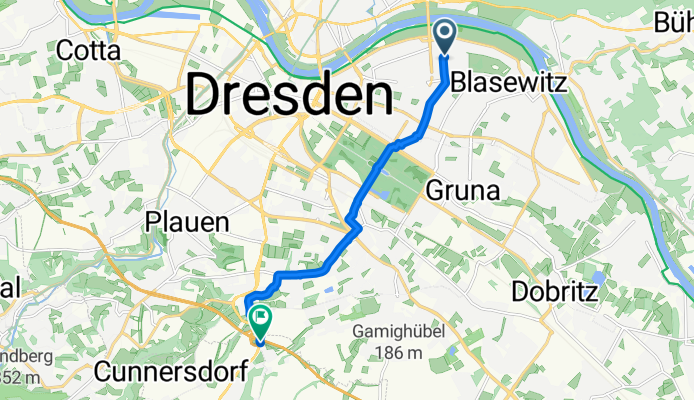
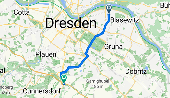
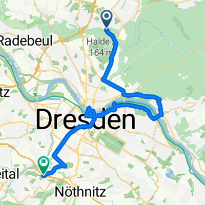
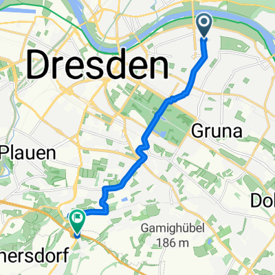
Rowerowa z Albertstadt do Bannewitz
Dostosuj własną trasę na podstawie naszego szablonu lub zobacz, jak nasza społeczność najchętniej jeździ z Albertstadt do Bannewitz.
Szablon trasy
Z Albertstadt do Bannewitz
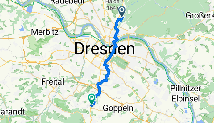
- 52 min
- Czas
- 14,9 km
- Dystans
- 201 m
- Przewyższenia
- 66 m
- Spadek
- 17 km/h
- Śr. Prędkość
- 284 m
- Maks. wysokość
This ride kicks off in Albertstadt, a historic Dresden neighborhood known for its impressive military barracks and leafy surroundings. From here, you’ll head out south, sticking mostly to quiet roads and smooth asphalt (over 88%!), so it’s a perfect route if you’re looking for a relaxed spin without battling much traffic. As you make your way through the city outskirts, expect a bit of a workout—there’s around 200 meters of climbing in total, mostly gentle, though a few ramps might get your legs pumping.
In just under 15 km you’ll roll into Bannewitz, a charming gateway to Saxon Switzerland with lovely views back towards Dresden. Bannewitz itself is a peaceful town set on the Elbe’s edge, perfect for a breather and maybe a cheeky pastry at a local bakery.
Most of the ride’s on good pavement, but watch for the occasional cobblestone or gravel patch—nothing too gnarly, just enough to keep things interesting. All in all, it’s a fun, scenic trip connecting city history and countryside calm, great for a morning adventure or an easy-going afternoon ride.
Wspólnota
Najlepsi użytkownicy w tym regionie


Od naszej społeczności
Najlepsze trasy rowerowe z Albertstadt do Bannewitz
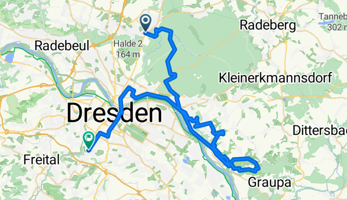
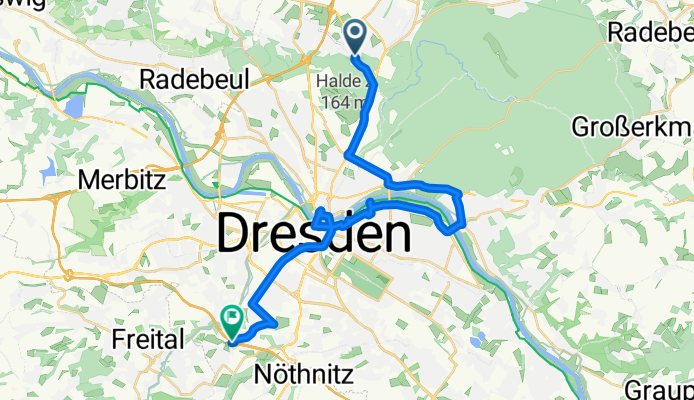
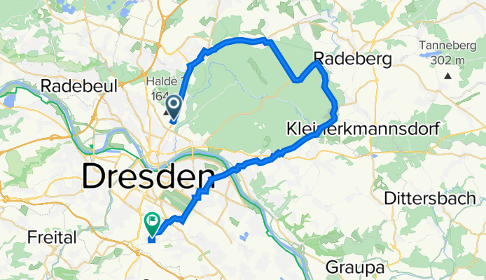
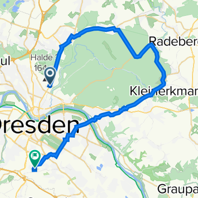
BikePoint Borsberg Tour
Trasa rowerowa w Albertstadt, Saksonia, Niemcy
- 48,7 km
- Dystans
- 605 m
- Przewyższenia
- 632 m
- Spadek
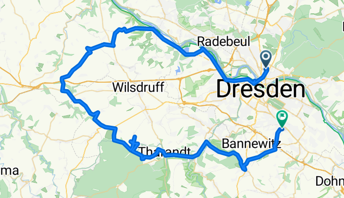
2011-09-30: Dresden - Kurort Hartha - Taubenheim - Dresden
Trasa rowerowa w Albertstadt, Saksonia, Niemcy
- 78,7 km
- Dystans
- 693 m
- Przewyższenia
- 659 m
- Spadek
DRESDEN ZURUECK
Trasa rowerowa w Albertstadt, Saksonia, Niemcy
- 11,8 km
- Dystans
- 67 m
- Przewyższenia
- 38 m
- Spadek
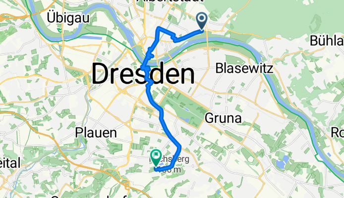
Fetscherstraße nach Nöthnitzer Hang
Trasa rowerowa w Albertstadt, Saksonia, Niemcy
- 9,8 km
- Dystans
- 126 m
- Przewyższenia
- 21 m
- Spadek
Erste Saisonausfahrt
Trasa rowerowa w Albertstadt, Saksonia, Niemcy
- 26,6 km
- Dystans
- 217 m
- Przewyższenia
- 183 m
- Spadek
Fetscherstraße nach Nöthnitzer Hang
Trasa rowerowa w Albertstadt, Saksonia, Niemcy
- 8,9 km
- Dystans
- 136 m
- Przewyższenia
- 75 m
- Spadek
Fetscherstraße nach Nöthnitzer Hang
Trasa rowerowa w Albertstadt, Saksonia, Niemcy
- 8,7 km
- Dystans
- 152 m
- Przewyższenia
- 82 m
- Spadek

Fetscherstraße nach Nöthnitzer Hang
Trasa rowerowa w Albertstadt, Saksonia, Niemcy
- 9,1 km
- Dystans
- 146 m
- Przewyższenia
- 79 m
- Spadek
Fetscherstraße nach Nöthnitzer Hang
Trasa rowerowa w Albertstadt, Saksonia, Niemcy
- 8,9 km
- Dystans
- 162 m
- Przewyższenia
- 95 m
- Spadek
Fetscherstraße nach Nöthnitzer Hang
Trasa rowerowa w Albertstadt, Saksonia, Niemcy
- 9,3 km
- Dystans
- 156 m
- Przewyższenia
- 95 m
- Spadek
Zeitenströmung – Heide – Altmockritz
Trasa rowerowa w Albertstadt, Saksonia, Niemcy
- 33,7 km
- Dystans
- 338 m
- Przewyższenia
- 327 m
- Spadek
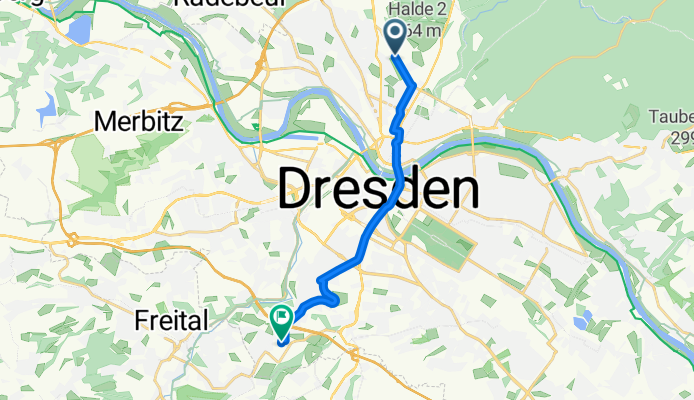
Stauffenbergallee-Heidelberger Straße entlang Linie 3
Trasa rowerowa w Albertstadt, Saksonia, Niemcy
- 11,1 km
- Dystans
- 153 m
- Przewyższenia
- 46 m
- Spadek
Odkryj więcej tras
 Erste Saisonausfahrt
- Dystans
- 26,6 km
- Przewyższenia
- 217 m
- Spadek
- 183 m
- Lokalizacja
- Albertstadt, Saksonia, Niemcy
 Fetscherstraße nach Nöthnitzer Hang
- Dystans
- 8,9 km
- Przewyższenia
- 136 m
- Spadek
- 75 m
- Lokalizacja
- Albertstadt, Saksonia, Niemcy
 Fetscherstraße nach Nöthnitzer Hang
- Dystans
- 8,7 km
- Przewyższenia
- 152 m
- Spadek
- 82 m
- Lokalizacja
- Albertstadt, Saksonia, Niemcy
 Fetscherstraße nach Nöthnitzer Hang
- Dystans
- 9,1 km
- Przewyższenia
- 146 m
- Spadek
- 79 m
- Lokalizacja
- Albertstadt, Saksonia, Niemcy
 Fetscherstraße nach Nöthnitzer Hang
- Dystans
- 8,9 km
- Przewyższenia
- 162 m
- Spadek
- 95 m
- Lokalizacja
- Albertstadt, Saksonia, Niemcy
 Fetscherstraße nach Nöthnitzer Hang
- Dystans
- 9,3 km
- Przewyższenia
- 156 m
- Spadek
- 95 m
- Lokalizacja
- Albertstadt, Saksonia, Niemcy
 Zeitenströmung – Heide – Altmockritz
- Dystans
- 33,7 km
- Przewyższenia
- 338 m
- Spadek
- 327 m
- Lokalizacja
- Albertstadt, Saksonia, Niemcy
 Stauffenbergallee-Heidelberger Straße entlang Linie 3
- Dystans
- 11,1 km
- Przewyższenia
- 153 m
- Spadek
- 46 m
- Lokalizacja
- Albertstadt, Saksonia, Niemcy
Trasy z Albertstadt
Jednodniowa wycieczka rowerowa od
Z Albertstadt do Heidenau
Jednodniowa wycieczka rowerowa od
Z Albertstadt do Senftenberg
Rowerowa od
Z Albertstadt do Moritzburg
Rowerowa od
Z Albertstadt do Radeberg
Trasy do Bannewitz
Rowerowa od
Z Drezno do Bannewitz