
Szybka przejażdżka rowerowa z Villefranche-sur-Mer do Nicea
Dostosuj własną trasę na podstawie naszego szablonu lub zobacz, jak nasza społeczność najchętniej jeździ z Villefranche-sur-Mer do Nicea.
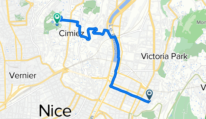
Szablon trasy
Z Villefranche-sur-Mer do Nicea

- 36 min
- Czas
- 9,9 km
- Dystans
- 180 m
- Przewyższenia
- 253 m
- Spadek
- 16,2 km/h
- Śr. Prędkość
- 157 m
- Maks. wysokość
Set off from the charming port town of Villefranche-sur-Mer, known for its pastel-colored waterfront and cozy Old Town. This ride to Nice is just under 10 km, making it a perfect coastal cruise with a bit of a workout. You’ll start with gentle climbs—almost 180 meters of ascent—with sweeping views of the Mediterranean as you pedal up and over the cape.
The route sticks mostly to quiet roads and designated cycleways, so you can really enjoy the sea breeze. After the high point, it’s a relaxing descent (more than 250 meters) as you coast toward Nice. The final stretch brings you into the heart of this lively Riviera city, famous for its Promenade des Anglais, pebble beaches, and vibrant markets.
With smooth asphalt nearly the whole way and minimal traffic, it’s a scenic, easygoing ride—just enough hills to keep things interesting without being too tough. Take your time, stop for photos, and maybe reward yourself with a gelato in Nice!
Wspólnota
Najlepsi użytkownicy w tym regionie


Od naszej społeczności
Najlepsze trasy rowerowe z Villefranche-sur-Mer do Nicea


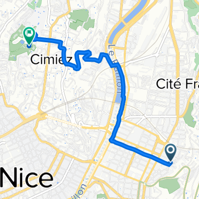
Monté Monte Alban
Trasa rowerowa w Villefranche-sur-Mer, Prowansja-Alpy-Lazurowe Wybrzeże, Francja
- 6,3 km
- Dystans
- 49 m
- Przewyższenia
- 253 m
- Spadek

Charly Bérard - 74 Km
Trasa rowerowa w Villefranche-sur-Mer, Prowansja-Alpy-Lazurowe Wybrzeże, Francja
- 70,5 km
- Dystans
- 2168 m
- Przewyższenia
- 2104 m
- Spadek

Nice - Petit tour
Trasa rowerowa w Villefranche-sur-Mer, Prowansja-Alpy-Lazurowe Wybrzeże, Francja
- 23,5 km
- Dystans
- 497 m
- Przewyższenia
- 496 m
- Spadek

Col d'Eze et Col de l'Arme
Trasa rowerowa w Villefranche-sur-Mer, Prowansja-Alpy-Lazurowe Wybrzeże, Francja
- 43,4 km
- Dystans
- 1083 m
- Przewyższenia
- 1079 m
- Spadek

Day 2 Route Final
Trasa rowerowa w Villefranche-sur-Mer, Prowansja-Alpy-Lazurowe Wybrzeże, Francja
- 112,4 km
- Dystans
- 1965 m
- Przewyższenia
- 1966 m
- Spadek

Nice - Eze - La Turbie - Monaco - Cap d'Ail - Eze de Mer - Beaulieu sur Mer - Villefrance sur Mer - Nice
Trasa rowerowa w Villefranche-sur-Mer, Prowansja-Alpy-Lazurowe Wybrzeże, Francja
- 45,1 km
- Dystans
- 952 m
- Przewyższenia
- 967 m
- Spadek

Nice - Nice
Trasa rowerowa w Villefranche-sur-Mer, Prowansja-Alpy-Lazurowe Wybrzeże, Francja
- 15 km
- Dystans
- 252 m
- Przewyższenia
- 256 m
- Spadek

Z
Trasa rowerowa w Villefranche-sur-Mer, Prowansja-Alpy-Lazurowe Wybrzeże, Francja
- 7,3 km
- Dystans
- 156 m
- Przewyższenia
- 46 m
- Spadek

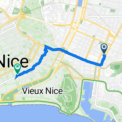
51 Rue Smolett, Nice à 1 Rue Gustave Deloye, Nice
Trasa rowerowa w Villefranche-sur-Mer, Prowansja-Alpy-Lazurowe Wybrzeże, Francja
- 2,1 km
- Dystans
- 52 m
- Przewyższenia
- 56 m
- Spadek

sainte agnes
Trasa rowerowa w Villefranche-sur-Mer, Prowansja-Alpy-Lazurowe Wybrzeże, Francja
- 67,1 km
- Dystans
- 1461 m
- Przewyższenia
- 1463 m
- Spadek

27 Rue Édouard Scoffier, Nice to 400 Boulevard de la Madeleine, Nice
Trasa rowerowa w Villefranche-sur-Mer, Prowansja-Alpy-Lazurowe Wybrzeże, Francja
- 8,3 km
- Dystans
- 101 m
- Przewyższenia
- 45 m
- Spadek
27 Rue Édouard Scoffier, Nice to 8 Avenue du Puits, Nice
Trasa rowerowa w Villefranche-sur-Mer, Prowansja-Alpy-Lazurowe Wybrzeże, Francja
- 4,2 km
- Dystans
- 121 m
- Przewyższenia
- 74 m
- Spadek
Odkryj więcej tras
 Day 2 Route Final
- Dystans
- 112,4 km
- Przewyższenia
- 1965 m
- Spadek
- 1966 m
- Lokalizacja
- Villefranche-sur-Mer, Prowansja-Alpy-Lazurowe Wybrzeże, Francja
 Nice - Eze - La Turbie - Monaco - Cap d'Ail - Eze de Mer - Beaulieu sur Mer - Villefrance sur Mer - Nice
- Dystans
- 45,1 km
- Przewyższenia
- 952 m
- Spadek
- 967 m
- Lokalizacja
- Villefranche-sur-Mer, Prowansja-Alpy-Lazurowe Wybrzeże, Francja
 Nice - Nice
- Dystans
- 15 km
- Przewyższenia
- 252 m
- Spadek
- 256 m
- Lokalizacja
- Villefranche-sur-Mer, Prowansja-Alpy-Lazurowe Wybrzeże, Francja
 Z
Z- Dystans
- 7,3 km
- Przewyższenia
- 156 m
- Spadek
- 46 m
- Lokalizacja
- Villefranche-sur-Mer, Prowansja-Alpy-Lazurowe Wybrzeże, Francja
 51 Rue Smolett, Nice à 1 Rue Gustave Deloye, Nice
- Dystans
- 2,1 km
- Przewyższenia
- 52 m
- Spadek
- 56 m
- Lokalizacja
- Villefranche-sur-Mer, Prowansja-Alpy-Lazurowe Wybrzeże, Francja
 sainte agnes
- Dystans
- 67,1 km
- Przewyższenia
- 1461 m
- Spadek
- 1463 m
- Lokalizacja
- Villefranche-sur-Mer, Prowansja-Alpy-Lazurowe Wybrzeże, Francja
 27 Rue Édouard Scoffier, Nice to 400 Boulevard de la Madeleine, Nice
- Dystans
- 8,3 km
- Przewyższenia
- 101 m
- Spadek
- 45 m
- Lokalizacja
- Villefranche-sur-Mer, Prowansja-Alpy-Lazurowe Wybrzeże, Francja
 27 Rue Édouard Scoffier, Nice to 8 Avenue du Puits, Nice
- Dystans
- 4,2 km
- Przewyższenia
- 121 m
- Spadek
- 74 m
- Lokalizacja
- Villefranche-sur-Mer, Prowansja-Alpy-Lazurowe Wybrzeże, Francja
Trasy do Nicea
Bikepacking od
Z Jausiers do Nicea
Jednodniowa wycieczka rowerowa od
Z Saint-Roman do Nicea
Jednodniowa wycieczka rowerowa od
Z Saint-Martin-Vésubie do Nicea
Szybka przejażdżka rowerowa od
Z Saint-Laurent-du-Var do Nicea