

Szablon trasy
Z Tours do Villandry
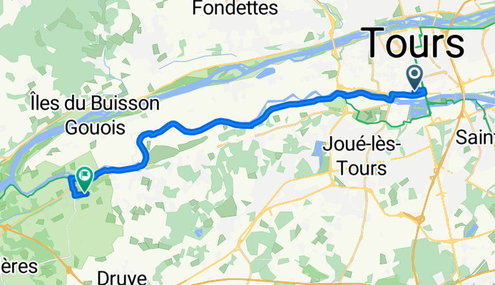
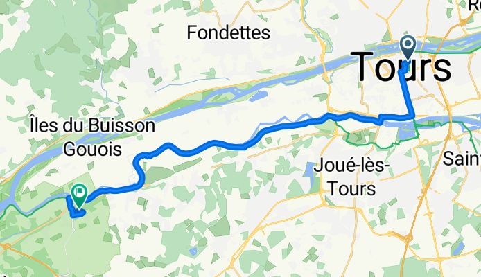
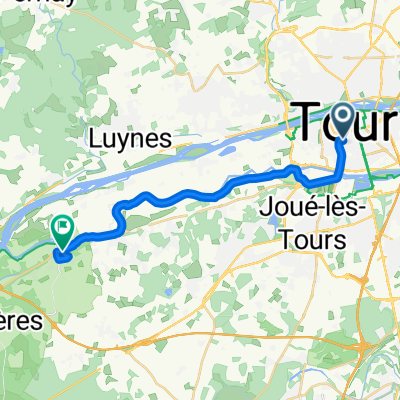
Set off from the vibrant city of Tours, famous for its medieval old town and beautiful Loire riverside. This scenic bike route takes you about 21 km southwest, mostly along quiet roads and smooth cycleways—ideal for a leisurely pace and soaking up the sights! The terrain is gentle with just a bit of a climb (around 89 meters ascent), so it’s friendly for most riders.
On your way, you’ll cross patches of classic French countryside, dotted with vineyards and charming villages. There’s plenty of paved and asphalt surfaces, though keep an eye out for a few segments where the path’s surface might be a little less predictable.
Your ride ends at Villandry, a highlight of the Loire Valley thanks to the stunning Château de Villandry and its world-renowned Renaissance gardens. It’s the perfect place to enjoy a picnic or just wander the hedgerows after your ride. This route is a lovely getaway from city bustle and a must-do for fans of castles and countryside!
Wspólnota
Najlepsi użytkownicy w tym regionie
Od naszej społeczności
Najlepsze trasy rowerowe z Tours do Villandry
Trip 09
Trasa rowerowa w Tours, Region Centralny-Dolina Loary, Francja
- 19,5 km
- Dystans
- 38 m
- Przewyższenia
- 40 m
- Spadek
2019 Loire 28 mai 2019 pm
Trasa rowerowa w Tours, Region Centralny-Dolina Loary, Francja
- 19,1 km
- Dystans
- 32 m
- Przewyższenia
- 31 m
- Spadek
Tours (Grand hôtel) - Villandry (Hôtel le Colombien)
Trasa rowerowa w Tours, Region Centralny-Dolina Loary, Francja
- 21,5 km
- Dystans
- 53 m
- Przewyższenia
- 56 m
- Spadek
Route from 78 Rue Roger Salengro, Tours
Trasa rowerowa w Tours, Region Centralny-Dolina Loary, Francja
- 18,4 km
- Dystans
- 44 m
- Przewyższenia
- 39 m
- Spadek
Rue du Chemin de Fer - Chemin de l'Audience
Trasa rowerowa w Tours, Region Centralny-Dolina Loary, Francja
- 19,1 km
- Dystans
- 51 m
- Przewyższenia
- 87 m
- Spadek
Rue de l'Élysée, Tours to Le Châtelard, Villandry
Trasa rowerowa w Tours, Region Centralny-Dolina Loary, Francja
- 19,5 km
- Dystans
- 80 m
- Przewyższenia
- 77 m
- Spadek
Avenue André Malraux, Tours naar 1–3 La Grange aux Moines, Berthenay
Trasa rowerowa w Tours, Region Centralny-Dolina Loary, Francja
- 16,6 km
- Dystans
- 6 m
- Przewyższenia
- 9 m
- Spadek
Rue de Nantes, Tours to 1 Rue de Munat, Villandry
Trasa rowerowa w Tours, Region Centralny-Dolina Loary, Francja
- 19,2 km
- Dystans
- 68 m
- Przewyższenia
- 62 m
- Spadek
Tours - Villandry
Trasa rowerowa w Tours, Region Centralny-Dolina Loary, Francja
- 18,4 km
- Dystans
- 68 m
- Przewyższenia
- 60 m
- Spadek
Rue Bernard Palissy, Tours to Le Châtelard, Villandry
Trasa rowerowa w Tours, Region Centralny-Dolina Loary, Francja
- 21 km
- Dystans
- 93 m
- Przewyższenia
- 91 m
- Spadek
Itinéraire à partir de 78 Rue Roger Salengro, Tours
Trasa rowerowa w Tours, Region Centralny-Dolina Loary, Francja
- 18,4 km
- Dystans
- 48 m
- Przewyższenia
- 43 m
- Spadek
Mercredi 2 Tours - Vallères
Trasa rowerowa w Tours, Region Centralny-Dolina Loary, Francja
- 27,8 km
- Dystans
- 81 m
- Przewyższenia
- 52 m
- Spadek
Odkryj więcej tras
- Rue du Chemin de Fer - Chemin de l'Audience
- Dystans
- 19,1 km
- Przewyższenia
- 51 m
- Spadek
- 87 m
- Lokalizacja
- Tours, Region Centralny-Dolina Loary, Francja
- Rue de l'Élysée, Tours to Le Châtelard, Villandry
- Dystans
- 19,5 km
- Przewyższenia
- 80 m
- Spadek
- 77 m
- Lokalizacja
- Tours, Region Centralny-Dolina Loary, Francja
- Avenue André Malraux, Tours naar 1–3 La Grange aux Moines, Berthenay
- Dystans
- 16,6 km
- Przewyższenia
- 6 m
- Spadek
- 9 m
- Lokalizacja
- Tours, Region Centralny-Dolina Loary, Francja
- Rue de Nantes, Tours to 1 Rue de Munat, Villandry
- Dystans
- 19,2 km
- Przewyższenia
- 68 m
- Spadek
- 62 m
- Lokalizacja
- Tours, Region Centralny-Dolina Loary, Francja
- Tours - Villandry
- Dystans
- 18,4 km
- Przewyższenia
- 68 m
- Spadek
- 60 m
- Lokalizacja
- Tours, Region Centralny-Dolina Loary, Francja
- Rue Bernard Palissy, Tours to Le Châtelard, Villandry
- Dystans
- 21 km
- Przewyższenia
- 93 m
- Spadek
- 91 m
- Lokalizacja
- Tours, Region Centralny-Dolina Loary, Francja
- Itinéraire à partir de 78 Rue Roger Salengro, Tours
- Dystans
- 18,4 km
- Przewyższenia
- 48 m
- Spadek
- 43 m
- Lokalizacja
- Tours, Region Centralny-Dolina Loary, Francja
- Mercredi 2 Tours - Vallères
- Dystans
- 27,8 km
- Przewyższenia
- 81 m
- Spadek
- 52 m
- Lokalizacja
- Tours, Region Centralny-Dolina Loary, Francja
Trasy z Tours
Jednodniowa wycieczka rowerowa od
Z Tours do Chinon
Jednodniowa wycieczka rowerowa od
Z Tours do Saumur