
Szablon trasy
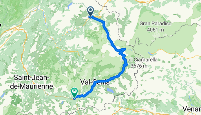
Z Séez do Modane

- 12 h 33 min
- Czas
- 124,3 km
- Dystans
- 6493 m
- Przewyższenia
- 6316 m
- Spadek
- 9,9 km/h
- Śr. Prędkość
- 2991 m
- Maks. wysokość
Cycling Route: Séez to Modane
If you’re craving a true alpine adventure by bike, this route from Séez to Modane is a game-changer! Starting in Séez, a charming Savoyard village near Bourg-Saint-Maurice, you’ll soon find yourself in classic mountain terrain—think hairpins, breathtaking peaks, and valleys bursting with wildflowers (and probably some curious cows).
The ride is no joke: about 124 kilometers, with massive climbing—over 6,400 meters of ascent—and equally thrilling descents. You’ll hit elevations near 3,000 meters, so be ready for some thin air and spectacular views. Nearly half the route is on less-defined surface or gravel/earth (mountain bike or robust gravel bike highly recommended). You’ll be leaving comfort zones behind, and proper prep is key.
Modane, at the finish, sits in the scenic Maurienne Valley, famous for its mountain tunnels and as a “gateway” to Italy. Treat yourself to a hearty Savoyard meal—your legs will deserve it! This is a ride for bold explorers, seasoned climbers, and lovers of wild alpine roads.
Wspólnota
Najlepsi użytkownicy w tym regionie


Od naszej społeczności
Najlepsze trasy rowerowe z Séez do Modane
Grandes Alpes_Kudrna_Etapa3
Trasa rowerowa w Séez, Owernia-Rodan-Alpy, Francja
- 104,7 km
- Dystans
- 2092 m
- Przewyższenia
- 1817 m
- Spadek

Col de l'Iseran
Trasa rowerowa w Séez, Owernia-Rodan-Alpy, Francja
- 76,5 km
- Dystans
- 1977 m
- Przewyższenia
- 1473 m
- Spadek

Tour de France 2016 dzień 9
Trasa rowerowa w Séez, Owernia-Rodan-Alpy, Francja
- 92,4 km
- Dystans
- 1743 m
- Przewyższenia
- 1841 m
- Spadek

GTA3 J3 Seez (Bourg-St-Maurice) - Aussois
Trasa rowerowa w Séez, Owernia-Rodan-Alpy, Francja
- 93,8 km
- Dystans
- 2867 m
- Przewyższenia
- 2277 m
- Spadek

3. Etappe Seez - Lanslebourg
Trasa rowerowa w Séez, Owernia-Rodan-Alpy, Francja
- 76,7 km
- Dystans
- 1946 m
- Przewyższenia
- 1449 m
- Spadek

Seez-Modane
Trasa rowerowa w Séez, Owernia-Rodan-Alpy, Francja
- 106,6 km
- Dystans
- 2119 m
- Przewyższenia
- 1911 m
- Spadek

3a Etappe: Route des Grandes Alpes
Trasa rowerowa w Séez, Owernia-Rodan-Alpy, Francja
- 85 km
- Dystans
- 2031 m
- Przewyższenia
- 1603 m
- Spadek

Route des Grandes Alpes 2010 - stage 3
Trasa rowerowa w Séez, Owernia-Rodan-Alpy, Francja
- 139 km
- Dystans
- 2857 m
- Przewyższenia
- 2608 m
- Spadek

Seez - Modane - Fernfahrt Genf Nizza
Trasa rowerowa w Séez, Owernia-Rodan-Alpy, Francja
- 104,3 km
- Dystans
- 1988 m
- Przewyższenia
- 1828 m
- Spadek

2012-08-13 Bourg St.Maurice-Val D´Isere-Col De I´Iseran-Modane
Trasa rowerowa w Séez, Owernia-Rodan-Alpy, Francja
- 103,9 km
- Dystans
- 2291 m
- Przewyższenia
- 2031 m
- Spadek

Grande route des Alpes-Auberge-Aussois
Trasa rowerowa w Séez, Owernia-Rodan-Alpy, Francja
- 83,2 km
- Dystans
- 1912 m
- Przewyższenia
- 1689 m
- Spadek

Ste. Foy du Tarentaise - Col de l'Iseran - Modane
Trasa rowerowa w Séez, Owernia-Rodan-Alpy, Francja
- 93,2 km
- Dystans
- 1838 m
- Przewyższenia
- 1823 m
- Spadek
Odkryj więcej tras
 3. Etappe Seez - Lanslebourg
- Dystans
- 76,7 km
- Przewyższenia
- 1946 m
- Spadek
- 1449 m
- Lokalizacja
- Séez, Owernia-Rodan-Alpy, Francja
 Seez-Modane
- Dystans
- 106,6 km
- Przewyższenia
- 2119 m
- Spadek
- 1911 m
- Lokalizacja
- Séez, Owernia-Rodan-Alpy, Francja
 3a Etappe: Route des Grandes Alpes
- Dystans
- 85 km
- Przewyższenia
- 2031 m
- Spadek
- 1603 m
- Lokalizacja
- Séez, Owernia-Rodan-Alpy, Francja
 Route des Grandes Alpes 2010 - stage 3
- Dystans
- 139 km
- Przewyższenia
- 2857 m
- Spadek
- 2608 m
- Lokalizacja
- Séez, Owernia-Rodan-Alpy, Francja
 Seez - Modane - Fernfahrt Genf Nizza
- Dystans
- 104,3 km
- Przewyższenia
- 1988 m
- Spadek
- 1828 m
- Lokalizacja
- Séez, Owernia-Rodan-Alpy, Francja
 2012-08-13 Bourg St.Maurice-Val D´Isere-Col De I´Iseran-Modane
- Dystans
- 103,9 km
- Przewyższenia
- 2291 m
- Spadek
- 2031 m
- Lokalizacja
- Séez, Owernia-Rodan-Alpy, Francja
 Grande route des Alpes-Auberge-Aussois
- Dystans
- 83,2 km
- Przewyższenia
- 1912 m
- Spadek
- 1689 m
- Lokalizacja
- Séez, Owernia-Rodan-Alpy, Francja
 Ste. Foy du Tarentaise - Col de l'Iseran - Modane
- Dystans
- 93,2 km
- Przewyższenia
- 1838 m
- Spadek
- 1823 m
- Lokalizacja
- Séez, Owernia-Rodan-Alpy, Francja
Trasy z Séez
Jednodniowa wycieczka rowerowa od
Z Séez do Val d'Isère
Trasy do Modane
Jednodniowa wycieczka rowerowa od
Z Bourg-Saint-Maurice do Modane