
Szablon trasy
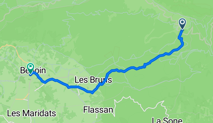
Z Sault do Bédoin

- 2 h 25 min
- Czas
- 29,7 km
- Dystans
- 536 m
- Przewyższenia
- 934 m
- Spadek
- 12,2 km/h
- Śr. Prędkość
- 1019 m
- Maks. wysokość
This ride starts in Sault, a charming village known for its sweeping lavender fields and as a gateway to Mont Ventoux. The route takes you on a 30 km adventure over mostly quiet roads and tracks, dipping in and out of woodlands and open vistas. There’s a solid climb at the beginning as you make your way up to about 1,000 meters, but the rest is a rewarding descent toward Bédoin.
Surfaces are mixed—so expect everything from paved stretches to some gravel and unpaved sections. It’s best to tackle this one with a gravel or sturdy hybrid bike. As you cruise down toward Bédoin, the scenery flips from wild plateau to lush vineyards and orchards. Bédoin welcomes you at the base of the legendary Mont Ventoux, a famous launch point for cyclists aiming for the summit.
All in, it’s a route for those who love quiet countrysides and don’t mind a little variety under their wheels!
Wspólnota
Najlepsi użytkownicy w tym regionie


Od naszej społeczności
Najlepsze trasy rowerowe z Sault do Bédoin

Sault-Ventoux
Trasa rowerowa w Sault, Prowansja-Alpy-Lazurowe Wybrzeże, Francja
- 26,2 km
- Dystans
- 1238 m
- Przewyższenia
- 76 m
- Spadek

Sault--col des abeilles--mont ventoux par bédoin
Trasa rowerowa w Sault, Prowansja-Alpy-Lazurowe Wybrzeże, Francja
- 63,6 km
- Dystans
- 2070 m
- Przewyższenia
- 942 m
- Spadek

Ascension du Mont Ventoux par Sault
Trasa rowerowa w Sault, Prowansja-Alpy-Lazurowe Wybrzeże, Francja
- 25,9 km
- Dystans
- 1200 m
- Przewyższenia
- 88 m
- Spadek

Sault Mont Ventoux
Trasa rowerowa w Sault, Prowansja-Alpy-Lazurowe Wybrzeże, Francja
- 25,2 km
- Dystans
- 1241 m
- Przewyższenia
- 79 m
- Spadek

Mont Ventoux La Douce
Trasa rowerowa w Sault, Prowansja-Alpy-Lazurowe Wybrzeże, Francja
- 30,9 km
- Dystans
- 1215 m
- Przewyższenia
- 114 m
- Spadek

Ventoux Sault
Trasa rowerowa w Sault, Prowansja-Alpy-Lazurowe Wybrzeże, Francja
- 25,6 km
- Dystans
- 1250 m
- Przewyższenia
- 112 m
- Spadek

1-Ventoux hin
Trasa rowerowa w Sault, Prowansja-Alpy-Lazurowe Wybrzeże, Francja
- 42,8 km
- Dystans
- 1469 m
- Przewyższenia
- 540 m
- Spadek

Jour 2 Sault - Mt. Ventoux - Malaucène - Bédoin
Trasa rowerowa w Sault, Prowansja-Alpy-Lazurowe Wybrzeże, Francja
- 58,2 km
- Dystans
- 1321 m
- Przewyższenia
- 1780 m
- Spadek

Stag 3, Sault - Ventoux, Bedoin
Trasa rowerowa w Sault, Prowansja-Alpy-Lazurowe Wybrzeże, Francja
- 100,2 km
- Dystans
- 1840 m
- Przewyższenia
- 2451 m
- Spadek

De Rue du Musée, Sault à Le Grand Mont Ventoux, Saint-Léger-du-Ventoux
Trasa rowerowa w Sault, Prowansja-Alpy-Lazurowe Wybrzeże, Francja
- 20,7 km
- Dystans
- 1234 m
- Przewyższenia
- 100 m
- Spadek

dag 5
Trasa rowerowa w Sault, Prowansja-Alpy-Lazurowe Wybrzeże, Francja
- 38,7 km
- Dystans
- 442 m
- Przewyższenia
- 888 m
- Spadek
RETOUR BEDOIN
Trasa rowerowa w Sault, Prowansja-Alpy-Lazurowe Wybrzeże, Francja
- 15,3 km
- Dystans
- 0 m
- Przewyższenia
- 1121 m
- Spadek
Odkryj więcej tras
 Mont Ventoux La Douce
- Dystans
- 30,9 km
- Przewyższenia
- 1215 m
- Spadek
- 114 m
- Lokalizacja
- Sault, Prowansja-Alpy-Lazurowe Wybrzeże, Francja
 Ventoux Sault
- Dystans
- 25,6 km
- Przewyższenia
- 1250 m
- Spadek
- 112 m
- Lokalizacja
- Sault, Prowansja-Alpy-Lazurowe Wybrzeże, Francja
 1-Ventoux hin
- Dystans
- 42,8 km
- Przewyższenia
- 1469 m
- Spadek
- 540 m
- Lokalizacja
- Sault, Prowansja-Alpy-Lazurowe Wybrzeże, Francja
 Jour 2 Sault - Mt. Ventoux - Malaucène - Bédoin
- Dystans
- 58,2 km
- Przewyższenia
- 1321 m
- Spadek
- 1780 m
- Lokalizacja
- Sault, Prowansja-Alpy-Lazurowe Wybrzeże, Francja
 Stag 3, Sault - Ventoux, Bedoin
- Dystans
- 100,2 km
- Przewyższenia
- 1840 m
- Spadek
- 2451 m
- Lokalizacja
- Sault, Prowansja-Alpy-Lazurowe Wybrzeże, Francja
 De Rue du Musée, Sault à Le Grand Mont Ventoux, Saint-Léger-du-Ventoux
- Dystans
- 20,7 km
- Przewyższenia
- 1234 m
- Spadek
- 100 m
- Lokalizacja
- Sault, Prowansja-Alpy-Lazurowe Wybrzeże, Francja
 dag 5
dag 5- Dystans
- 38,7 km
- Przewyższenia
- 442 m
- Spadek
- 888 m
- Lokalizacja
- Sault, Prowansja-Alpy-Lazurowe Wybrzeże, Francja
 RETOUR BEDOIN
- Dystans
- 15,3 km
- Przewyższenia
- 0 m
- Spadek
- 1121 m
- Lokalizacja
- Sault, Prowansja-Alpy-Lazurowe Wybrzeże, Francja
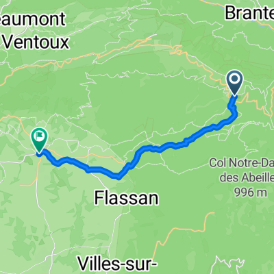
Trasy do Bédoin
Jednodniowa wycieczka rowerowa od
Z Awinion do Bédoin
Szybka przejażdżka rowerowa od
Z Malaucène do Bédoin