
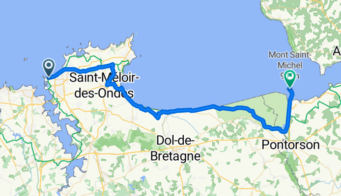
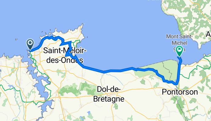
Jednodniowa wycieczka rowerowa z Saint-Malo do Roz-sur-Couesnon
Dostosuj własną trasę na podstawie naszego szablonu lub zobacz, jak nasza społeczność najchętniej jeździ z Saint-Malo do Roz-sur-Couesnon.
Szablon trasy
Z Saint-Malo do Roz-sur-Couesnon

- 2 h 39 min
- Czas
- 42,9 km
- Dystans
- 135 m
- Przewyższenia
- 81 m
- Spadek
- 16,2 km/h
- Śr. Prędkość
- 61 m
- Maks. wysokość
Ready for a scenic ride from the iconic walled port city of St-Malo to the charming village of Roz-sur-Couesnon? This route runs about 43 kilometers and offers a nice mix of quiet country roads and a bit of adventure on some unpaved sections—so wider tires wouldn’t hurt! You’ll roll past salt marshes and fields as you coast inland from the rugged Breton coast.
St-Malo itself is famous for its pirate history, sandy beaches, and impressive ramparts—definitely worth a stroll before hopping on your bike. The ride is fairly gentle with some rolling hills (just over 130 meters of ascent), perfect for soaking up the views. You’ll spend most of your time on quiet roads, with a few stretches of gravel or track—expect a little bumpiness, but nothing too technical.
Roz-sur-Couesnon, perched on a ridge, is a classic countryside village that overlooks the UNESCO-listed bay of Mont-Saint-Michel. When you arrive, treat yourself to a cold drink and enjoy the sweeping vistas. All in all, a delightful blend of history, fresh air, and rural Brittany charm!
Wspólnota
Najlepsi użytkownicy w tym regionie


Od naszej społeczności
Najlepsze trasy rowerowe z Saint-Malo do Roz-sur-Couesnon

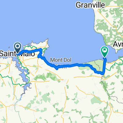
St Malo to Mont St Michel via Dol de Bretagne
Trasa rowerowa w Saint-Malo, Bretania, Francja
- 54,7 km
- Dystans
- 220 m
- Przewyższenia
- 227 m
- Spadek

St Malo to Mt St Michelle
Trasa rowerowa w Saint-Malo, Bretania, Francja
- 53,1 km
- Dystans
- 113 m
- Przewyższenia
- 124 m
- Spadek

Saint Malo a Le Mont Saint Michel
Trasa rowerowa w Saint-Malo, Bretania, Francja
- 65,4 km
- Dystans
- 122 m
- Przewyższenia
- 115 m
- Spadek

24/05-SAINT MALO/PONTORSON 56 KM
Trasa rowerowa w Saint-Malo, Bretania, Francja
- 56,1 km
- Dystans
- 103 m
- Przewyższenia
- 104 m
- Spadek

St Malo to Mont St Michel
Trasa rowerowa w Saint-Malo, Bretania, Francja
- 54 km
- Dystans
- 130 m
- Przewyższenia
- 120 m
- Spadek

Day 2 - Saint-Malo to Mont Saint-Michel
Trasa rowerowa w Saint-Malo, Bretania, Francja
- 50,4 km
- Dystans
- 95 m
- Przewyższenia
- 89 m
- Spadek
Place Chateaubriand, Saint-Malo to Grande Rue, Le Mont-Saint-Michel
Trasa rowerowa w Saint-Malo, Bretania, Francja
- 57,7 km
- Dystans
- 119 m
- Przewyższenia
- 109 m
- Spadek

St Malo - Mont St Michel
Trasa rowerowa w Saint-Malo, Bretania, Francja
- 53,5 km
- Dystans
- 135 m
- Przewyższenia
- 142 m
- Spadek

01-toStMichele
Trasa rowerowa w Saint-Malo, Bretania, Francja
- 55,4 km
- Dystans
- 117 m
- Przewyższenia
- 116 m
- Spadek

Tour de Manche Saint-Malo Le Mont-Saint-Michel.kml_Tour de Manche Saint-Malo Le Mont-Saint-Michel
Trasa rowerowa w Saint-Malo, Bretania, Francja
- 58,6 km
- Dystans
- 0 m
- Przewyższenia
- 0 m
- Spadek
St Malo to Mont St Michele
Trasa rowerowa w Saint-Malo, Bretania, Francja
- 59,1 km
- Dystans
- 170 m
- Przewyższenia
- 164 m
- Spadek

St Malo to Mnt St Mic
Trasa rowerowa w Saint-Malo, Bretania, Francja
- 39,7 km
- Dystans
- 126 m
- Przewyższenia
- 111 m
- Spadek
Odkryj więcej tras
 St Malo to Mont St Michel
- Dystans
- 54 km
- Przewyższenia
- 130 m
- Spadek
- 120 m
- Lokalizacja
- Saint-Malo, Bretania, Francja
 Day 2 - Saint-Malo to Mont Saint-Michel
- Dystans
- 50,4 km
- Przewyższenia
- 95 m
- Spadek
- 89 m
- Lokalizacja
- Saint-Malo, Bretania, Francja
 Place Chateaubriand, Saint-Malo to Grande Rue, Le Mont-Saint-Michel
- Dystans
- 57,7 km
- Przewyższenia
- 119 m
- Spadek
- 109 m
- Lokalizacja
- Saint-Malo, Bretania, Francja
 St Malo - Mont St Michel
- Dystans
- 53,5 km
- Przewyższenia
- 135 m
- Spadek
- 142 m
- Lokalizacja
- Saint-Malo, Bretania, Francja
 01-toStMichele
- Dystans
- 55,4 km
- Przewyższenia
- 117 m
- Spadek
- 116 m
- Lokalizacja
- Saint-Malo, Bretania, Francja
 Tour de Manche Saint-Malo Le Mont-Saint-Michel.kml_Tour de Manche Saint-Malo Le Mont-Saint-Michel
- Dystans
- 58,6 km
- Przewyższenia
- 0 m
- Spadek
- 0 m
- Lokalizacja
- Saint-Malo, Bretania, Francja
 St Malo to Mont St Michele
- Dystans
- 59,1 km
- Przewyższenia
- 170 m
- Spadek
- 164 m
- Lokalizacja
- Saint-Malo, Bretania, Francja
 St Malo to Mnt St Mic
- Dystans
- 39,7 km
- Przewyższenia
- 126 m
- Spadek
- 111 m
- Lokalizacja
- Saint-Malo, Bretania, Francja
Trasy z Saint-Malo
Jednodniowa wycieczka rowerowa od
Z Saint-Malo do Rennes
Szybka przejażdżka rowerowa od
Z Saint-Malo do Cancale