
Bikepacking z Saint-Lary-Soulan do Saint-Girons
Dostosuj własną trasę na podstawie naszego szablonu lub zobacz, jak nasza społeczność najchętniej jeździ z Saint-Lary-Soulan do Saint-Girons.
Szablon trasy
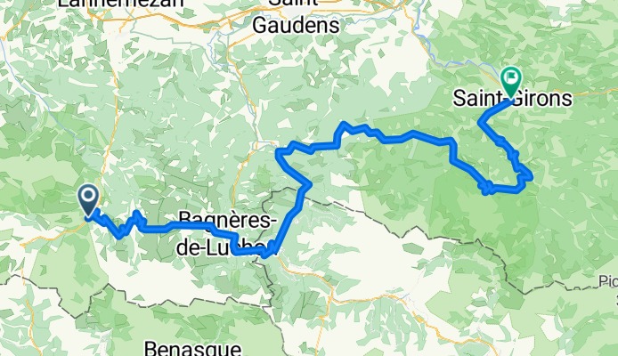
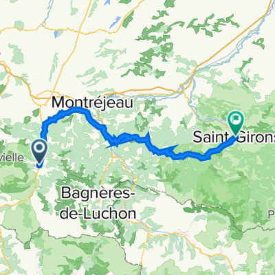
Z Saint-Lary-Soulan do Saint-Girons
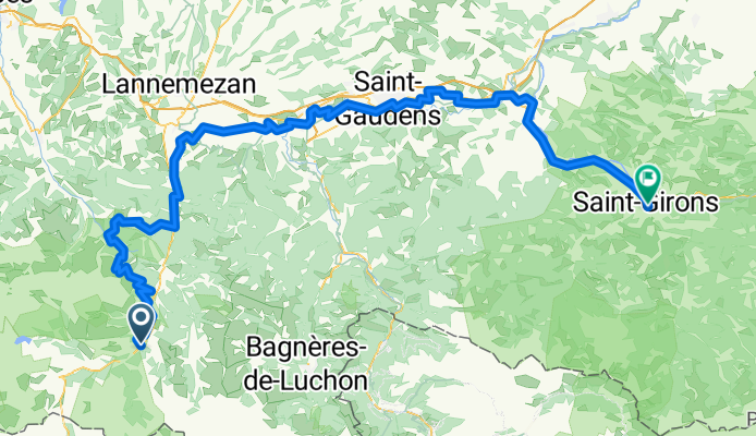
- 10 h 33 min
- Czas
- 153,2 km
- Dystans
- 2984 m
- Przewyższenia
- 3407 m
- Spadek
- 14,5 km/h
- Śr. Prędkość
- 1602 m
- Maks. wysokość
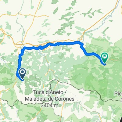
A classic Pyrenean traverse from Saint-Lary-Soulan to Saint-Girons. Roll out from this ski-and-spa town in the Aure valley—famous in the Tour de France and a gateway to the Néouvielle Nature Reserve—then string together a couple of steady cols and fast, sweeping descents. You’ll top out around 1,600 m, rack up roughly 3,000 m of climbing over about 153 km, and gradually lose altitude toward Ariège.
Routing favors quiet roads most of the way, with some paths and tracks and the occasional gravel stretch—wider tires (30–32 mm) are a good shout. Expect shaded valleys, open high meadows, and stone villages for quick resupplies, but there can be remote gaps, so carry water and layers; mountain weather flips fast.
Roll into Saint-Girons, a laid-back Couserans market town on the Salat River and a gateway to the Pyrénées Ariégeoises Regional Park—perfect for a celebratory bite if you time it with the renowned Saturday market. Big day out; split it over two if you want to linger.
Wspólnota
Najlepsi użytkownicy w tym regionie


Od naszej społeczności
Najlepsze trasy rowerowe z Saint-Lary-Soulan do Saint-Girons

Saint-Lary-Soulan - Castillon-en-Couserans
Trasa rowerowa w Saint-Lary-Soulan, Occitanie, Francja
- 188,9 km
- Dystans
- 3823 m
- Przewyższenia
- 4026 m
- Spadek

QV A2M S4 Loudenvielle > Siex
Trasa rowerowa w Saint-Lary-Soulan, Occitanie, Francja
- 119,4 km
- Dystans
- 2726 m
- Przewyższenia
- 3171 m
- Spadek
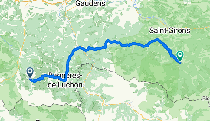
Traversee des Pyrennees - Day 4 - Cadeac to St Girons
Trasa rowerowa w Saint-Lary-Soulan, Occitanie, Francja
- 110,3 km
- Dystans
- 1981 m
- Przewyższenia
- 2314 m
- Spadek
TDF Tag 14
Trasa rowerowa w Saint-Lary-Soulan, Occitanie, Francja
- 103,9 km
- Dystans
- 2609 m
- Przewyższenia
- 2923 m
- Spadek

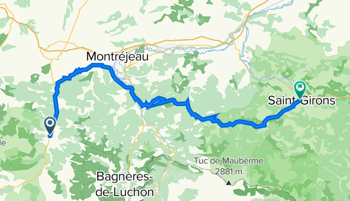
5. Tag Pyrenäen
Trasa rowerowa w Saint-Lary-Soulan, Occitanie, Francja
- 112,4 km
- Dystans
- 1859 m
- Przewyższenia
- 2161 m
- Spadek
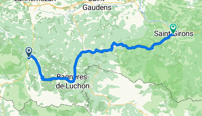
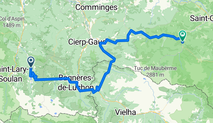
Saint-Lary-Soulan - Saint-Girons
Trasa rowerowa w Saint-Lary-Soulan, Occitanie, Francja
- 118,8 km
- Dystans
- 1552 m
- Przewyższenia
- 2016 m
- Spadek
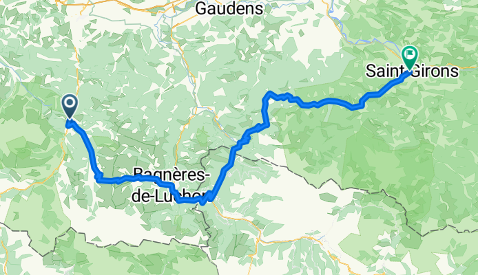
Pyrénées 3 : Saint-Lary-Soulan - Saint-Girons
Trasa rowerowa w Saint-Lary-Soulan, Occitanie, Francja
- 180,8 km
- Dystans
- 4162 m
- Przewyższenia
- 4590 m
- Spadek
Avajan-castillon
Trasa rowerowa w Saint-Lary-Soulan, Occitanie, Francja
- 116,5 km
- Dystans
- 2670 m
- Przewyższenia
- 3047 m
- Spadek
QV A2M S4 Loudenvielle > Siex
Trasa rowerowa w Saint-Lary-Soulan, Occitanie, Francja
- 117,2 km
- Dystans
- 2509 m
- Przewyższenia
- 2953 m
- Spadek

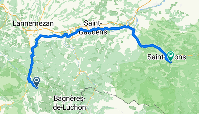
Saint-Lary-Soulan - Saint-Girons
Trasa rowerowa w Saint-Lary-Soulan, Occitanie, Francja
- 187,7 km
- Dystans
- 4269 m
- Przewyższenia
- 4698 m
- Spadek

PYH 2012 dag 5 variant
Trasa rowerowa w Saint-Lary-Soulan, Occitanie, Francja
- 132,9 km
- Dystans
- 2688 m
- Przewyższenia
- 3072 m
- Spadek
D09 Arreau-Saint Girons
Trasa rowerowa w Saint-Lary-Soulan, Occitanie, Francja
- 107,1 km
- Dystans
- 2131 m
- Przewyższenia
- 2131 m
- Spadek
Odkryj więcej tras
 5. Tag Pyrenäen
- Dystans
- 112,4 km
- Przewyższenia
- 1859 m
- Spadek
- 2161 m
- Lokalizacja
- Saint-Lary-Soulan, Occitanie, Francja
 Saint-Lary-Soulan - Saint-Girons
- Dystans
- 118,8 km
- Przewyższenia
- 1552 m
- Spadek
- 2016 m
- Lokalizacja
- Saint-Lary-Soulan, Occitanie, Francja
 Pyrénées 3 : Saint-Lary-Soulan - Saint-Girons
- Dystans
- 180,8 km
- Przewyższenia
- 4162 m
- Spadek
- 4590 m
- Lokalizacja
- Saint-Lary-Soulan, Occitanie, Francja
 Avajan-castillon
- Dystans
- 116,5 km
- Przewyższenia
- 2670 m
- Spadek
- 3047 m
- Lokalizacja
- Saint-Lary-Soulan, Occitanie, Francja
 QV A2M S4 Loudenvielle > Siex
- Dystans
- 117,2 km
- Przewyższenia
- 2509 m
- Spadek
- 2953 m
- Lokalizacja
- Saint-Lary-Soulan, Occitanie, Francja
 Saint-Lary-Soulan - Saint-Girons
- Dystans
- 187,7 km
- Przewyższenia
- 4269 m
- Spadek
- 4698 m
- Lokalizacja
- Saint-Lary-Soulan, Occitanie, Francja
 PYH 2012 dag 5 variant
- Dystans
- 132,9 km
- Przewyższenia
- 2688 m
- Spadek
- 3072 m
- Lokalizacja
- Saint-Lary-Soulan, Occitanie, Francja
 D09 Arreau-Saint Girons
- Dystans
- 107,1 km
- Przewyższenia
- 2131 m
- Spadek
- 2131 m
- Lokalizacja
- Saint-Lary-Soulan, Occitanie, Francja
Trasy z Saint-Lary-Soulan
Jednodniowa wycieczka rowerowa od
Z Saint-Lary-Soulan do Argelès-Gazost
Jednodniowa wycieczka rowerowa od
Z Saint-Lary-Soulan do Bagnères-de-Luchon
Trasy do Saint-Girons
Jednodniowa wycieczka rowerowa od
Z Ax-les-Thermes do Saint-Girons
Jednodniowa wycieczka rowerowa od
Z Bagnères-de-Luchon do Saint-Girons