
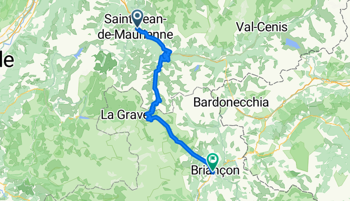
Jednodniowa wycieczka rowerowa z Saint-Jean-de-Maurienne do Briançon
Dostosuj własną trasę na podstawie naszego szablonu lub zobacz, jak nasza społeczność najchętniej jeździ z Saint-Jean-de-Maurienne do Briançon.
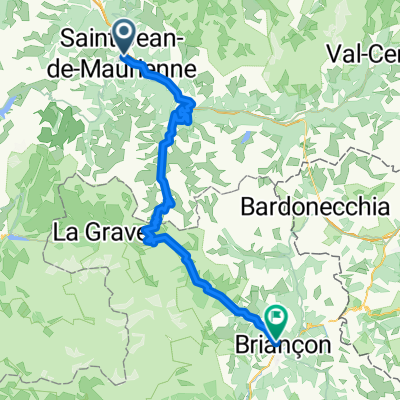
Szablon trasy
Z Saint-Jean-de-Maurienne do Briançon

- 9 h 4 min
- Czas
- 93,2 km
- Dystans
- 4347 m
- Przewyższenia
- 3573 m
- Spadek
- 10,3 km/h
- Śr. Prędkość
- 2634 m
- Maks. wysokość
Get ready for a true Alpine adventure! This classic cycling route takes you from the charming town of Saint-Jean-de-Maurienne, famously known as a gateway to some of the Tour de France’s legendary mountain passes, to historic Briançon, Europe’s highest city. Covering just over 93 km, you’ll rack up plenty of elevation (over 4,300 meters of climbing!), with the route hitting awe-inspiring altitudes up to 2,634 meters.
The ride rolls mostly along quiet roads mixed with some sections on busier stretches and scenic tracks, so it’s a great mix for those who love both smooth tarmac and a hint of adventure. Roughly half the surfaces are unclassified, so expect a couple of surprises, but most climbs (including the epic Col du Galibier if you follow the iconic route) are paved.
You’ll be surrounded by dramatic Alpine scenery for much of the journey. Once you roll into Briançon, reward yourself with a stroll among its Vauban fortifications and old cobbled streets. This ride is a real bucket list challenge for any seasoned cyclist!
Wspólnota
Najlepsi użytkownicy w tym regionie


Od naszej społeczności
Najlepsze trasy rowerowe z Saint-Jean-de-Maurienne do Briançon

Alpes 3
Trasa rowerowa w Saint-Jean-de-Maurienne, Owernia-Rodan-Alpy, Francja
- 104,5 km
- Dystans
- 3225 m
- Przewyższenia
- 2455 m
- Spadek

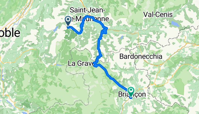
3ª Etapa St jean Maurienne - Briancon
Trasa rowerowa w Saint-Jean-de-Maurienne, Owernia-Rodan-Alpy, Francja
- 142,6 km
- Dystans
- 3671 m
- Przewyższenia
- 2924 m
- Spadek

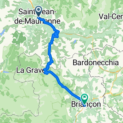
Saint-Jean-de-Maurienne - Briançon
Trasa rowerowa w Saint-Jean-de-Maurienne, Owernia-Rodan-Alpy, Francja
- 82,5 km
- Dystans
- 2160 m
- Przewyższenia
- 1486 m
- Spadek

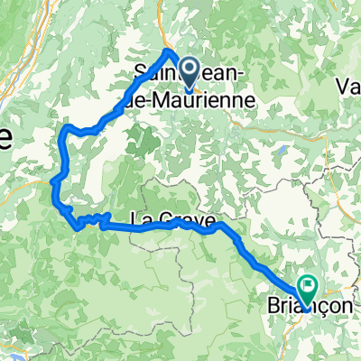
Day 3 Route des Grand Alpes
Trasa rowerowa w Saint-Jean-de-Maurienne, Owernia-Rodan-Alpy, Francja
- 84,7 km
- Dystans
- 2265 m
- Przewyższenia
- 1542 m
- Spadek
Percorso 2015 4° tappa: Saint Jean de Maurienne - Briancon
Trasa rowerowa w Saint-Jean-de-Maurienne, Owernia-Rodan-Alpy, Francja
- 83,7 km
- Dystans
- 2252 m
- Przewyższenia
- 1574 m
- Spadek

Bikedress MVC GA 3 Tag
Trasa rowerowa w Saint-Jean-de-Maurienne, Owernia-Rodan-Alpy, Francja
- 142,8 km
- Dystans
- 3142 m
- Przewyższenia
- 2476 m
- Spadek

PeaksGalibier
Trasa rowerowa w Saint-Jean-de-Maurienne, Owernia-Rodan-Alpy, Francja
- 84,4 km
- Dystans
- 2265 m
- Przewyższenia
- 1513 m
- Spadek

Saint-Jean-de-Maurienne via Galibier
Trasa rowerowa w Saint-Jean-de-Maurienne, Owernia-Rodan-Alpy, Francja
- 84,1 km
- Dystans
- 2286 m
- Przewyższenia
- 1567 m
- Spadek

20140609 - Saint-Jean-de-Maurienne - Birancon
Trasa rowerowa w Saint-Jean-de-Maurienne, Owernia-Rodan-Alpy, Francja
- 82,9 km
- Dystans
- 2160 m
- Przewyższenia
- 1517 m
- Spadek
B - W / Etappe 10
Trasa rowerowa w Saint-Jean-de-Maurienne, Owernia-Rodan-Alpy, Francja
- 109 km
- Dystans
- 2313 m
- Przewyższenia
- 2772 m
- Spadek

18 St-Jean - Briancon
Trasa rowerowa w Saint-Jean-de-Maurienne, Owernia-Rodan-Alpy, Francja
- 84,5 km
- Dystans
- 2232 m
- Przewyższenia
- 1584 m
- Spadek

Tag 7 - Galibier
Trasa rowerowa w Saint-Jean-de-Maurienne, Owernia-Rodan-Alpy, Francja
- 78,1 km
- Dystans
- 2204 m
- Przewyższenia
- 1512 m
- Spadek
Odkryj więcej tras
 Percorso 2015 4° tappa: Saint Jean de Maurienne - Briancon
- Dystans
- 83,7 km
- Przewyższenia
- 2252 m
- Spadek
- 1574 m
- Lokalizacja
- Saint-Jean-de-Maurienne, Owernia-Rodan-Alpy, Francja
 Bikedress MVC GA 3 Tag
- Dystans
- 142,8 km
- Przewyższenia
- 3142 m
- Spadek
- 2476 m
- Lokalizacja
- Saint-Jean-de-Maurienne, Owernia-Rodan-Alpy, Francja
 PeaksGalibier
- Dystans
- 84,4 km
- Przewyższenia
- 2265 m
- Spadek
- 1513 m
- Lokalizacja
- Saint-Jean-de-Maurienne, Owernia-Rodan-Alpy, Francja
 Saint-Jean-de-Maurienne via Galibier
- Dystans
- 84,1 km
- Przewyższenia
- 2286 m
- Spadek
- 1567 m
- Lokalizacja
- Saint-Jean-de-Maurienne, Owernia-Rodan-Alpy, Francja
 20140609 - Saint-Jean-de-Maurienne - Birancon
- Dystans
- 82,9 km
- Przewyższenia
- 2160 m
- Spadek
- 1517 m
- Lokalizacja
- Saint-Jean-de-Maurienne, Owernia-Rodan-Alpy, Francja
 B - W / Etappe 10
- Dystans
- 109 km
- Przewyższenia
- 2313 m
- Spadek
- 2772 m
- Lokalizacja
- Saint-Jean-de-Maurienne, Owernia-Rodan-Alpy, Francja
 18 St-Jean - Briancon
- Dystans
- 84,5 km
- Przewyższenia
- 2232 m
- Spadek
- 1584 m
- Lokalizacja
- Saint-Jean-de-Maurienne, Owernia-Rodan-Alpy, Francja
 Tag 7 - Galibier
- Dystans
- 78,1 km
- Przewyższenia
- 2204 m
- Spadek
- 1512 m
- Lokalizacja
- Saint-Jean-de-Maurienne, Owernia-Rodan-Alpy, Francja
Trasy z Saint-Jean-de-Maurienne
Jednodniowa wycieczka rowerowa od
Z Saint-Jean-de-Maurienne do Valloire
Jednodniowa wycieczka rowerowa od
Z Saint-Jean-de-Maurienne do Huez
Trasy do Briançon
Bikepacking od
Z Val d'Isère do Briançon
Jednodniowa wycieczka rowerowa od
Z Saint-Michel-de-Maurienne do Briançon
Jednodniowa wycieczka rowerowa od
Z Huez do Briançon